This week will continue to see plenty of thunderstorms and rain for Southwest Mississippi as typical summertime weather dominates. The upper-level ridge is still parked over the Four Corners Region in the Southwest while the Bermuda high over the Western Atlantic. Between these two features near the Mississippi Valley is an slight upper-level trough.
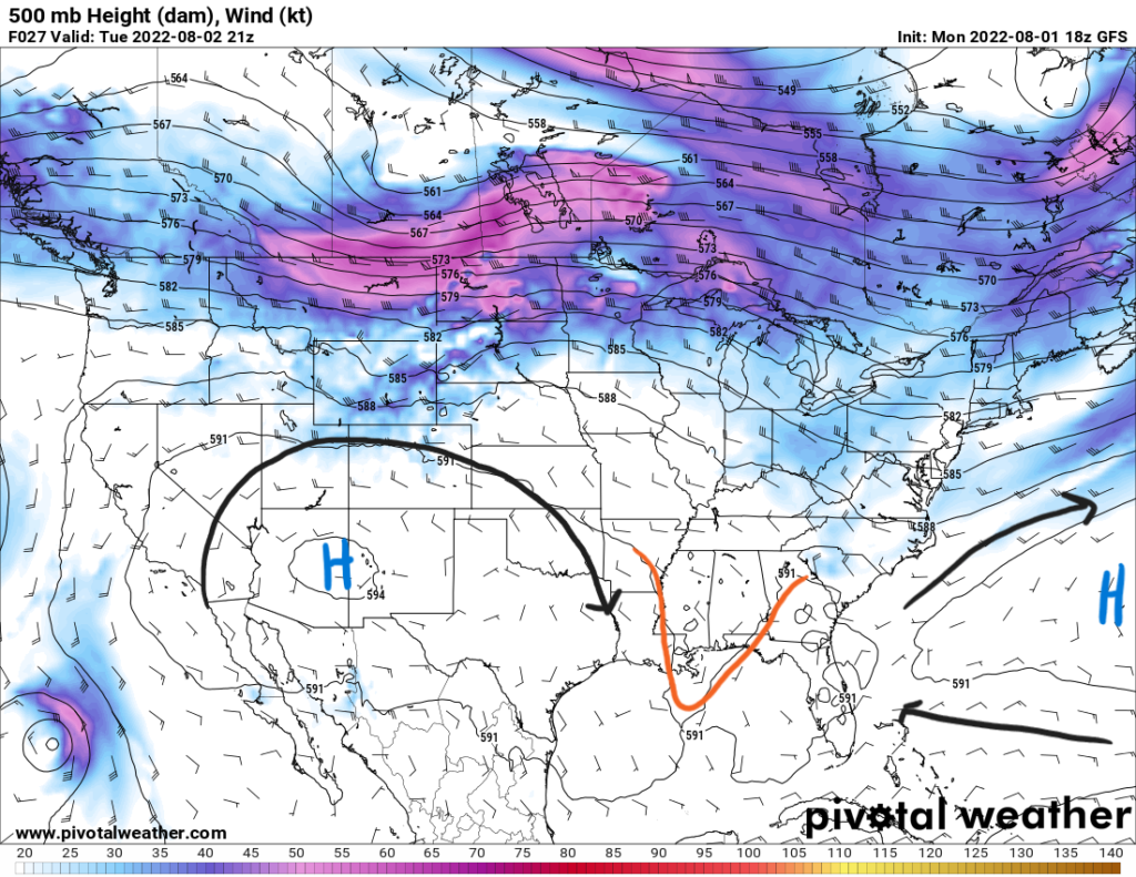
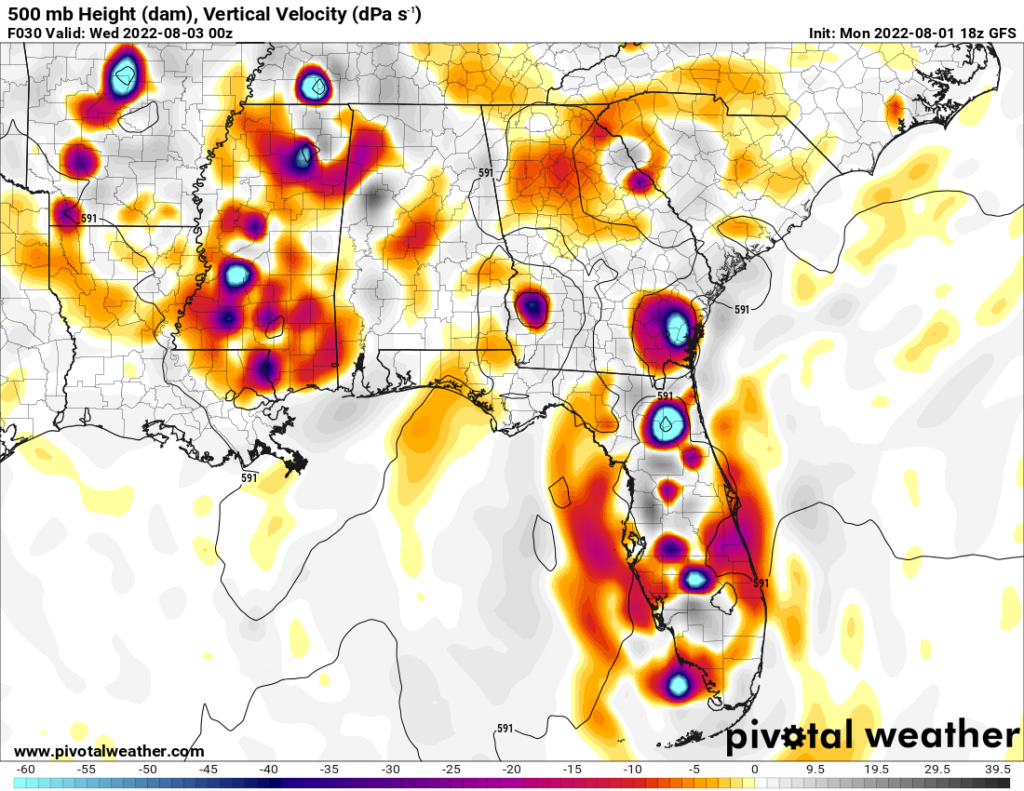
This trough will give way to rising vertical motion supporting convection for afternoon thunderstorms. Dewpoints for the day will be in the 70s along with precipitable water values north of 1.8″ present a very moist atmosphere. Some storms could be on the stronger side with localized heavy rainfall and gusty winds. This diurnally driven convection should last throughout the week as well.
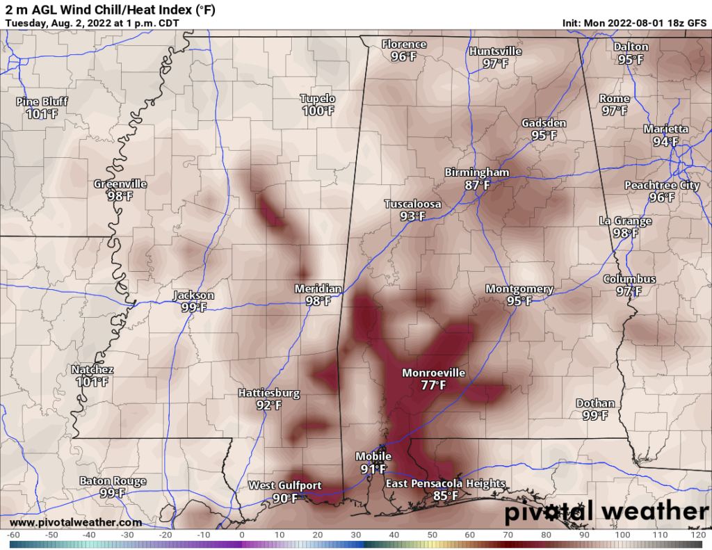
Temperatures will remain in the low-to-mid 90s for the area. With higher dewpoints in the 70s. heat index values will reach past 100F in some places, but they should remain below warning criteria. Either way it will be hot before any rain develops during the day. Make sure to limit time spent outdoors during the peak of heating. High temperatures will stay in this range as the week progresses.
Day-to-Day Forecast
Tuesday
Cloudy with a 70-percent chance of scattered thunderstorms beginning in the late morning/early afternoon hours. Highs will be in the low 90s with heat indices in the low 100s. Lows will be in the mid 70s.
Wednesday
Mostly cloudy with a 60-percent chance of isolated to scattered thunderstorms beginning in the early afternoon hours. Highs will be in the low 90s with heat index values around 100F. Lows will be in the mid 70s.
Thursday
Partly cloudy with a 60-percent chance of scattered thunderstorms in the afternoon. Highs will be in the low 90s with heat index values around 100F. Lows will be in the mid 70s.
Friday
Mostly sunny with a 60-percent chance of precipitation. Highs in the upper 80s and low 90s with heat index values in the upper 90s. Lows in the low 70s.
Saturday
Mostly sunny with a 40-percent chance of precipitation. Highs in the low 90s with heat index values in the upper 90s. Lows in the low 70s.
Sunday
Sunny with a 40-percent chance of precipitation. Highs in the low 90s with heat index values in the upper 90s reaching 100F. Lows in the low 70s.
Monday
Mostly sunny with a 40-percent chance of precipitation. Highs in the around 90F with heat index values around 100F. Lows in the mid 70s.


