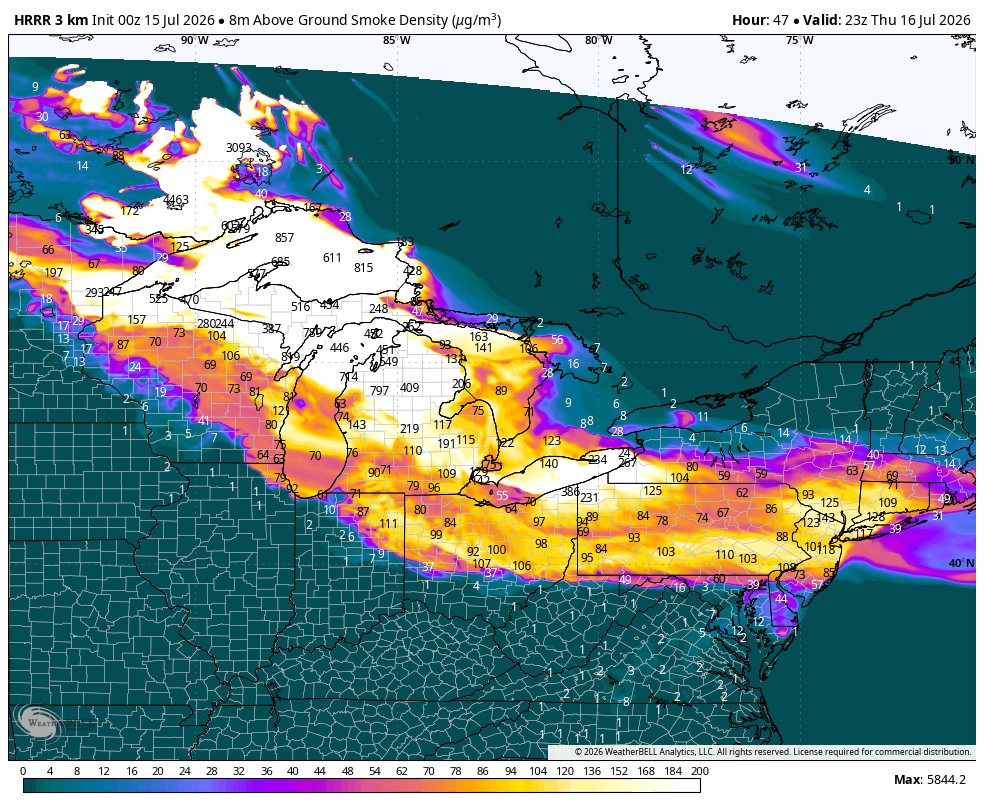
Before we get into everything, just take a look at this wildfire smoke forecast from the HRRR model. Areas in the Midwest and Northeast will certainly see some hazy skies and potentially smell smoke on Wednesday and Thursday!
Tonight’s Severe Threat in Northern New England
It’s certainly rare to have an Enhanced severe weather threat in northern New England, mainly because it’s usually difficult to get all the right ingredients together to produce strong-to-severe storms, such as wind shear and strong instability. This area has been highlighted on the SPC map for a few days now, and the threat of damaging winds, tornadoes, and hail has increased significantly each day.
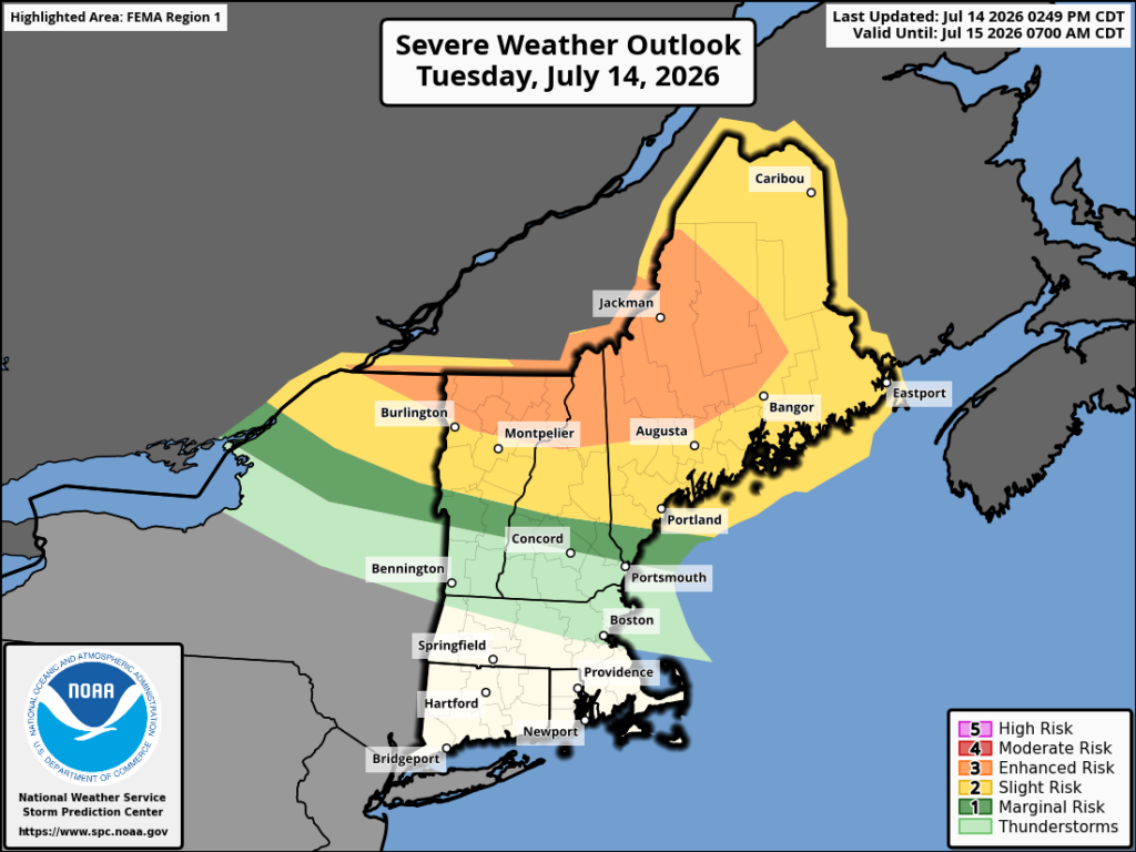
A few storms have already become severe in northern Vermont and New Hampshire, but the main threat is expected in the next few hours, sometime between 9 PM and after 12 AM. According to the SPC’s most recent update, the influence of all of the surrounding wildfire smoke as well as increased cloud cover has actually decreased the severe threat slightly, but the SPC is still concerned for some cells to form that could produce damaging winds in excess of 75 mph and strong EF2+ tornadoes, as well as large hail up to 1 inch.
Tomorrow’s Overall Setup
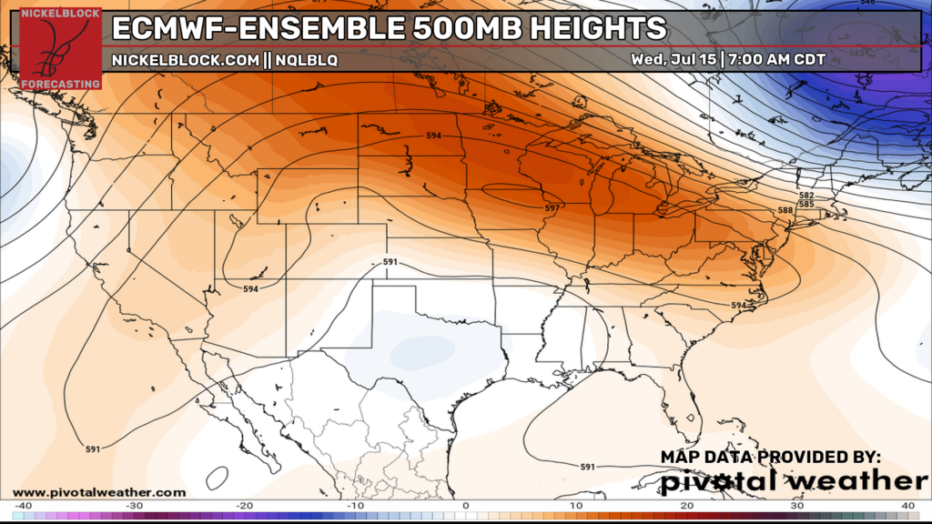
As we can see from the 500 mb map above, there is a large area of ridging over the western, northern central, and eastern U.S. and an area of troughing/low pressure over Texas and the central southern region. As most of us know, the orange colors, which show areas of ridging, typically align with warmer, drier weather, and the blue colors, which show areas of troughing, typically align with cooler, wetter weather. Let’s see if that corresponds down below:
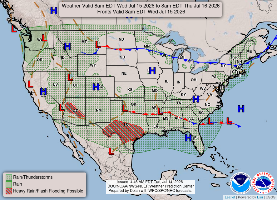
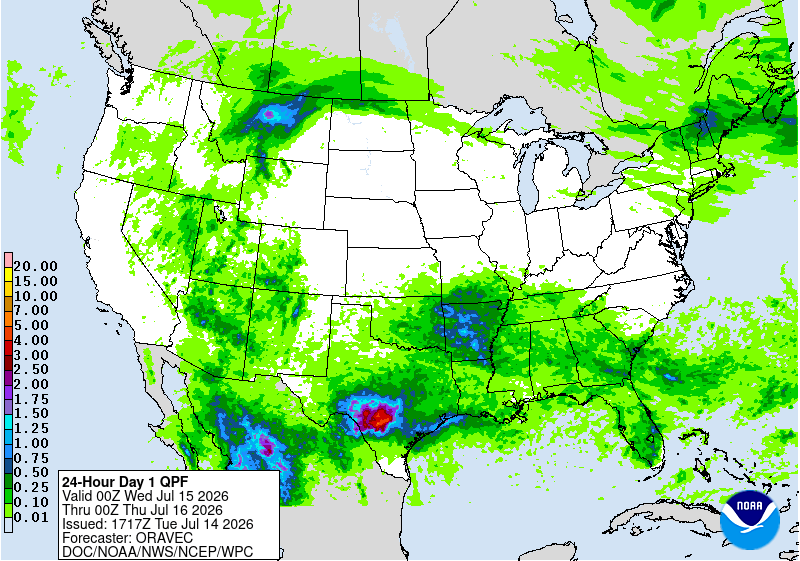
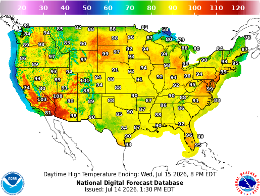
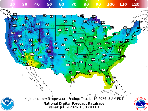
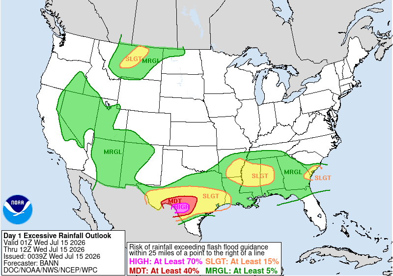
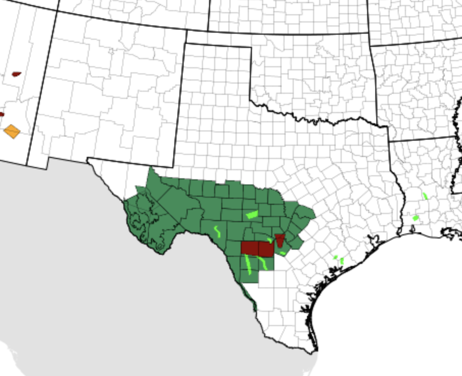
That certainly aligns when looking at the surface map, the precipitation totals map, and even the high-temperature map for tomorrow. Most of the precipitation for tomorrow appears to be for the southern locations, especially over southern and central Texas, where a low-pressure system associated with the trough will move through and dump quite a bit of rain, with 4-5 inches+ possible, with flash flooding becoming extremely concerning in the areas highlighted in red and pink down below.
Those pink colors indicate a 70 percent chance of rainfall exceeding flash flood guidance within 25 miles of a point. If you are in southern and central Texas, I would seriously take caution and avoid travel given this threat. Flood Watches are posted across much of the region.
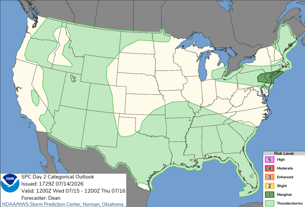
As for the severe weather threat tomorrow, most of the U.S is clear from any severe thunderstorms, aside from a small area in the northern mid-Atlantic region, over eastern PA, northern NJ, and all of Long Island, NY. The severe threat comes from storms that could develop along a southward-moving cold front, where extreme heat, moderate instability, and strong northwesterly flow could support isolated damaging winds and hail.
Thursday’s Weather
By Thursday, the flash flood risk remains very high in the same areas of Texas. The main concern is continued flash flooding during the overnight and early morning hours, as repeated storms may produce 2 to 4 inches of rain per hour over already saturated ground. Take this seriously and be safe! Seek advice from local officials on the best course of action for the next few days.
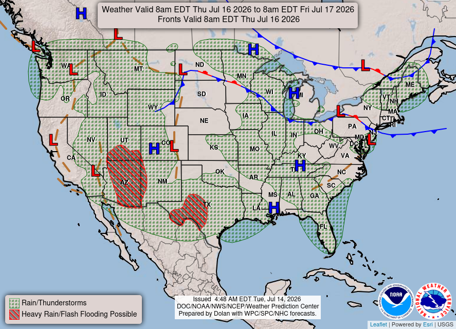
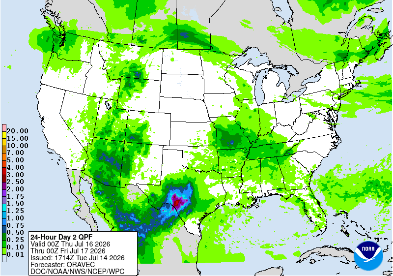
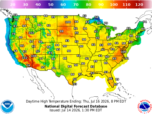
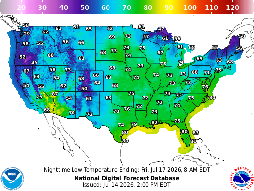
The rest of the U.S. on Thursday is looking pretty similar to Wednesday, with rain impacting the same areas and heat soaring over the northern Plains, the mid-Atlantic, and the northeast. Temperatures reaching 100 with high humidity will allow for heat indices to hit up to 110 in some areas. Stay hydrated and indoors if possible under this heat!
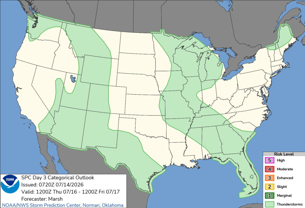
No severe storms are currently forecasted for anywhere in the U.S on Thursday. Been a while, hasn’t it?!
CONUS Weekly Temperature & Precipitation Outlook
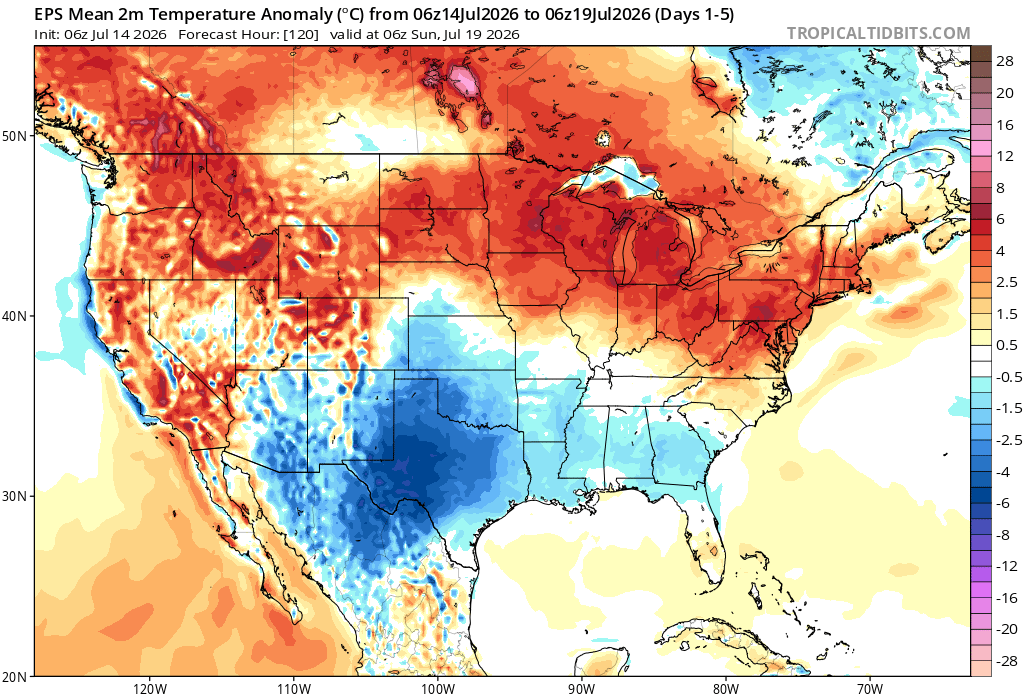
Here’s a look at the EPS modeled temperature anomalies through Sunday. Red indicates above-average temperatures on average for the week, white indicates average temperatures, and blue indicates below-average temperatures.
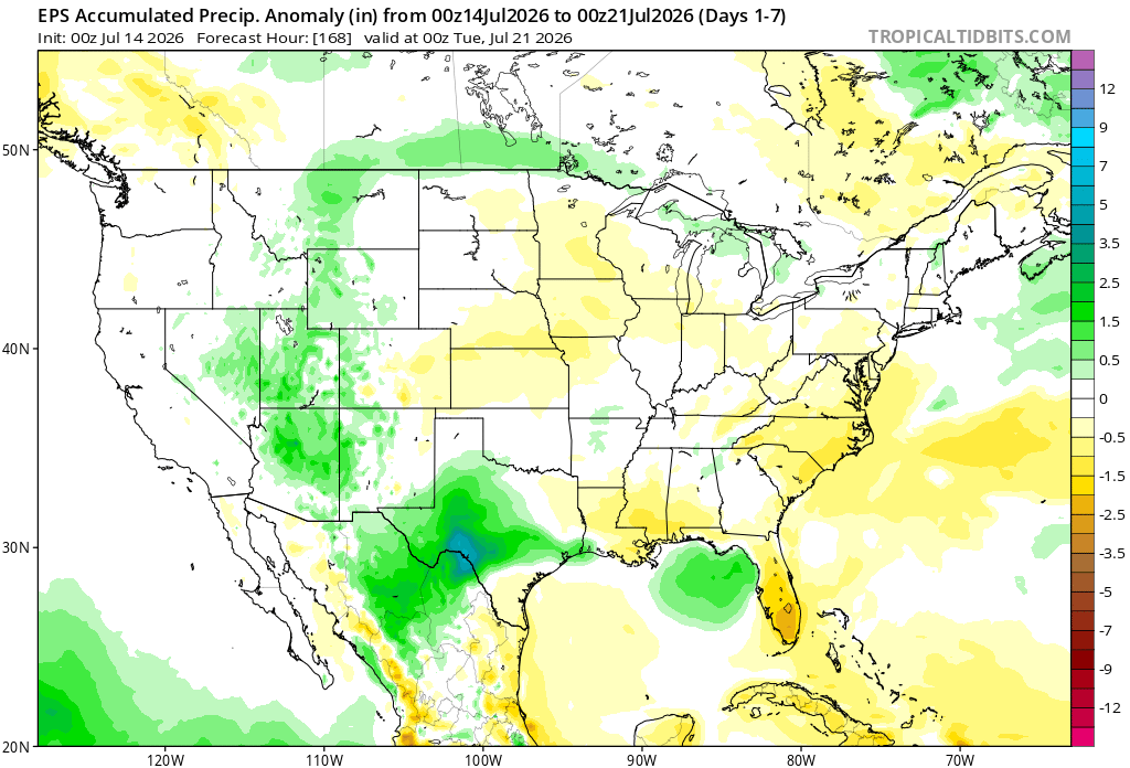
Here’s a look at the EPS modeled precipitation anomalies through next Tuesday. Green indicates above-average precipitation, white indicates average precipitation, and yellow indicates below-average precipitation. Let’s look into the details by region:
Weekly Outlook: Western & Central United States
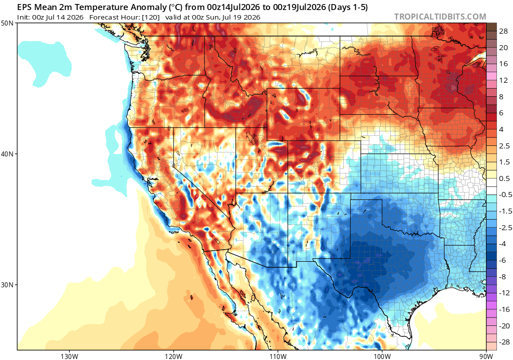
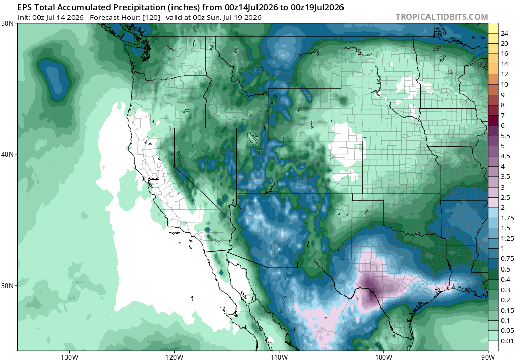
For the western and central U.S. this week, above-average temperatures will be felt across much of California, the Pacific Northwest, and the Rockies, while Arizona, New Mexico, and Texas will see mostly cooler-than-average temperatures, due to above-average rainfall and clouds that will be around, naturally cooling the environment.
Weekly Outlook: Eastern United States
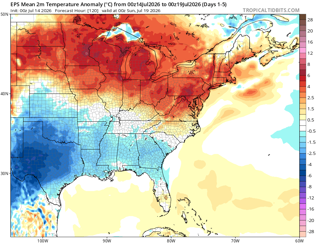
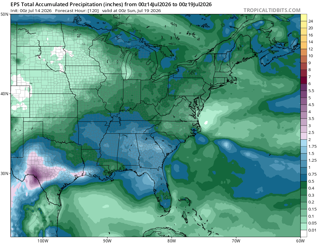
For the eastern U.S. this week, it’s looking like temperatures will sit a few degrees cooler than average for much of the south and southeast, and much warmer than average in the northern Plains, Midwest, and Northeast. Rainfall looks near-average to slightly below-average this week, thanks to that area of ridging sticking around until next week.
Extended Outlook
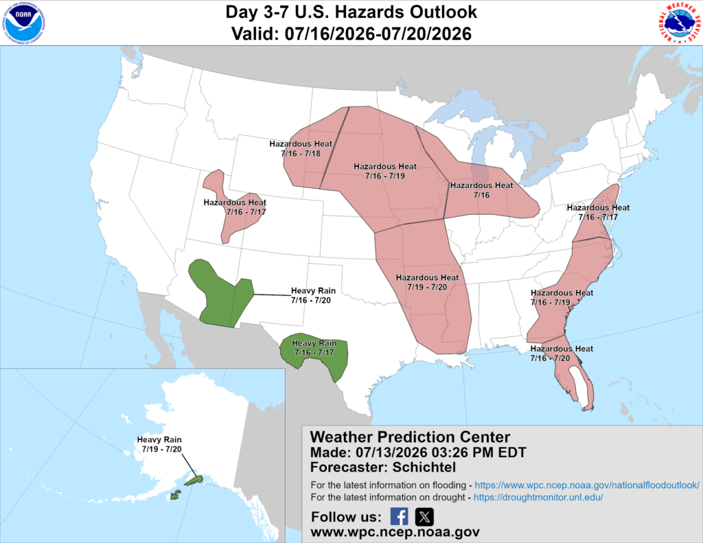
Above is a look at the U.S. Hazards Outlook from NOAA, highlighting areas of more impactful weather to be aware of over the next 3 to 7 days.
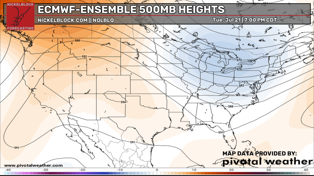
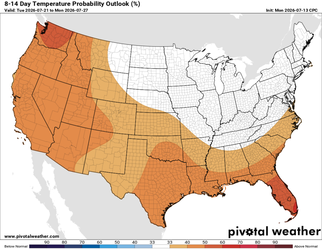
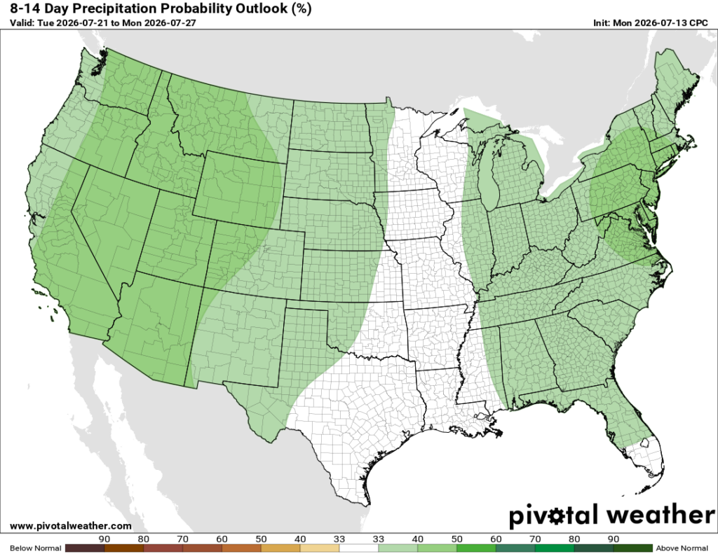
Looking into the 8-14 day period, which would bring us to next Tuesday the 21st to Monday the 27th, the pattern looks to change a bit, with ridging building out west and troughing digging into the east from the north, which would bring above-average temperatures to much of the west and the south, and near-normal or slightly below-average temperatures in the north and east. So far, the rainfall outlook indicates above-average precipitation for much of the country during that period.
Thanks for tuning in to this National Forecast! Tune in to our local, tropical, and regional forecasts to stay up to date on the latest!


