After a wet start to the day for Southern Louisiana, storms will push northeast into Mississippi and Louisiana throughout the afternoon, bringing potential flood risks to the region.

Today
Currently across our area, scattered thunderstorms are impacting a majority of Alabama while a more tightly packed system hovers over central to northern Mississippi. These storms can bring heavy rainfall, high winds, and potential localized flooding to our region.
We also have a flash flood warning in effect for Southwestern Humphreys County, Southeastern Washington County, and Northeastern Sharkey County in west-central Mississippi. This area has received a lot of rain and with the heavy storms still to come this evening, flash flooding could occur. Always remember, if you encounter a flooded roadway, turn around; don’t drown.
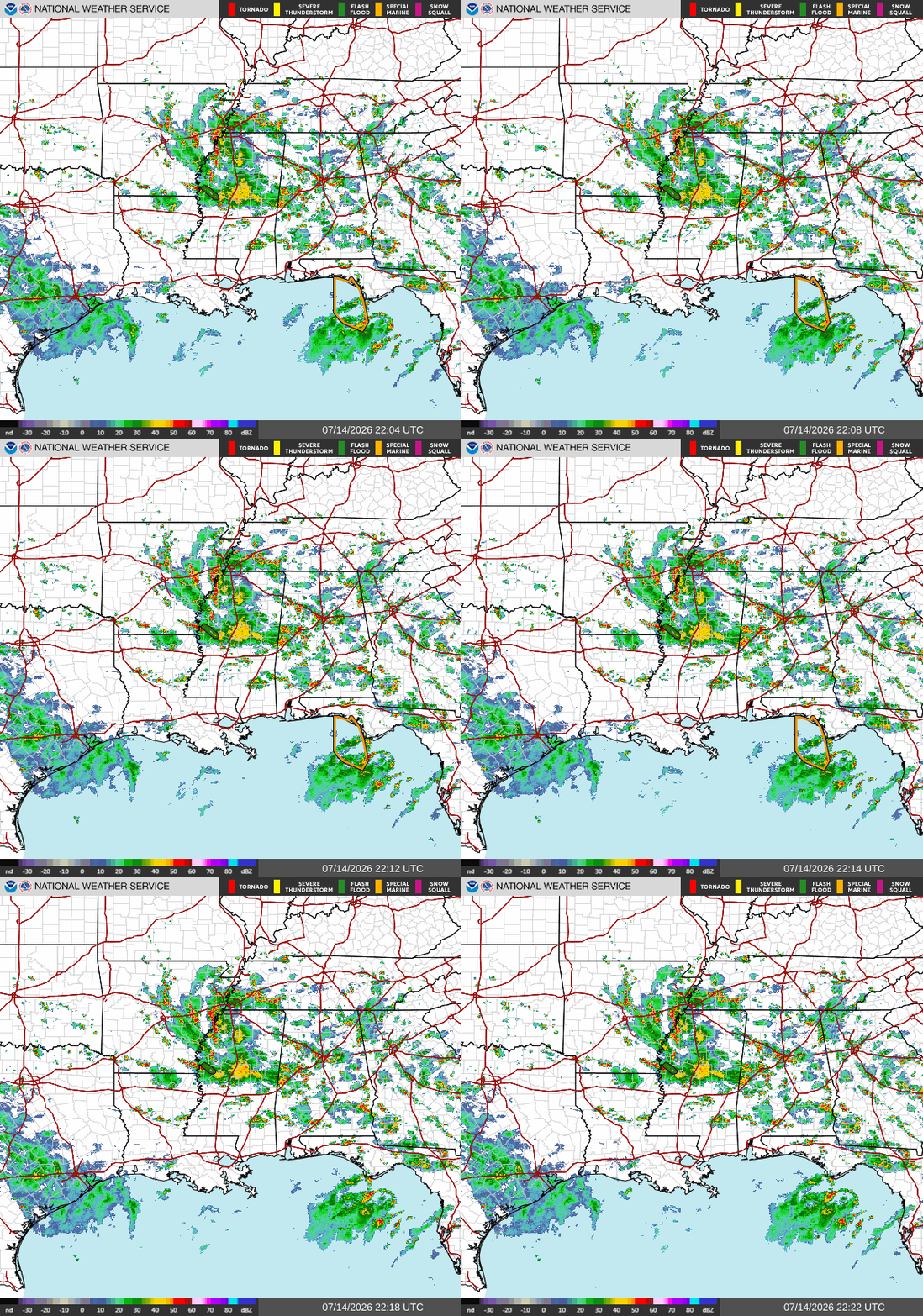
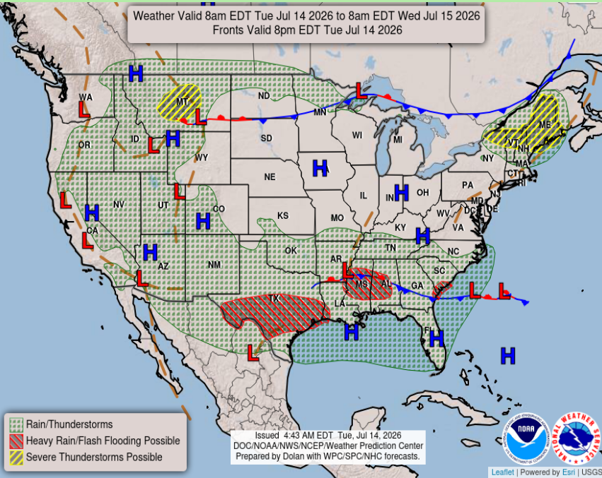
The thunderstorms seen above are associated with a stationary front over central MS/AL, combined with warm, moisture-rich air from the Gulf. Daytime heating and sea breeze collisions provide additional lift, creating the big block of thunderstorms we are seeing throughout the Mississippi region and the scattered thunderstorms over Alabama.
Tomorrow
Looking ahead to tomorrow, our 500 MB height chart gives us a good look at the overall weather pattern. A large area of high pressure remains centered over the Midwest, with the Gulf Coast sitting along the southern edge of the ridge. This pattern will keep the temperatures warm, but weak winds higher in the atmosphere and daytime heating will allow thunderstorms to develop and linger through the afternoon. With a stalled front nearby and plenty of moisture coming in from the Gulf, scattered thunderstorms are expected, with some locations seeing periods of heavy rainfall.
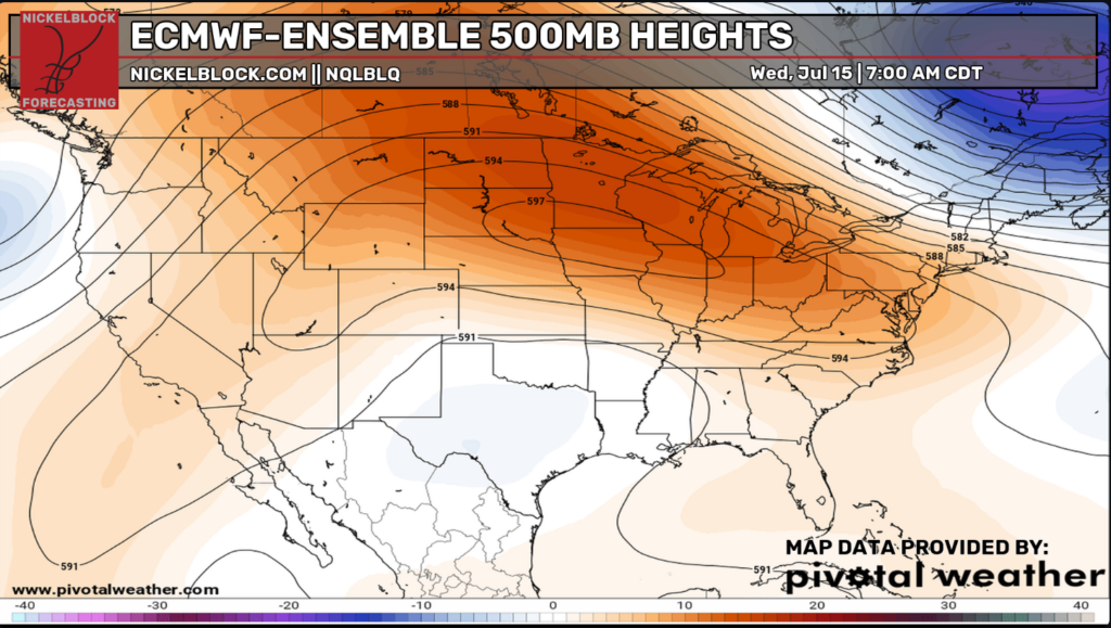
What this means for tomorrow is that another hot and humid day can be expected, with afternoon thunderstorms popping up of course. The combination of Gulf moisture, daytime heating, and a nearby stalled front will keep storm chances elevated through the afternoon and evening. With weak upper-level winds, the storms will be relatively slow-moving, which could bring heavy rainfall to some areas.
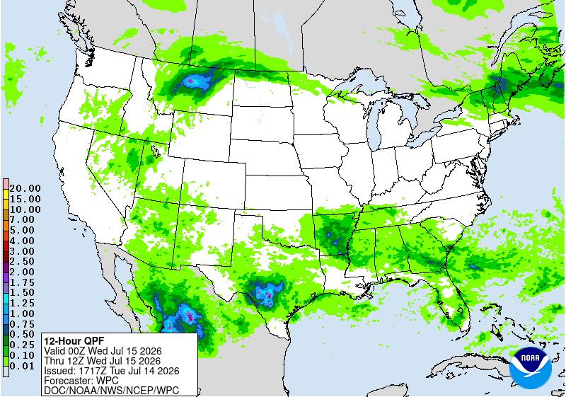
Above we see our 12-hr Quantitative Precipitation Forecast showing a drier patch over Louisiana and Southern Mississippi tomorrow, so I guess we’ll see how that works out. Storms popping up tomorrow will be sneaky, so don’t forget your umbrella!

Thursday
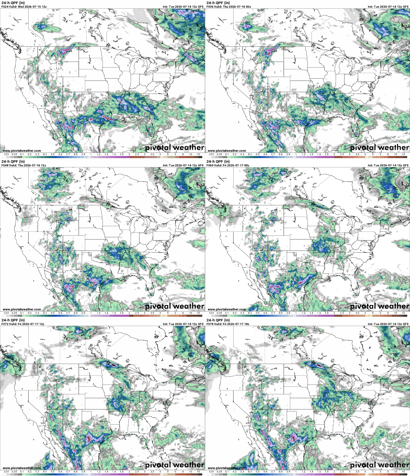
Above is our 24-hour Quantitative Precipitation Forecast showing the expected precipitation for Thursday and Friday. Thursday is looking to be a bit wetter for our area, while on Friday, an area of high pressure pushes off the Gulf and brings fairer weather to the region.
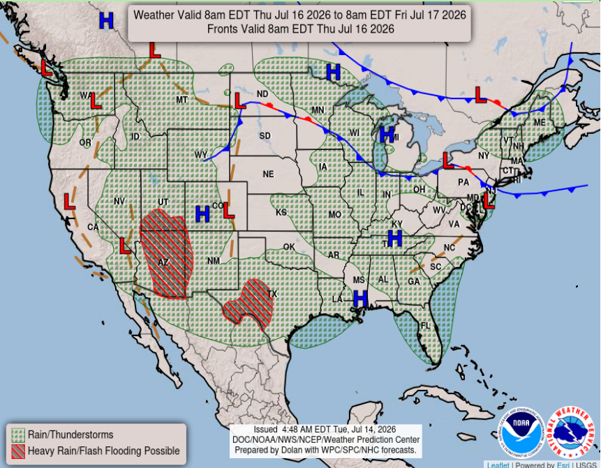
Above in our Thursday-Friday National Forecast chart, we see the incoming area of high pressure bringing some clearer weather for the region. Although high-pressure systems are associated with sinking air and generally bring fairer weather, with the daytime heating and heavy moisture in the air, afternoon showers are still a possibility across the area. With “clearer” days ahead, be prepared for more of the intense heat we have been experiencing without the widespread showers moving in to cool things off. Don’t be surprised if real feel temperatures exceed 100 degrees to finish off the workweek.

Extended Forecast
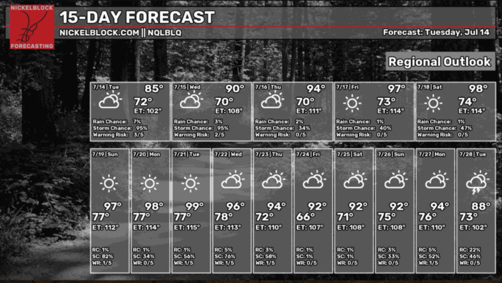
Looking ahead to our NickelBlock 15-day regional outlook, we are starting the week with lower-than-average temperatures before they start to skyrocket starting Friday when the area of high pressure settles in. Along with the high pressure, we see clearer skies with lower chances of precipitation over the region. Stay hydrated and be prepared for the heat, as the risk for heat-related illnesses will be high this weekend and early next week.
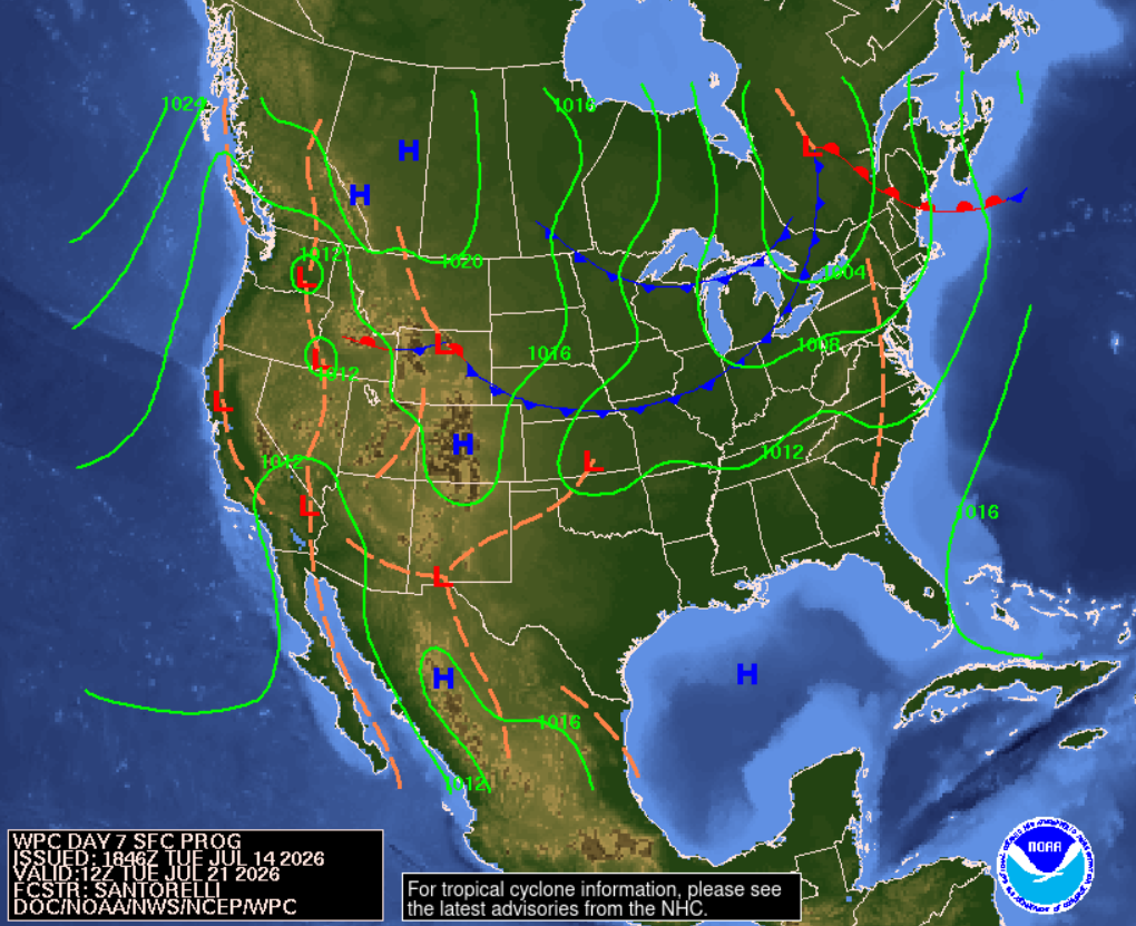
The Weather Prediction Center’s medium-range fronts and pressure forecast shows the area of high pressure sticking off the Gulf Coast all the way into next Tuesday. This system can hopefully steer away any sort of tropical development in the Gulf and cause any potential systems to lose steam and die out before making landfall.
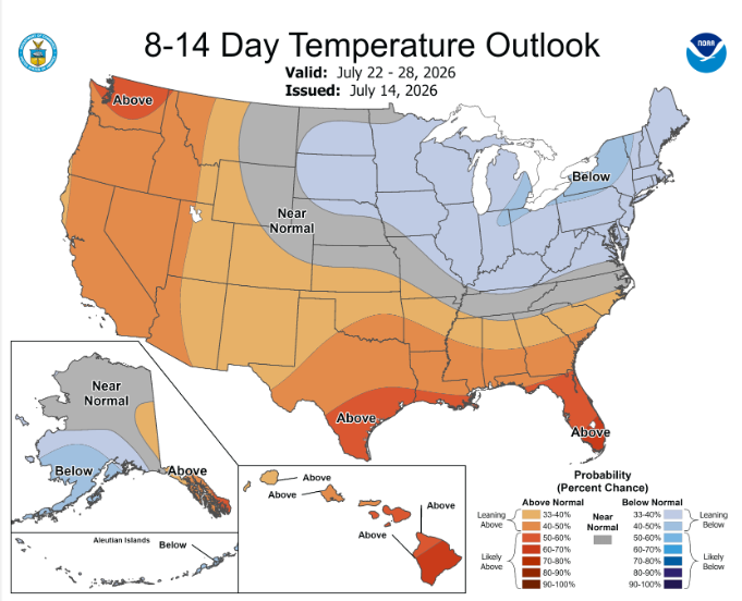
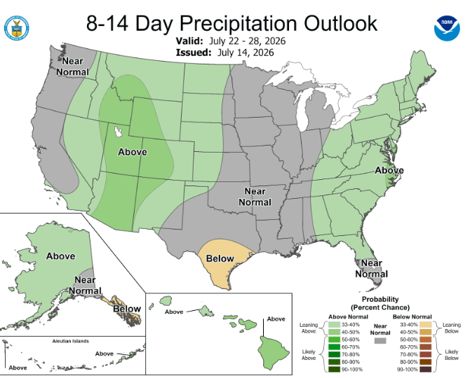
For our 8-14 day outlooks, we will see a bit of relief from the above-average rainfall the area has recently collected, while temperatures remain slightly above average. Now, I’m not too sure what “near normal” rainfall is for the region since we’ve had a lot going on this past month, but I’d assume afternoon thunderstorms are still to be expected as we move into the dog days of summer.