Sunday will be another active weather day across the country with varying threats. Severe weather is expected across the Ohio Valley as a surface cold front pushes southeastward. Heavy rainfall will cover the Southern Plains that will bring the threat of flooding to some areas. Much of the Southern and Eastern parts of the U.S. will see showers and thunderstorms throughout the day as well.
Severe Weather
An upper-level trough will be moving down towards the Ohio Valley on Sunday but will weaken as the day progresses. Associated with this trough is a surface low and weak cold front. This front will act as a trigger for convergence to initiate convection.
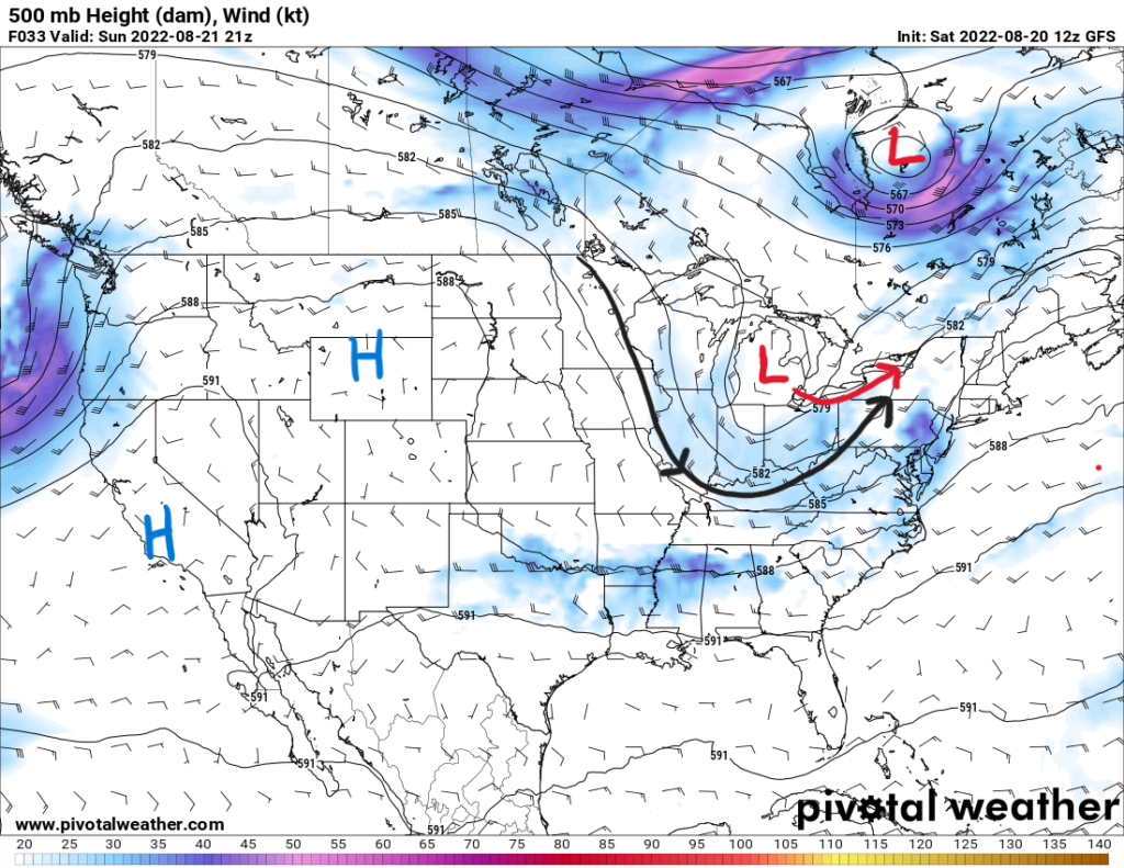
As the front pushes down, the upper trough will interact with the warm sector of the surface low. This is an area with a destabilizing airmass as temperatures could reach the 80s in the afternoon. Surface cape values could range between 1000 J/kg to 2000 J/kg along with moderate shear that will help support stronger storms and isolated supercells.
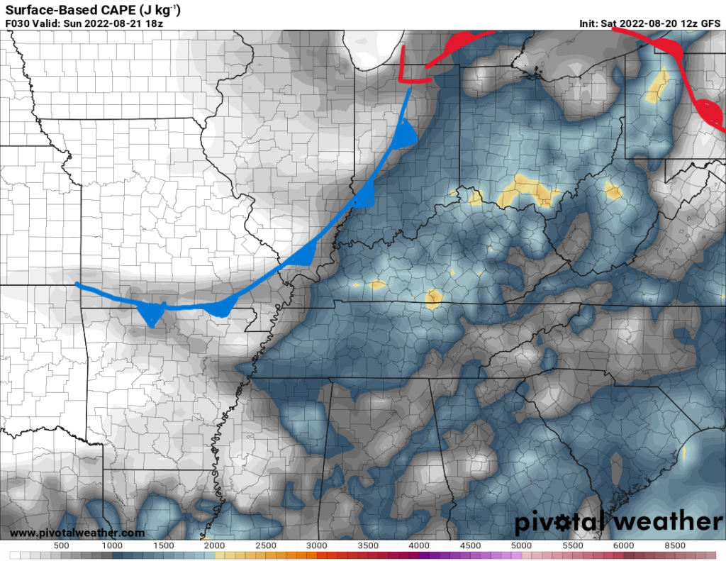
The main threat with these scattered thunderstorms will be severe/damaging wind gusts with the stronger storms. Given the moderate shear, a brief, isolated tornado cannot be ruled out. The Storm Prediction Center has marked this area with a slight risk (2/5) on the outlook.
Flood Threats
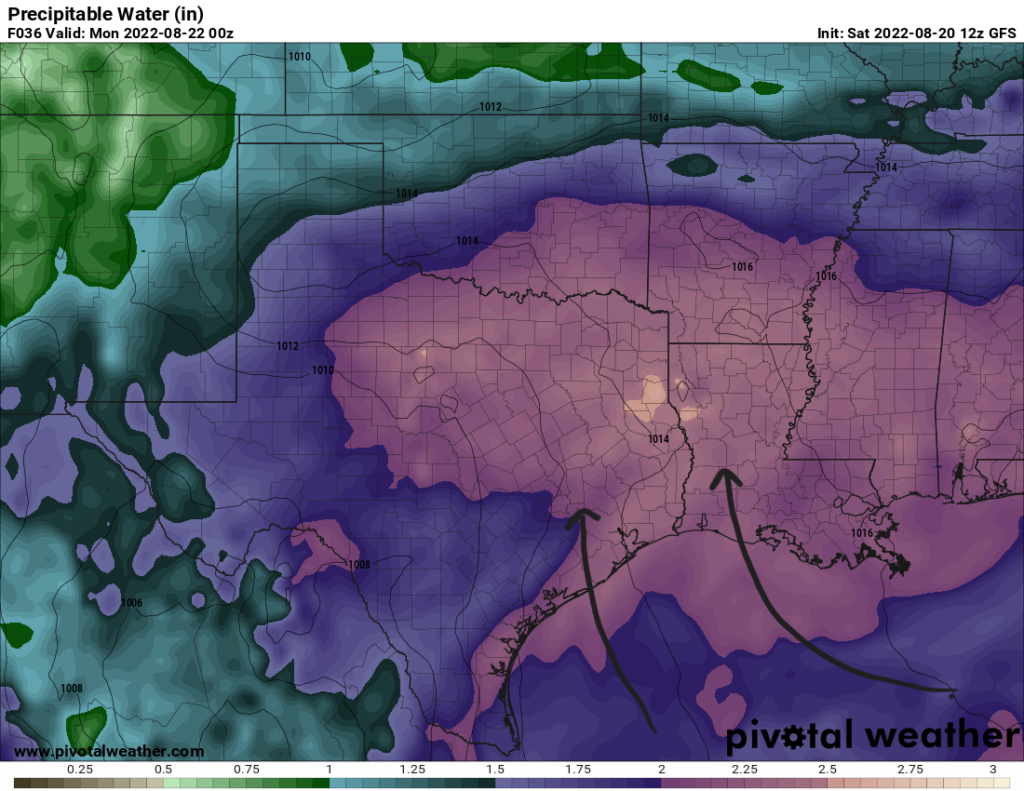
Parts of the Southern Plains into Texas will be seeing plenty of heavy rainfall over the next few days as a surface boundary stalls over the area. The atmosphere will have plenty of moisture with precipitable water values between 2″ and 2.5″. This will support heavy rainfall and flash flooding with slower moving storms. Surface winds near the coast will be southerly bringing tropical moisture inland from the Gulf of Mexico. The remnants of Potential Tropical Cyclone Four (PTC4) will interact with the boundary to bring some added moisture and showers to Southern Texas as it moves inland over Mexico.
Added to the threat is the chance of severe weather with some of the stronger thunderstorms. In the SPC’s outlook in the severe discussion above, a marginal risk (1/5) exists over Eastern Texas into Southwestern Mississippi for severe wind gusts. Localized wind damage could occur with the downdrafts of the storms.
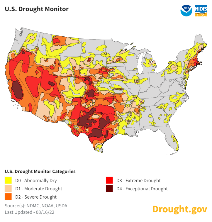
The heaviest of rainfall from storm training could bring rainfall rates of 2″ to 3″ per hour. This brings the risk of flash flooding in urban settings. This rainfall will help with the recent drought conditions over the region which is good news. Much of the area has been in extreme or exceptional drought for quite some time now. However, too much rain in a short period of time can result in flooding.
For Sunday, the Weather Prediction Center has outlined the Northeastern Texas and Texarkana area in a moderate risk (3/4) for excessive rainfall. Even with the recent dry conditions, high moisture content and slow moving storms still pose the risk for flash flooding.
This flood risk will continue for the next couple days as the WPC has outlined a slight risk for excessive rainfall over the area on Monday as well. Over the next three days, rainfall totals could reach up to 5″ in some places and more than 2″ over the Southern Central U.S. as a whole.
As you plan your commutes into the workweek, give yourself extra time incase you encounter a flooded roadway. Take detours if you cannot see the bottom of the road through the water. Remember to turn around and don’t drown. Do not risk stalling your car out in flood waters.