After a relatively quiet opening to this year’s hurricane season, the Atlantic basin looks to become active with two potential areas of interest. Over on the Pacific side, another area of interest has developed and will be monitored as it progresses over the coming days.
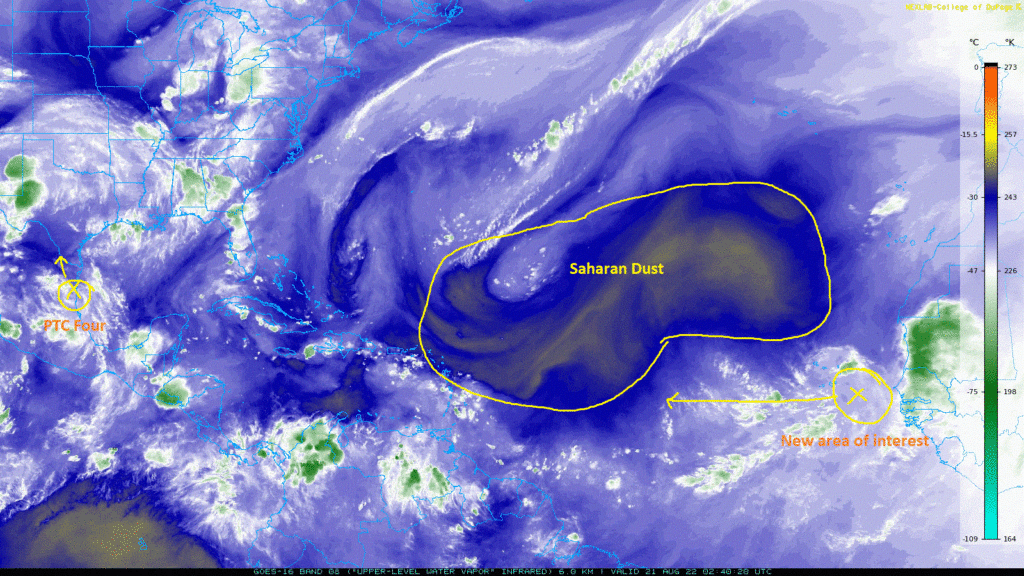
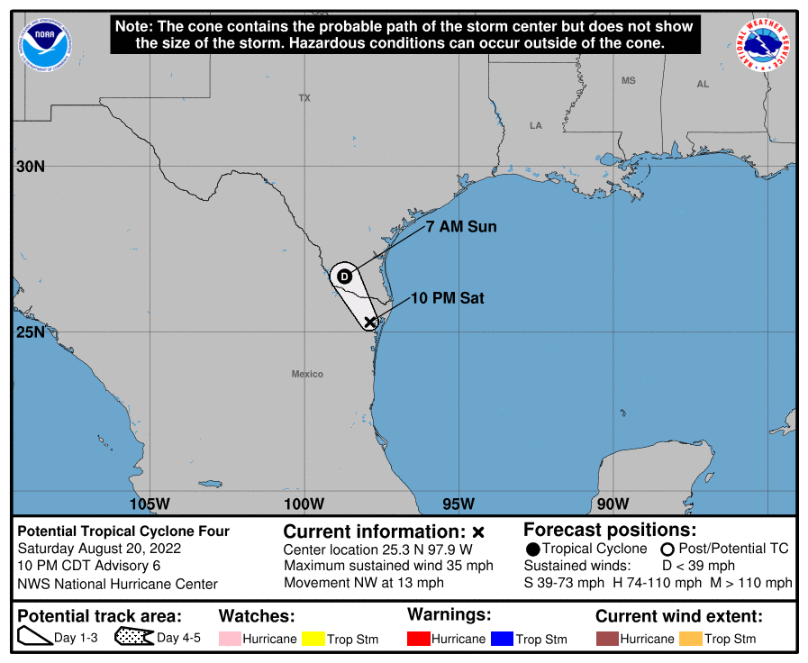
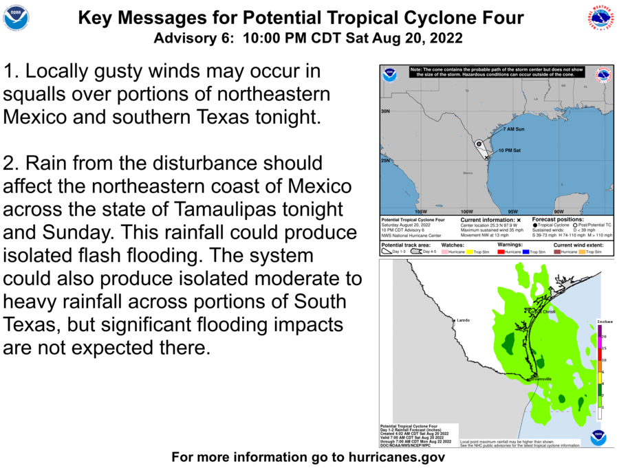
As hurricane season begins to enter its peak months, the Atlantic basin has decided to join the party and open the door for potential tropical development. Two areas of interest are noted currently, with one located just off the southern tip of Texas, and the other now coming off the west coast of Africa. Beginning with the closest disturbance, Potential Tropical Cyclone Four (as of 7pm CDT) is making landfall around San Fernando, Mexico. This storm is expected to strengthen into a Tropical Depression overnight as it moves northwest towards the Texas-Mexico border at around 14 mph. Increased areas of rainfall are expected along the southern coast of Texas up to Corpus Christi, but significant impacts are low at this time.
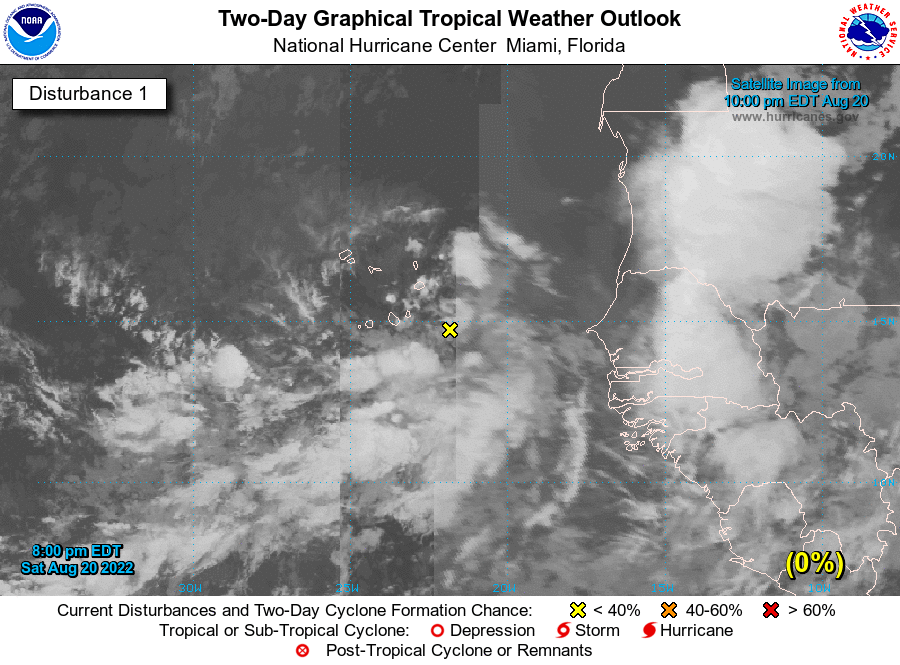
The second area of interest off the coast of Africa is expected to slowly but surely mature over the near future. At the moment, the National Hurricane Center is giving this area a 0% chance of development over the next 48 hours, and a 20% chance of development over the next 5 days. Sea surface temperatures remain modest in the mid to upper 20-degree Celsius range, but upper level wind shear will make organization difficult. Nonetheless, conditions may change rapidly from now and quicker/further intensification is always not out of the question.
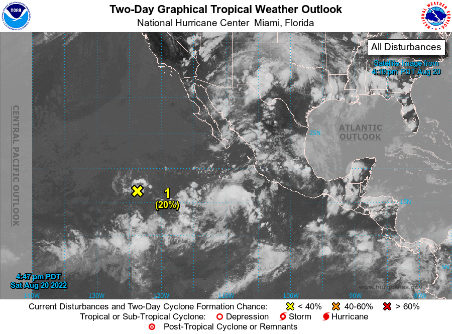
Over in the Pacific, a cluster of thunderstorms leftover from the remnants of Ivette is being monitored for potential redevelopment over the coming days. Currently, the National Hurricane Center is also giving this area a 20% chance of development over the next 48 hours and 5 days as it makes its way westward. While wind shear aloft is weak at the moment, it is expected to intensify and create an environment hostile for tropical development, which will keep the odds of organization low at this time. The area of interest’s current track is expected to remain over open waters of the Eastern and Central Pacific Ocean, with it staying well away off the coast of Hawaii.