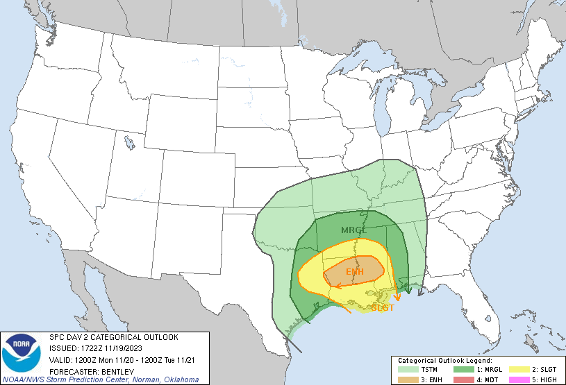
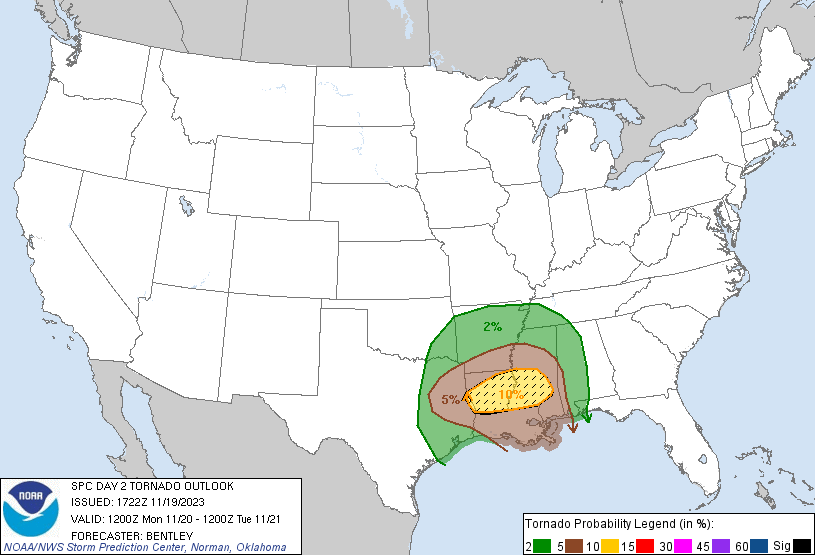
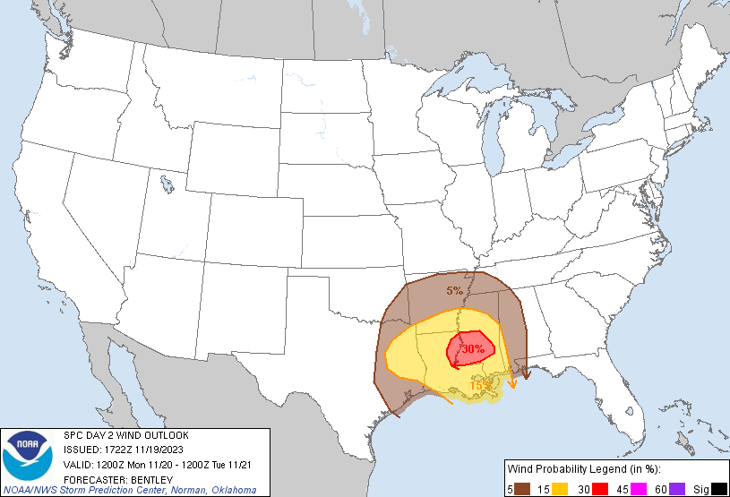
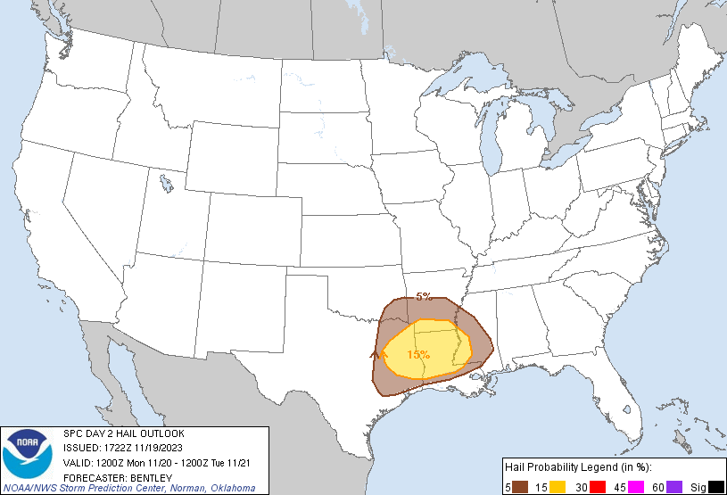
A significant severe weather event is expected to occur Monday across some of the Gulf Coast states, with the greatest risk currently forecast over north and central Louisiana and southwest Mississippi, as highlighted by the map above. All severe hazards are possible, including tornadoes, some of which may be strong.
A trough over the Plains will provide lifting and strong shear ahead of it (i.e. over the Gulf Coast states). Shear, lifting, and moisture are all very favorable for severe weather, so the biggest determining factor for which areas see severe weather will be the amount of instability. That will be determined both by how much warm air is advected (transferred) off the Gulf and into the region and also by how much daytime heating occurs (the more sunshine there is, the higher the instability, so breaks in cloud cover will increase storm risk).
The NAMNEST and HRRR models disagree somewhat on the timing of the storms (the HRRR has it coming through earlier than the NAMNEST), but the general idea is that the storms will start ramping up in east Texas and Oklahoma in the morning, moving into southern Arkansas no later than midday, Louisiana in the afternoon, and southwest Mississippi sometime during the evening. The model disagreement does emphasize that the exact timing is uncertain, so I would advise anyone in the risk areas to check their forecasts tomorrow for a more updated estimate on timing.
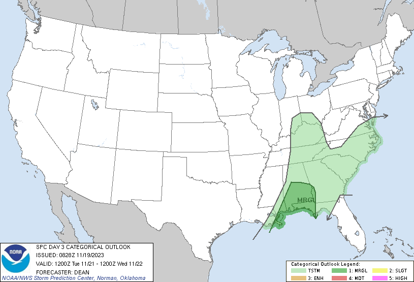
The severe threat may continue into the day Tuesday across southern Alabama, southeastern Mississippi, and northwest Florida, especially early in the day, according to the SPC. The main threats are isolated damaging winds and possibly an isolated tornado. The threat should not be as big as Monday, however, which is why the SPC currently has the risk at Marginal. Still, those in the general area should pay attention to their forecasts for Tuesday.
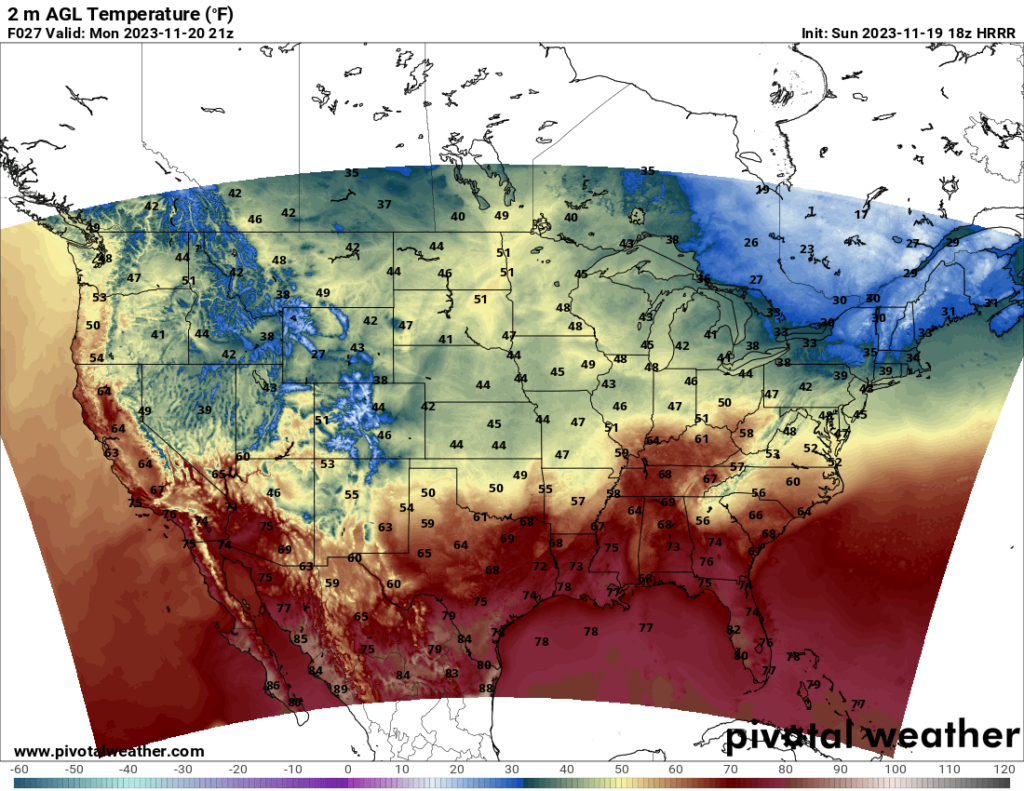
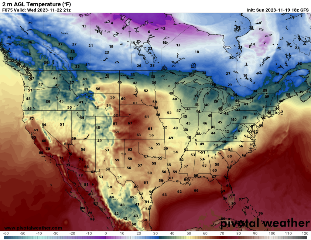
Looking to the temperatures for the week, nothing is too remarkable, at least for this time of year. Many places are beginning to feel winter-like temperatures, with cold temperatures in the northern states in particular. A cold front associated with the severe storm system will move through the Southeast over the next couple days, bringing temperatures down a bit. Overall, it is shaping up to be a chilly to cold start to the week for most of the US.
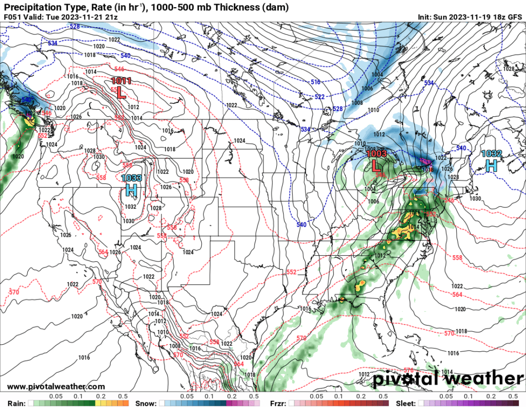
Looking at precipitation, the midlatitude cyclone associated with the severe weather in the South will also bring rain to the Midwest Monday and Tuesday, and it will bring rain to the East Coast and Northeast by Tuesday and into Wednesday. Some northern states may see snow and/or ice, so it is worth paying attention to the winter weather forecast if you live in the Northeast or Great Lakes states.
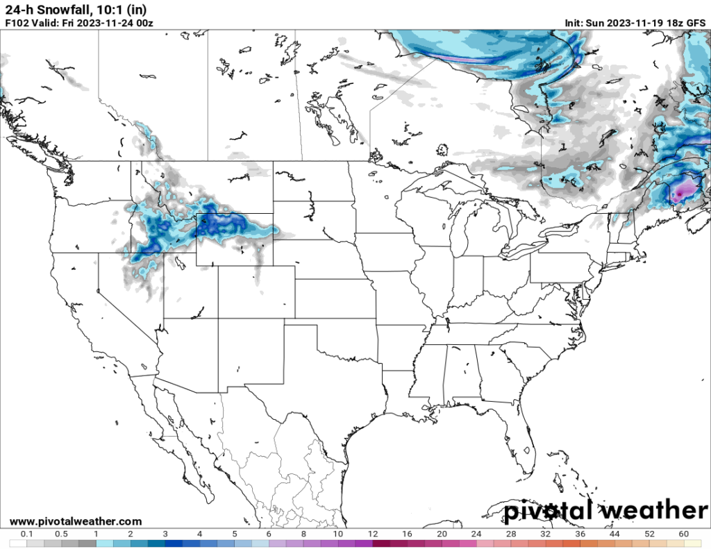
Speaking of winter weather, it looks like some of the states in the Mountain West will see snow Wednesday and Thursday. The system is forecast to spread southward as it progresses. The map above shows snowfall estimates from 5 PM Mountain time Wednesday to 5 PM Mountain time Thursday (keep in mind it will continue to move south beyond this forecast period). It seems like most areas will receive anywhere from 2 to 6 inches of snow, which, as a southerner, seems like a lot to me, but probably isn’t considered that much in the northwest states. How y’all deal with constant snow in the winter is beyond me, but that’s why I live down here and not up there (though those in the north would probably say the same thing about how we deal with the heat in the South).


