Some folks picked up a lot of rain last night. Radar estimates show up to 6″ of rain just to the northwest of Soso in Jones County. Most spots along or near Highway 84 grabbed about 2″ to 3″ of rain with up to 5″ of rain in spots.
There was some flash flooding in a few low-lying areas, particularly in and around Laurel and Ellisville. The water should already be back down to a safe level, but if you come across any water on the road this morning, please try to find another way around. You never know what is – or isn’t – under the water after a flash flood.
We learned that from HWY 589 in March of 2016 after it was covered in water and completely washed away.
For today, another round of showers and storms will be possible. Things shouldn’t be quite as robust as yesterday, but – honestly – it can’t be ruled out. The way the overall pattern is setup, there is a lot of divergence aloft which is allowing storms to develop pretty easily in the afternoon heat.
And there will be plenty of heat!
Tropics
As I mentioned yesterday, we are keeping eyes on two places int he tropics. One in the Caribbean and the other is off the coast of Africa.
It looks like the NHC is also starting to monitor the area near Africa.

But there is still another place to keep tabs on down in the Caribbean.
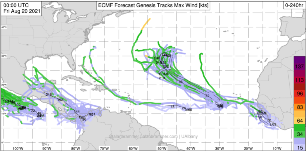
And how the overall pattern evolves during the next five days will dictate if this area is one of concern or not as we head through the end of next week.
Day-to-Day Forecast
Today
Patchy fog in the morning with passing clouds and a few showers and storms this afternoon. Highs in the lower 90s. The chance of rain 30-percent. Heat Index as high as 103.
Tonight
Clearing skies. Lows in the mid 70s.
Saturday
Mostly sunny with a 20-percent chance for an afternoon storm. Highs in the mid 90s. Heat Index as high as 105.
Saturday Night
Partly cloudy. Lows in the mid 70s.
Sunday
Mostly sunny with a 30-percent chance for an afternoon storm. Highs in the mid 90s. Heat Index as high as 108.
Sunday Night
Partly cloudy. Lows in the mid 70s.
Monday
Sunny with a 30-percent chance of showers and thunderstorms. Highs in the mid 90s. Heat Index as high as 106.
Monday Night
Mostly clear. Lows in the mid 70s.
Tuesday
Passing clouds with a few storms possible. Highs in the mid 90s. The chance of rain 30-percent. Heat Index as high as 105.
Tuesday Night
Mostly clear. Lows in the mid 70s.
Wednesday
Mostly cloudy with a 40-percent chance for storms. Highs in the lower 90s. Heat Index as high as 101.
Wednesday Night
Partly cloudy. Lows in the lower 70s.
Thursday
Partly cloudy. Highs in the lower 90s. The chance of rain 30-percent. Heat Index as high as 101.


