Since yesterday, we have been seeing the same storm system, with a slight increase in moisture, leading to higher afternoon storm coverage across southern Louisiana and Mississippi. Flood/flash flood warnings are in effect across our area.
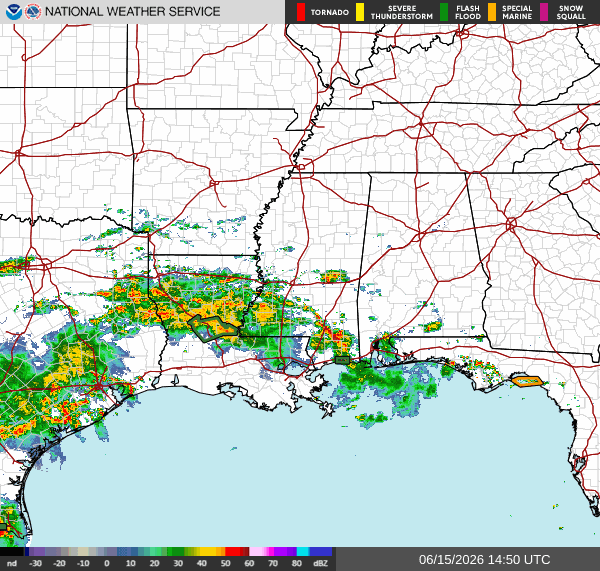
Flood concerns are the primary problem across portions of southern Louisiana, Mississippi, and Alabama today. Multiple rounds of thunderstorms are moving over the same locations, leading to areas of heavy rainfall and an increased risk of flash flooding. While not everyone will experience flooding, locations that receive repeated downpours could see rapidly rising water on roadways, in low-lying areas, and near creeks and drainage canals. Some areas can expect double-digit rainfall amounts through the rest of the week.
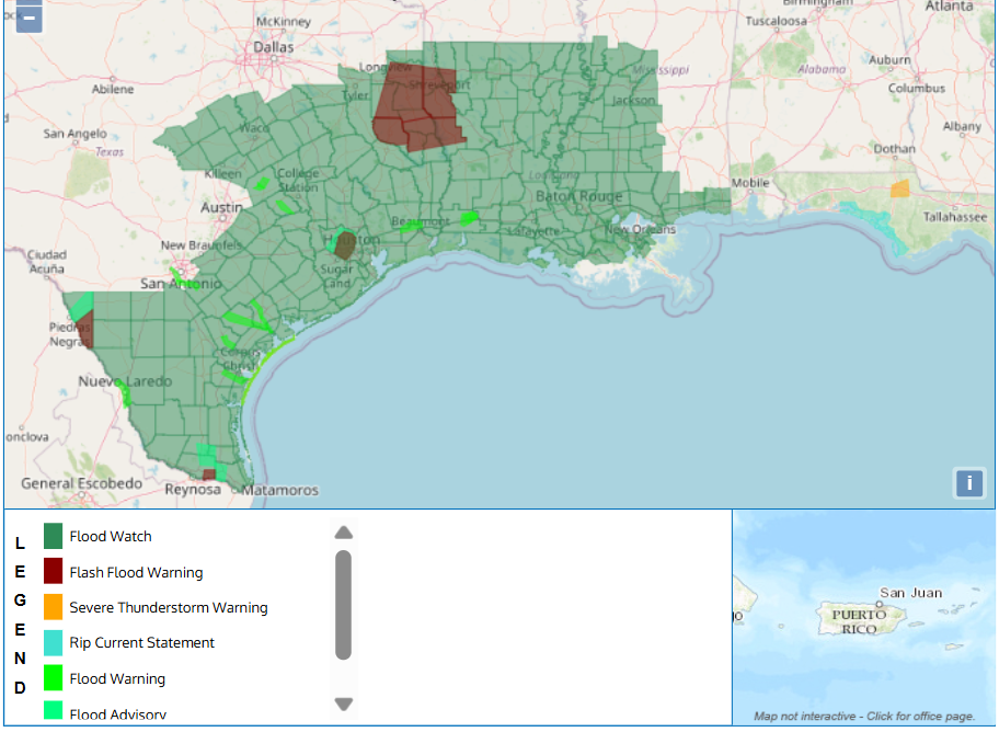
Looking above, much of our area is under at least a flood watch, with Caddo, Bossier, De Soto, and Sabine Parishes under flash flood warnings until at least 2:15 pm, with Caddo’s warning extending until at least 3 pm. (This is as of 12:32 pm).
Locations with a high risk of flash flooding include:
- Shreveport, Bossier City, Mansfield, Haughton, Greenwood,
Blanchard, Stonewall, Logansport, Fosters, Eastwood, South
Mansfield, Keachi, Grand Cane, Longstreet, Stanley, Frierson,
Kingston, Reeds Store, Gloster and Kickapoo.
Remember, flash flooding can develop very quickly during summer thunderstorm events, especially when storms repeatedly track over the same area. If you encounter a flooded roadway, turn around; don’t drown.
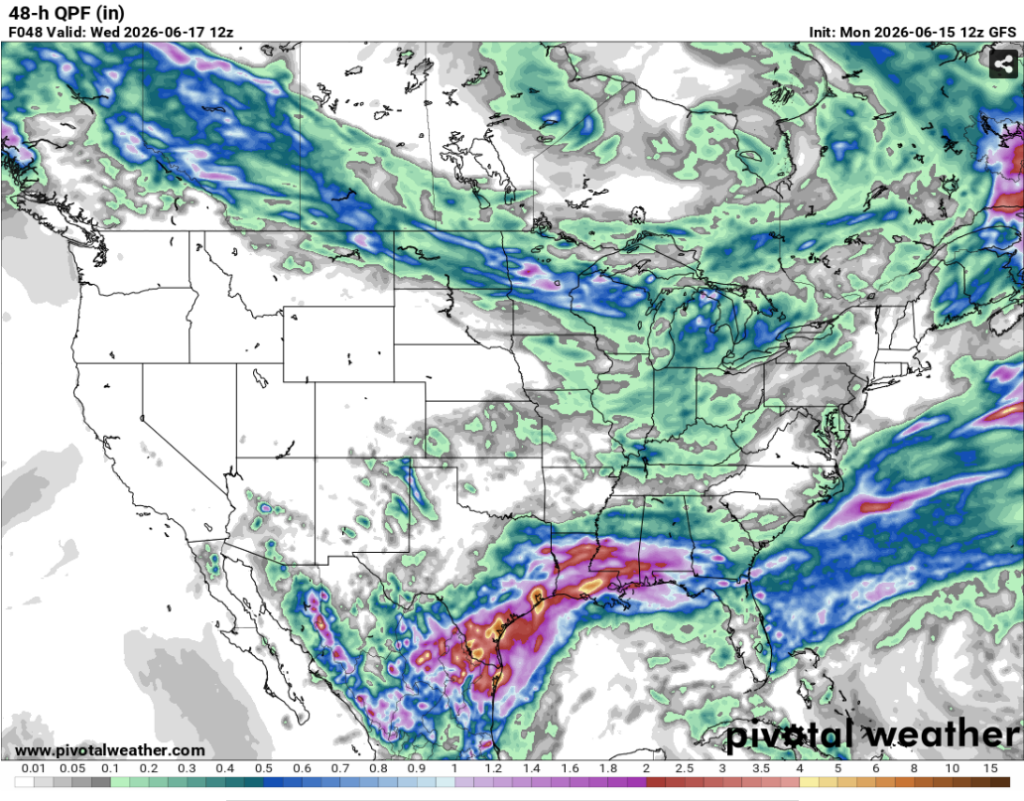
As this storm continues east and pushes inland, expect more widespread storms and rainfall accumulation across our entire region. This system will move into Mississippi and Alabama after soaking areas of Louisiana today, bringing continued flood risks to a majority of our southern coverage area. The graphic above shows the total rainfall estimates for the next 48 hours. Take this as a warning to prepare for a potential flood if you live in a susceptible area, as this storm will continue dumping insane amounts of rain through the week.
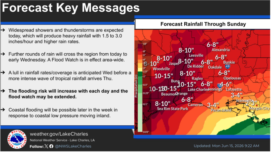
Again, our Southern LA/MS/AL region will receive a lot of rain throughout the week. Be prepared across the entire area as these heavy storms will continue as the tropical system moves inland. Even though this is a “no-name” storm and poses a low tropical threat, treat this as the real deal because historic flooding is possible with this system.


