Currently, most of our region is remaining dry through the afternoon hours. Got some isolated showers and possible thunderstorms near Southern LA’s coast lingering in that general area. No active alerts in our area.
By the early afternoon into the evening, scattered showers and thunderstorms will organize in Southern LA. Southern MS will see isolated showers and thunderstorms near the MS/LA border and pop-ups just north of the coast. Fairly similar to yesterday’s forecast. Slight difference in the placement of these showers and storms, staying more west in LA.
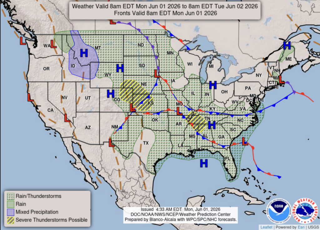
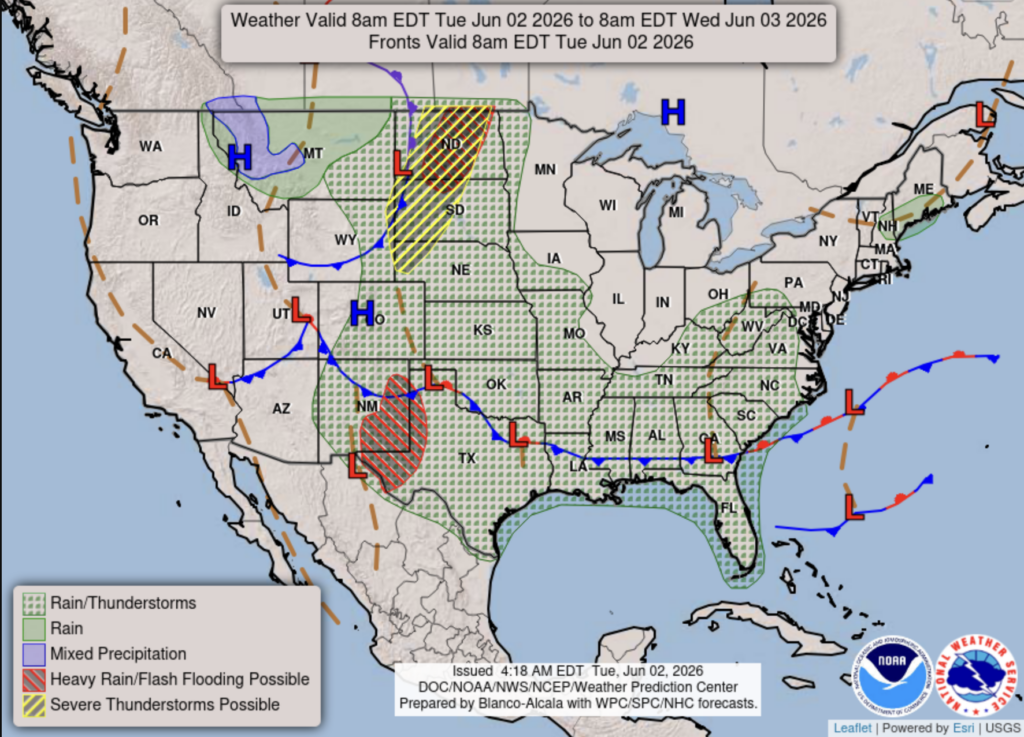
Yesterday’s national forecast chart on the left looks quite different from today’s chart on the right. We’re seeing a more defined cold front pushing south, stretching across the entire Southern region. We are going to see storms forming along the front, especially near the Gulf, where warm, moist air is present.
Tonight
During the evening into the nighttime hours, we see a line of showers and storms moving southeast through our area. Compared to yesterday, when the storms weren’t as organized and began to dissipate during the nighttime hours.
Same as yesterday’s forecast, still expecting excessive rainfall throughout our area tonight into tomorrow morning. The main concerns are flooding, flash flooding, the wind, and lightning.
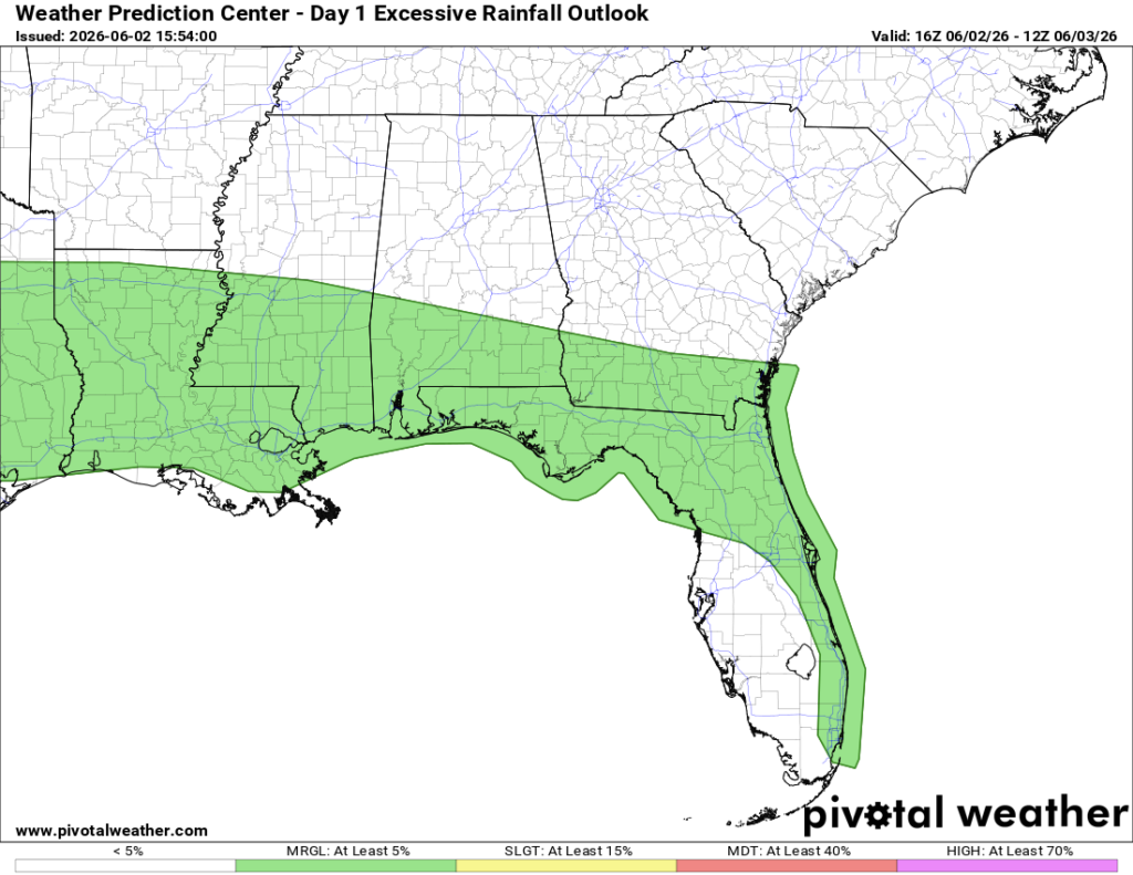
Tomorrow
Our chances for rain and storms decreased slightly from yesterday’s forecast. Still going to be humid and hot.
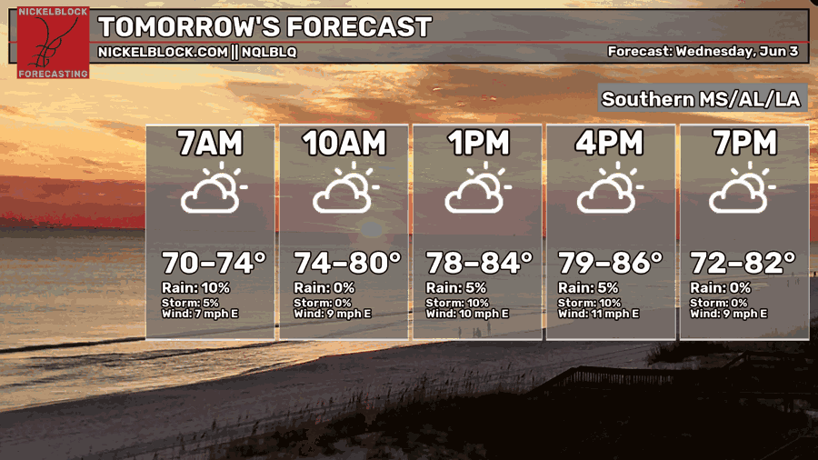
While it can still change, we get an idea that the rain and storms might stay near Southern LA and MS for the most part.


