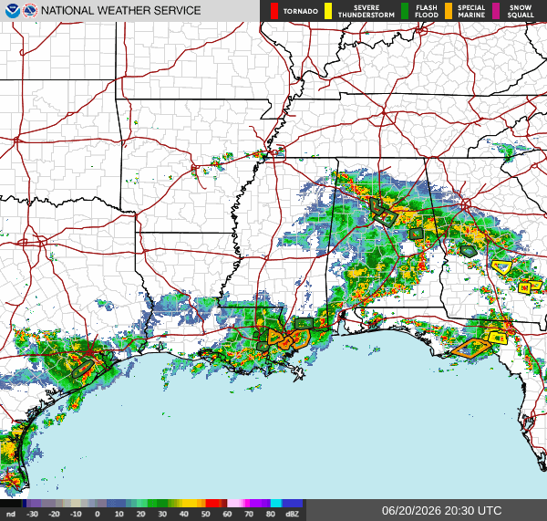
Currently, there is a line of thunderstorms and rain moving east, stretching all the way through our area. We have multiple flash floods and special marine warnings in Southern LA and Southern MS.
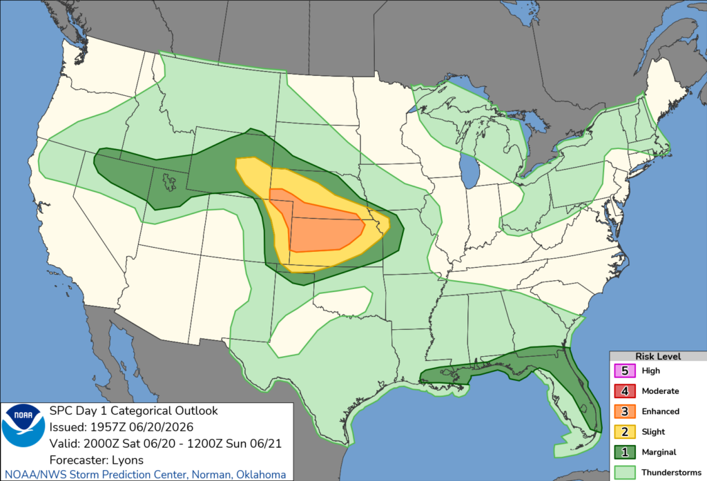
We are under a marginal risk for severe weather, meaning isolated severe thunderstorms will be possible. The biggest concerns are wind, lightning, and flash flooding.
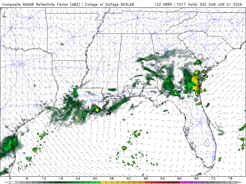
Tonight
The weather is lining up with yesterday’s forecasts, with storms and rain rolling into our area in the evening. We should start to see clearing around late nighttime and into the early morning.
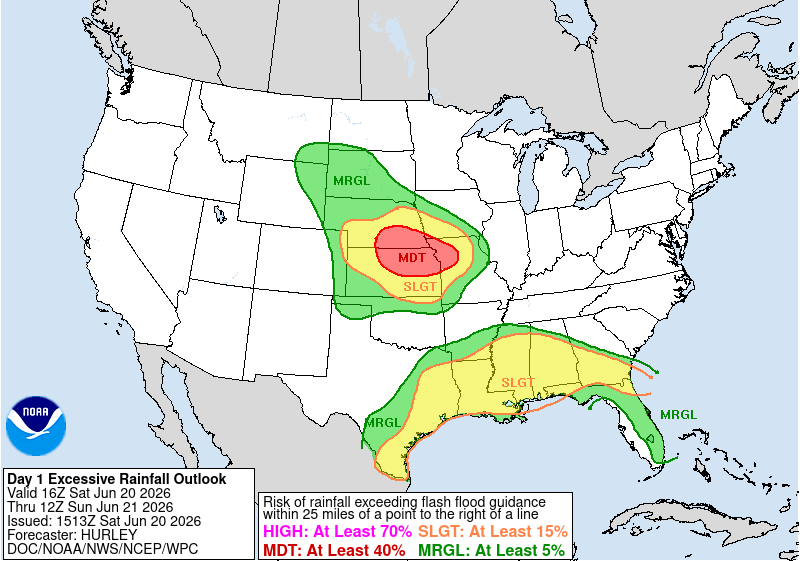
Still under a slight risk for excessive rainfall, meaning localized flash floods are possible.
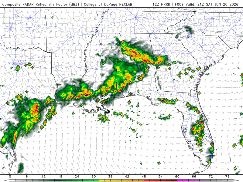
Tomorrow
Our temperatures are staying in the high 80s, while our chances of precipitation have increased during the evening.
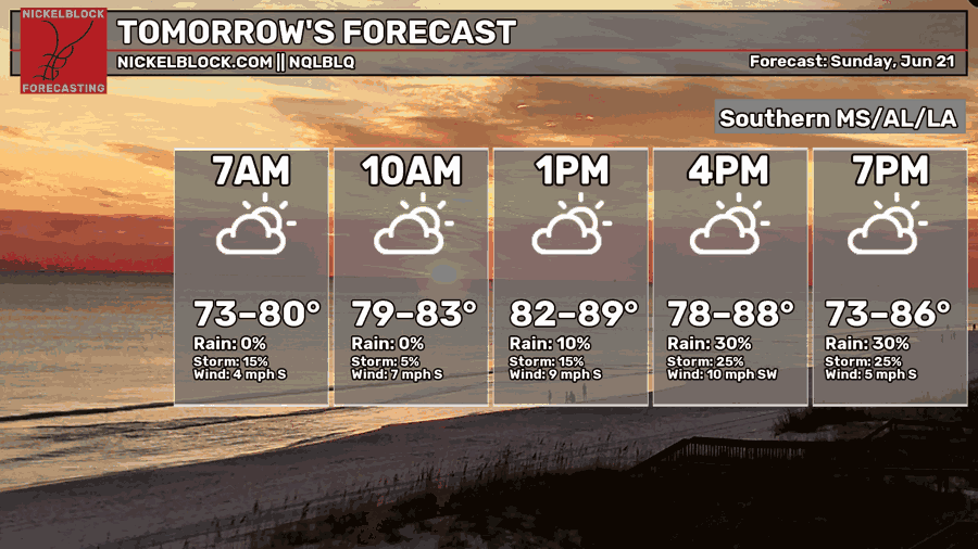
We can expect scattered thunderstorms and rain throughout our area, mostly in Southern MS and AL. For MS, rain and thunderstorms will most likely occur during the morning hours, ending around the afternoon. Southern AL will experience precipitation into the evening hours. Should be a clear night for our area. Will still be in the marginal risk for excessive rainfall.