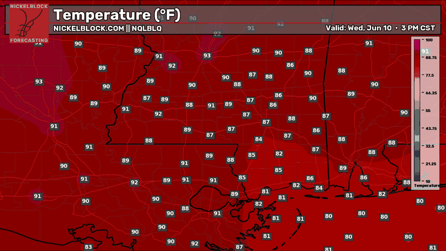
Currently, weather conditions in our area are hot and sunny with a few scattered cumulus clouds in the sky, but no rain. Temperatures are generally in the upper 80s and 90s. Dew points are currently in the upper 60s and lower 70s across the region, which is humid, but not as humid as we’re used to.
Some scattered weak storms are possible later tonight, but they will certainly not be widespread. As I mentioned yesterday, the conditions at the surface are excellent for storm development, but the mid/upper atmosphere is extremely dry, which prevents storms from deepening and becoming stronger. This is ultimately because we are at the center of an area of high pressure, where air sinks, compresses, warms, and dries.
Overall, not much in my forecast from yesterday has changed.
Tomorrow
Tomorrow, we’re in for another hot and dry day.
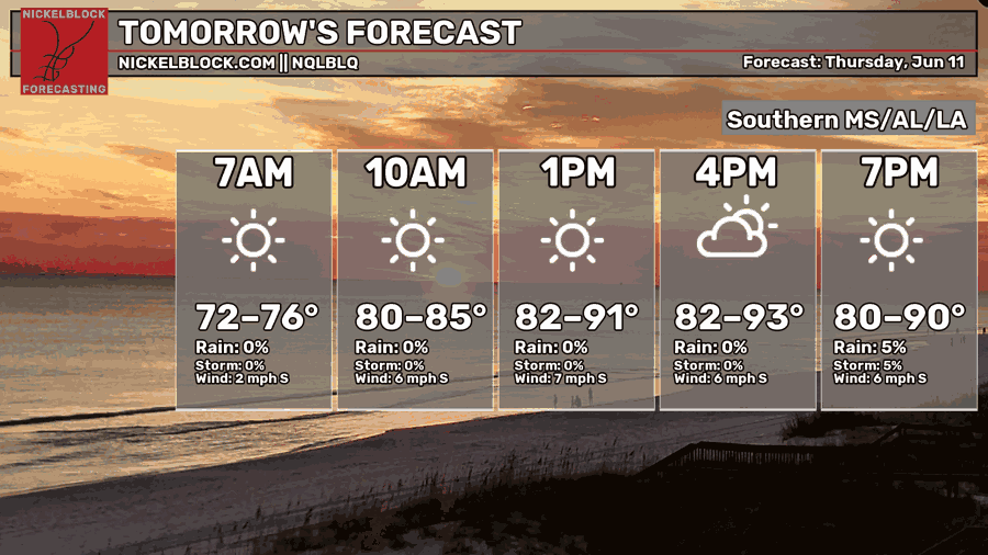
Highs will range from the lower 80s to the low-mid 90s. Highs on that lower range will be mostly by the coast which has the sea breeze to cool down the air. Tomorrow also looks to be the driest day this week, with a very small chance of rain and storms tomorrow evening. Storms, if any, will be very weak and not widespread at all.

Since yesterday, the only thing from my forecast for tomorrow that has changed has been the high temperatures. The highs are looking to be ever so slightly hotter than they were forecasted to be yesterday.
Extended Outlook
For those of you who have gardens to tend to, you will unfortunately have to wait until early next week for any real help with the water bill. For the beachgoers, you have until early next week to take the drive and soak up the sun.
The big weather story for the next week or so is hot and dry. Each day for the next 7 days the high is forecasted to reach the lower 90s with a very small chance of rain.
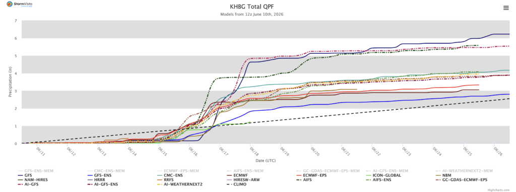
Around Tuesday or Wednesday of next week, that changes, with some models hinting at a significant rain event caused by a cold front that may pass through the area. When it’s all said and done, some models suggest rain totals could reach up to 5″! However, it’s important to take this with a grain of salt as this is still a week out.
Beyond that, I would say expect more hot and dry conditions.
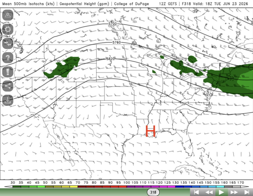
The GFS Ensemble seems to think that more ridging directly over our area is likely in the latter half of June. Of course, this means more summer heat and daily weak storms being suppressed by upper level dry air, similar to this upcoming week.


