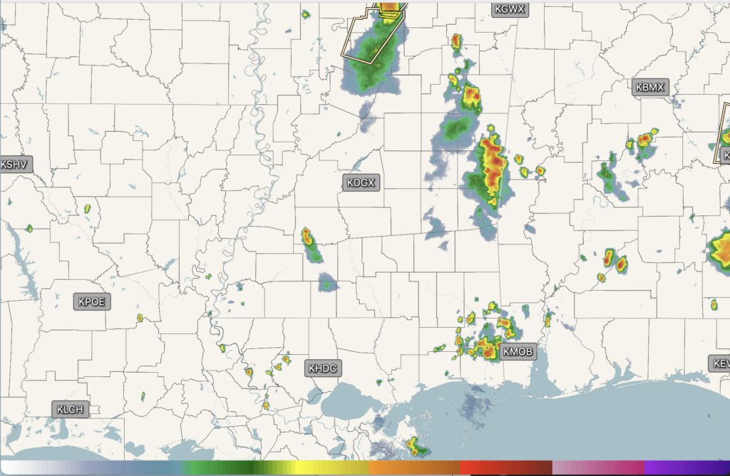
We are seeing a few cells out and about around the area, with some heavy downpours, thunder, and lightning embedded in some of them. There are even stronger cells up in northern MS with 40-mph wind gusts and nickel-sized hail! We could see a few more pop-ups as the night progresses, but it should be winding down overall soon.

Tonight’s Forecast
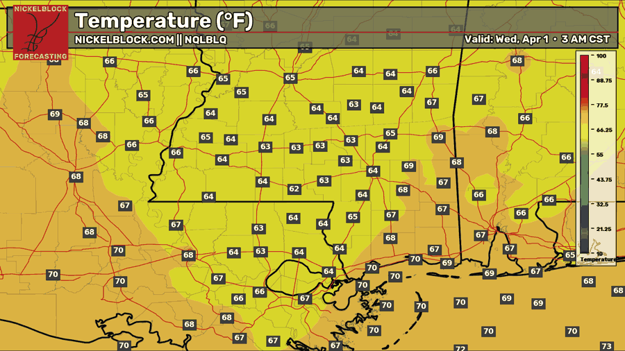
Tonight, we will see a mix of clouds with most of the rain activity over by midnight. Our low temperature will be around 3 AM, in the mid-60s. Our normal nighttime low is around 58, so we are above average.

Tomorrow’s Forecast: Wednesday, April 1st
It’s going to snow tomorrow! April Fools!! It looks like we are done with any wintry precip for the season. We will have to wait to see if next year brings us one of those nice snowstorms!
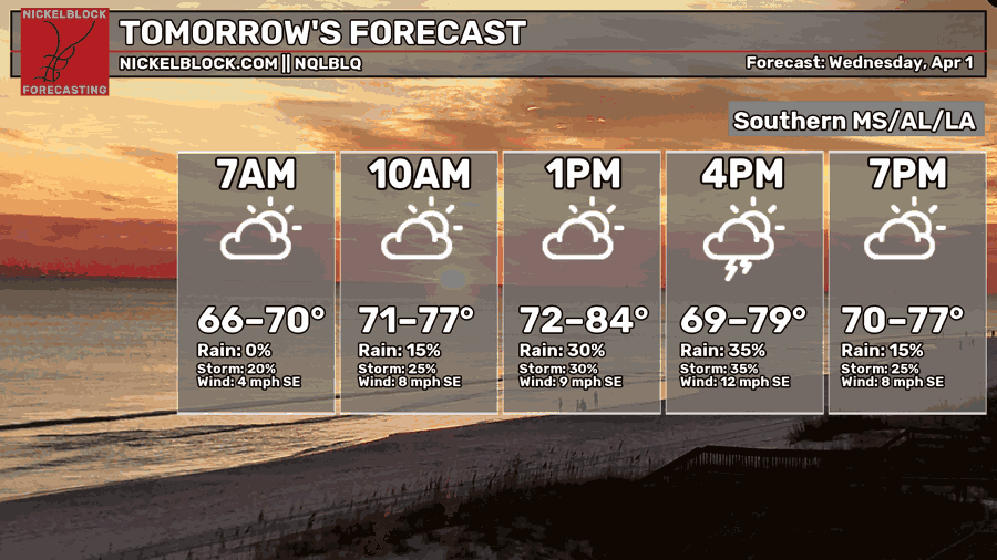
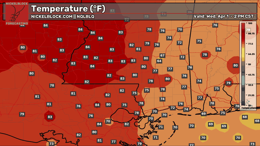
Similar to today, we will see a few clusters of heavy downpours and maybe some thunderstorms with isolated high wind gusts throughout the afternoon and early evening tomorrow. With the high humidity and temperatures in the upper 70s and low 80s, plus some offshore energy making its way onshore, clouds and rain will have no issue forming. Classic spring and summertime storms! Keep an eye out on the radar, because these will be isolated in nature, so it won’t be raining everywhere at the same time!
Thursday’s Forecast: April 2
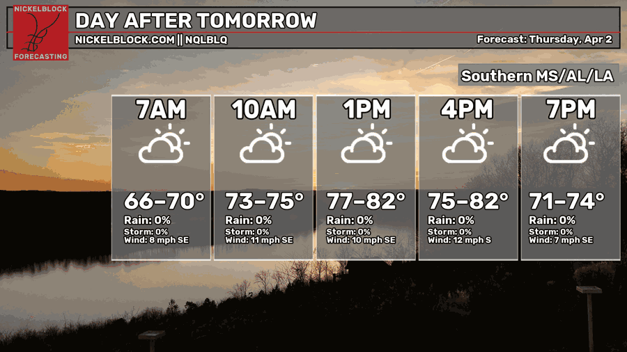
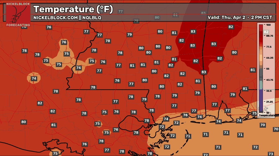
Thursday will be another hot and humid day with temperatures in the lower 80s. For reference, our average high is around 76, so we are yet again above average. We will stay in this pattern for the rest of the week, but by next week, we will flip to near-normal. Back to Thursday, no rain is in the forecast, though it’s not impossible to see a quick pop-up shower or thunderstorm, but it’s less likely than Wednesday’s threat.

Extended Local Outlook
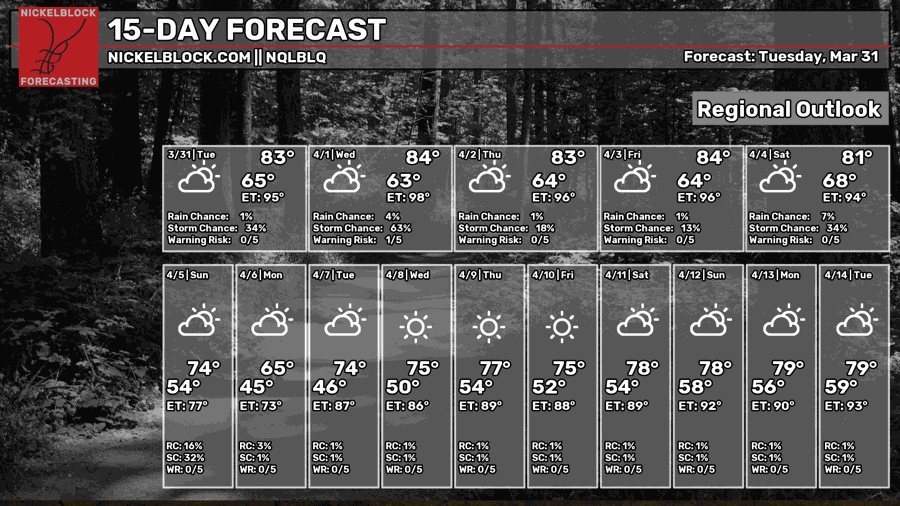
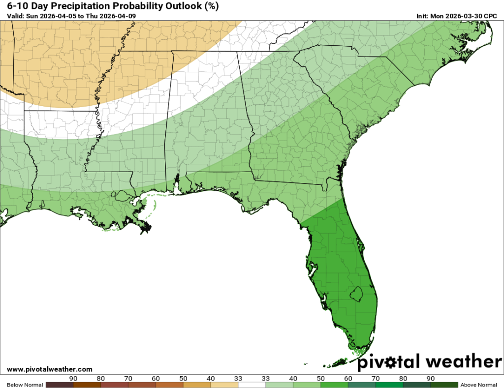
As I mentioned, we will stay with the hot and humid trend through Saturday, and then a frontal system is planning to sweep through by Sunday, bringing us near-normal or even below-normal temperatures for next Sunday through Thursday! We know frontal systems also typically bring us some temporary relief from the humidity, so that is something to look forward to. However, there might be some increased chances of rain during that time period as well, so it has its pros and cons…


