After a bit of a frosty start this morning, we will warm back to around 60 this afternoon. That is the benefit of dry air, it is easy to warm up! And we will be warming up even more in the coming days as we get ready for another shot for showers and storms
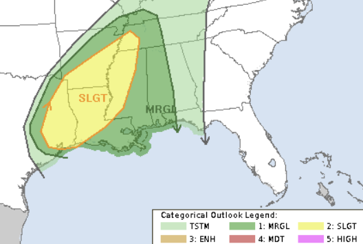
The Storm Prediction Center currently has parts of the area under a Slight Risk and other parts under a MArginal Risk for severe weather. That is a “2” and a “1,” respectively, on the 1-to-5 scale where “5” is the highest risk for the most significant severe weather.
That shot for storms arrives on Saturday as the next cold front rips through the area. And it looks like we may have two potential rounds of storms. The first one in the afternoon and then another overnight and into Sunday morning.
The first round of storms will be pretty isolated and may feature a chance for some wind gusts up to 60mph, small hail and the potential for a tornado or two. The second round will likely feature mainly rain, wind and lightning as the main concerns.
The timeline for Round One: 11a – 5p
The timeline for Round Two: 11p – 5a
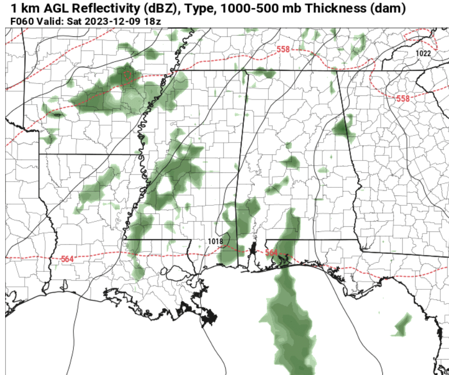
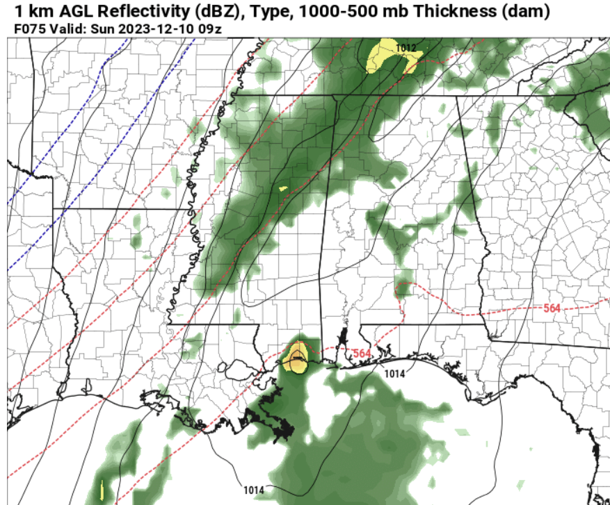
Neither round looks overly robust and both may be limited by a blob of storms trying to form off the coast and out into the Gulf of Mexico. But if that blob isn’t there, I think it really raises the ceiling on how active some of the storms may be.
Then things clear out through the day on Sunday. And things should remain seasonably chilly next week.
[wpcode id=”41149″]
REGIONAL DAY TO DAY FORECAST
Thursday: Areas of frost in the morning. Mostly sunny. Highs around 60. Southeast winds around 5 mph.
Thursday Night: Mostly cloudy. Not as cool with lows in the lower 40s. Southeast winds around 5 mph.
Friday: Partly sunny. Not as cool with highs around 70.
Friday Night: Mostly cloudy. A slight chance of showers after midnight. Not as cool. Near steady temperature in the upper 50s. Chance of rain 20 percent.
Saturday: Partly sunny. A slight chance of showers and thunderstorms in the morning, then showers likely with a chance of thunderstorms in the afternoon. Highs in the mid 70s. Chance of rain 60 percent.
Saturday Night: Showers with a chance of thunderstorms in the evening, then showers likely with a slight chance of thunderstorms after midnight. Cooler with lows in the mid 40s. Chance of rain 90 percent.
Sunday: Sunny. A slight chance of showers in the morning. Much cooler with highs in the upper 50s. Chance of rain 20 percent.
Sunday Night: Mostly clear. Cooler with lows in the mid 30s.
Monday: Mostly sunny. Highs in the lower 60s.
Monday Night: Partly cloudy in the evening, then becoming mostly cloudy. Lows in the upper 30s.
Tuesday: Partly sunny. Highs around 60.


