Good morning folks!
Summer equinox was yesterday and we are now slowly losing sunlight. Despite this change, the ridging over the southern U.S. hasn’t budged, and will be pushing today’s temperatures into the upper 90s with calm winds. Humidity will improve a little as we get later into the afternoon, as sufficiently warm surface temperatures will create vertical mixing of the moist surface air with the drier air aloft. An isolated thunderstorm or shower can’t be ruled out this afternoon/evening.
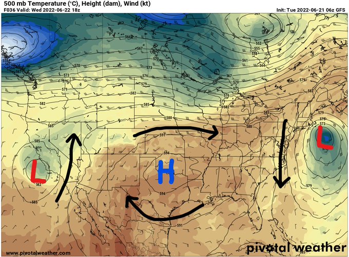
The area of high pressure over the southern U.S. has remained consistent over the past couple weeks keeping the heat and humidity trapped underneath it. With two areas of low pressure located to the ridge’s west and east, the high pressure will be strengthened and an omega pattern will ensue. This is forecasted to persist until after this Friday when the west coast low pressure moves northeastward over the ridge causing the area of high pressure to become less consolidated. This will allow for *slightly* cooler temperatures beginning next week.
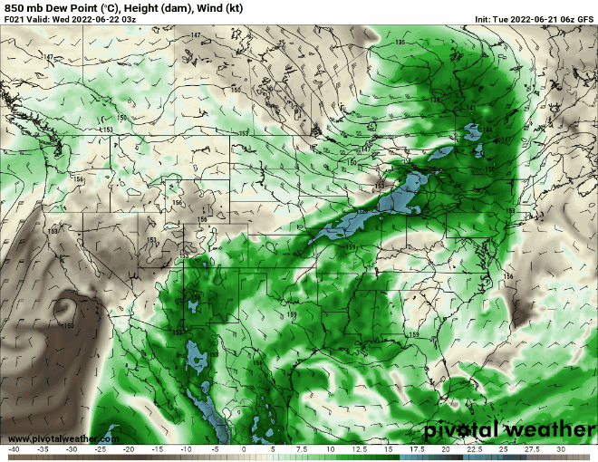
Above is a GIF displaying how we could expect the moisture to persist in coastal MS/LA/AL. Although the ridging pattern is getting a shake up at the end of this week, the high moisture content about a mile above the surface (favorable for thunderstorm development) is expected to persist and increase at the beginning of next week as a weak area of low pressure develops near Florida.
Both that and the low pressure over the Pacific Coast should be monitored as it moves eastward potentially draping a slow-moving boundary across the region which would induce higher precipitation chances.
Day To Day Forecast
Today
Mostly sunny with a 20-percent chance for showers and thunderstorms in the afternoon/evening. Highs in the upper 90s. Heat Index values surpassing 100F.
Tonight
Mostly clear. Lows in the upper 70s.
Thursday
Sunny. Highs in the upper 90s. Heat Index values surpassing 100F.
Thursday Night
Partly cloudy. Lows in the upper 70s.
Friday
Sunny. Highs in the upper 90s. Heat Index values surpassing 100F.
Friday Night
Mostly clear. Lows in the upper 70s.
Saturday
Mostly sunny with a 20-percent chance for showers and thunderstorms in the afternoon/evening. Highs in the upper 90s.
Saturday Night
Mostly clear. Lows in the upper 70s.
Sunday
Mostly sunny with a 20-percent chance for showers and thunderstorms in the afternoon/evening. Highs in the upper 90s.
Sunday Night
Mostly clear. Lows in the upper 70s.
Monday
Mostly sunny with a 20-percent chance for showers and thunderstorms in the afternoon/evening. Highs in the mid 90s.
Monday Night
Mostly clear. Lows in the mid 70s.
Tuesday
Mostly sunny with a 30-percent chance for showers and thunderstorms in the afternoon/evening. Highs in the mid 90s.
Tuesday Night
Mostly clear. Lows in the mid 70s.


