Howdy!
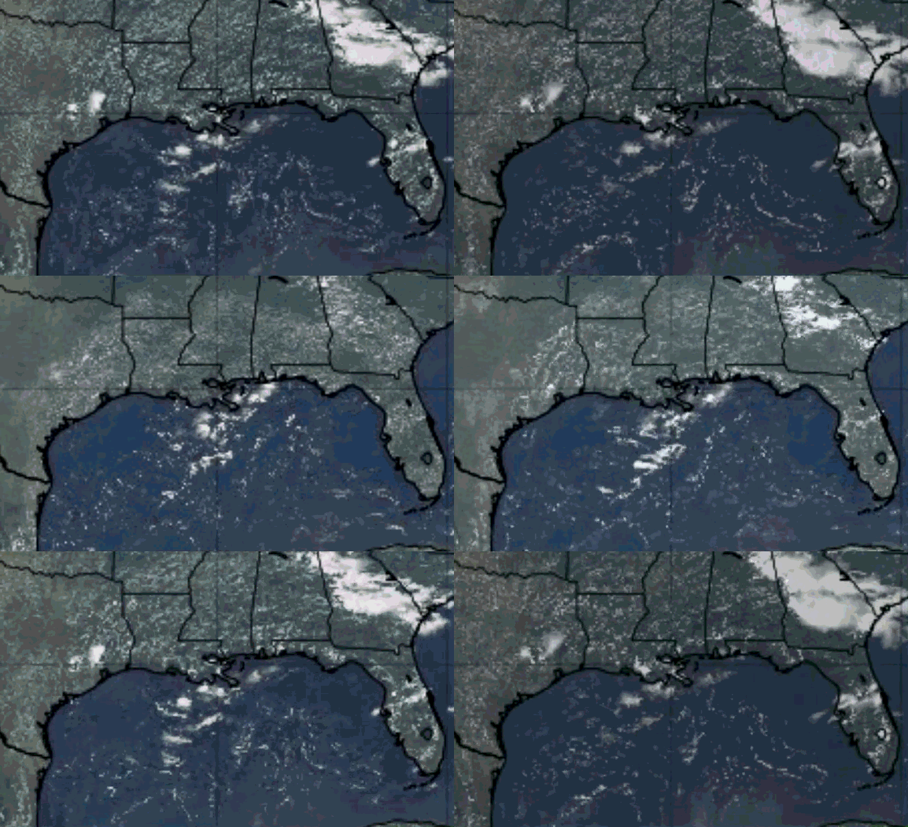
Looking out the window (satellite image from Tropical Tidbits), we can see that currently (around 4:30 CST) there is not a lot of cloud coverage over the region, coverage being in areas where it is currently raining. These areas are in Alabama and Georgia, a bit in Louisiana.
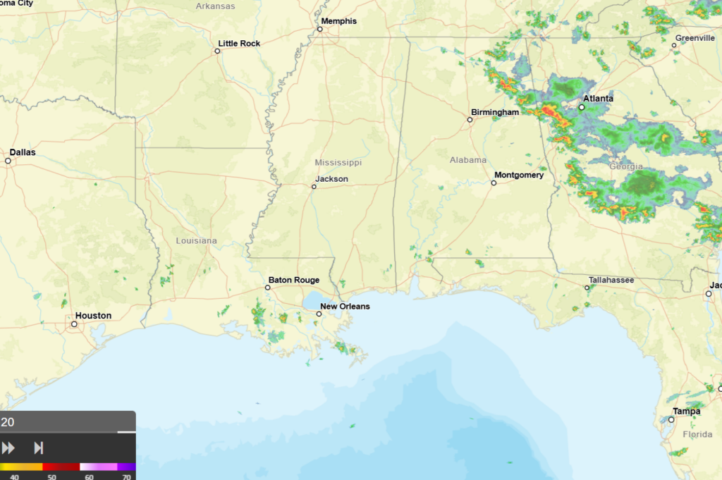
High pressure currently dominates the region, an upper-level ridge moving westward into the region creating a bit of subsidence that limits the chance of rain. Isolated to scattered showers and thunderstorms are possible today, mainly in the eastern portions of the region. Highs will be in the 90s with heat index values reaching over 100.
Some shortwaves in the upper-level flow will start to impact the region tomorrow, triggering lift and the opportunity to see a bit more rain. These shortwaves combined with the westward moving ridge will start to move a surface high over the gulf will start to shift, allowing a drier airmass move northward into our area by Thursday.
By Friday into the weekend, moisture will return as the ridge moves more north. This ridge will still be producing subsidence and limited chance of rain, but the chance of rain is not zero. Isolated to scattered showers and thunderstorms are possible, temperatures will remain hot with heat indices likely increasing over 100.
The heat is here to stay, isolated showers and thunderstorms in the afternoon, a return to normal summer weather. Heat risk will increase throughout the week into the weekend, below showing what Saturday’s heat risk could be. A lot of extremes and major risk, so it is important to stay hydrated and safe for this time of year.
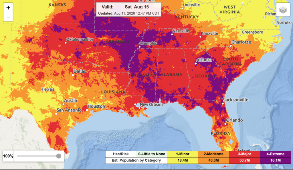
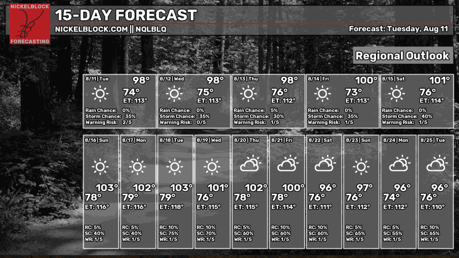
Highs will reach up to the 100s by the weekend and next week. Take this heat seriously and try to stay cool out there!
3-DAY TRAVEL FORECAST
AIRPORTS
KIAH/KHOU (Houston) – No weather-related delays are anticipated. A slight chance for thunderstorms exists this afternoon, but nothing significant enough for delays.
KSHV (Shreveport) – No weather-related delays are anticipated.
KBTR (Baton Rouge) – No weather-related delays are anticipated.
KJAN (Jackson) – No weather-related delays are anticipated.
KMSY (New Orleans) – Brief delays are possible today and tomorrow afternoon as there are chances for thunderstorms.No weather-related delays are anticipated for Thursday.
KMOB (Mobile) – No weather-related delays are anticipated.
KATL (Atlanta) – Delays due to lightning are possible today and tonight. No delays are expected tomorrow and Thursday.
KTLH (Tallahassee) – A chance for showers and thunderstorms exists each day, brief delays possible but nothing major.
KBHM (Birmingham) – A chance for showers and thunderstorms exists today through tomorrow afternoon, brief delays due to lightning are possible. No delays expected Thursday.
HIGHWAYS
I-10 – Isolated to scattered showers and thunderstorms along I-10 are possible each afternoon. Some storms could produce locally strong wind gusts, lightning, and heavy rain.
I-20 – Isolated showers and thunderstorms are possible each afternoon, Alabama seeing the most chance for rain. For the most part, conditions are clear.
I-49 – Isolated to scattered showers and thunderstorms are possible each afternoon, the main chances being closer to the gulf coast of Louisiana.
I-55 – Isolated to scattered showers and thunderstorms are possible each afternoon, the main chances being closer to the gulf coast of Louisiana. Mississippi will be mostly clear of precipitation over the next few days.
I-59 – Isolated to scattered showers and thunderstorms are possible each afternoon, main chances falling near the coast of Louisiana and further along the highway in Alabama. Locally strong wind gusts, lightning, and heavy rainfall are possible with stronger storms.
I-65 – Isolated to scattered showers and thunderstorms are possible each afternoon, central/northern Alabama has an increased chance to see rain over the next few days.
I-75 – Scattered showers and thunderstorms are possible each afternoon. Storms could be strong and produce strong wind gusts, heavy rain, and lightning. Be cautious when traveling on this highway for the next few days as showers and thunderstorms are very likely.
CITY FORECASTS
Houston, TX
Today/tonight – A 40% chance of showers and thunderstorms in the afternoon. Other than that, mostly sunny skies with a high near 97, heat index values reaching as high as 109. Tonight, a 20% chance of showers and thunderstorms before 11pm. The low will fall around 79 with mostly clear skies.
Tomorrow – Mostly sunny and hot conditions with a high of 96. Heat index values will reach as high as 107. Tomorrow nught, mostly clear conditions with a low around 79.
Thursday – Sunny and hot conditions with a high near 98. Wind gusts up to 20 mph are possible. At night, mostly clear conditions with a low around 80.
Shreveport, LA
Today/tonight – Mostly sunny and hot conditions with a high near 97 and heat index values as high as 105. Tonight, mostly clear skies with a low around 78.
Tomorrow – Another sunny and hot day! The high will be around 98 with heat index values as high as 104. Tomorrow night, clear skies with a low around 78.
Thursday – Sunny and hot conditions with a high of 98 and a low around 76. Clear skies at night.
Baton Rouge, LA
Today/tonight – Sunny and hot conditions with a high of 95 and heat index values as high as 105. Tonight, mostly clear conditions with a low around 76.
Tomorrow – The high will reach 95 with heat index values as high as 106. Another hot and sunny day. Tomorrow night, mostly clear conditions with a low around 76.
Thursday – Lots of sun with hot conditions, the high near 96 and the low around 74. Mostly clear conditions at night.
Jackson, MS
Today/tonight – Mostly sunny with a high of 96 and heat index values as high as 106. Tonight, mostly clear skies with a low around 77.
Tomorrow – More sun and hot conditions, the high near 97 and heat index values as high as 106. Tomorrow night, mostly clear skies with a low around 76.
Thursday – Another hot and sunny day. The high will be around 98, the low falling to 76. Mostly clear conditions at night.
New Orleans, LA
Today/tonight – This afternoon, a 30% chance of showers and thunderstorms exists. Mostly sunny with a high near 93 and heat index values as high as 105. Tonight, mostly clear skies with a low around 78.
Tomorrow – A 40% chance of showers and thunderstorms in the afternoon. Other than that, mostly sunny skies with a high near 92 and heat index values as high as 105. Tomorrow night, mostly clear with a low around 77.
Thursday – Sunny conditions with a high of 94. The low will fall around 77 with mostly clear skies at night.
Mobile, AL
Today/tonight – Mostly sunny skies with a high near 93 and heat index values as high as 109. Tonight, mostly clear with a low around 76.
Tomorrow – A 20% chance of showers and thunderstorms in the afternoon. Other than that, mostly sunny skies with a high near 94 and heat index values as high as 109. Tomorrow night, mostly clear conditions with a low around 77.
Thursday – Sunny conditions with a high near 95. At night, mostly clear skies with a low around 77.
Atlanta, GA
Today/tonight – A 40% chance of showers and thunderstorms in the afternoon. Partly sunny skies with a high near 91. Wind gusts up to 15 mph are possible. Tonight, a 30% chance of showers and thunderstorms exists. Partly cloudy conditions with a low around 75.
Tomorrow – A sunny day with a high near 92 and heat index values reaching up to 98. Wind gusts up to 20 mph are possible. Tomorrow night, partly cloudy skies with a low around 75.
Thursday – Mostly sunny skies with a high near 94. At night, partly cloudy skies with a low around 77.
Tallahassee, FL
Today/tonight – A heat advisory is in effect today until 7:00pm tonight. A 10% chance of showers and thunderstorms exists this afternoon. Mostly sunny and hot conditions with a high of 96 and heat index values as high as 106. Tonight, mostly clear skies with a low around 76.
Tomorrow – A 30% chance of showers and thunderstorms in the afternoon. Other than that, mostly sunny and hot conditions with a high near 97 and heat index values as high as 107. Tomorrow night, a 30% chance of precipitation mainly before 8pm. The low will fall around 77.
Thursday – A 30% chance of showers and thunderstorms in the afternoon. Otherwise, sunny and hot conditions with a high near 97. At night, a 30% chance of precipitation before 8pm, a low around 77.
Birmingham, AL
Today/tonight – A 40% chance of showers and thunderstorms in the afternoon. Partly sunny skies with a high near 91 and heat index values as high as 105. Tonight, mostly clear skies with a low around 75.
Tomorrow – A 40% chance of showers and thunderstorms for the day. Other than that, mostly sunny with a high near 92 and heat index values as high as 106. Tomorrow night, partly cloudy and a low around 76.
Thursday – Mostly sunny conditions with a high near 94. At night, partly cloudy skies with a low around 77.
Check out my video forecast!


