Howdy!
It will be a bit dry for the next couple of days, little chance of rain. By the later half of this week, the chance of rain will increase as moisture returns and so does the heat. Looking into next week, temperatures are expected to be above average with the chance for some afternoon thunderstorms.

TODAY/TONIGHT
Currently (around 2:00CST), there is a bit of cloud coverage in the region, a couple showers near Bucks, AL and Maryland, LA.
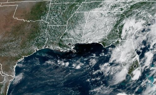
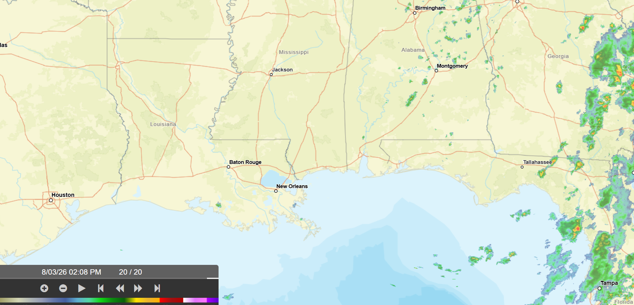
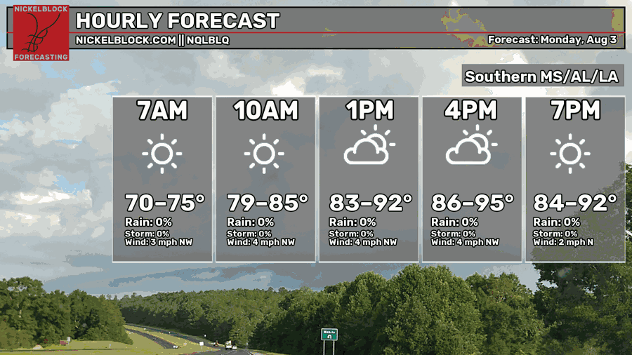
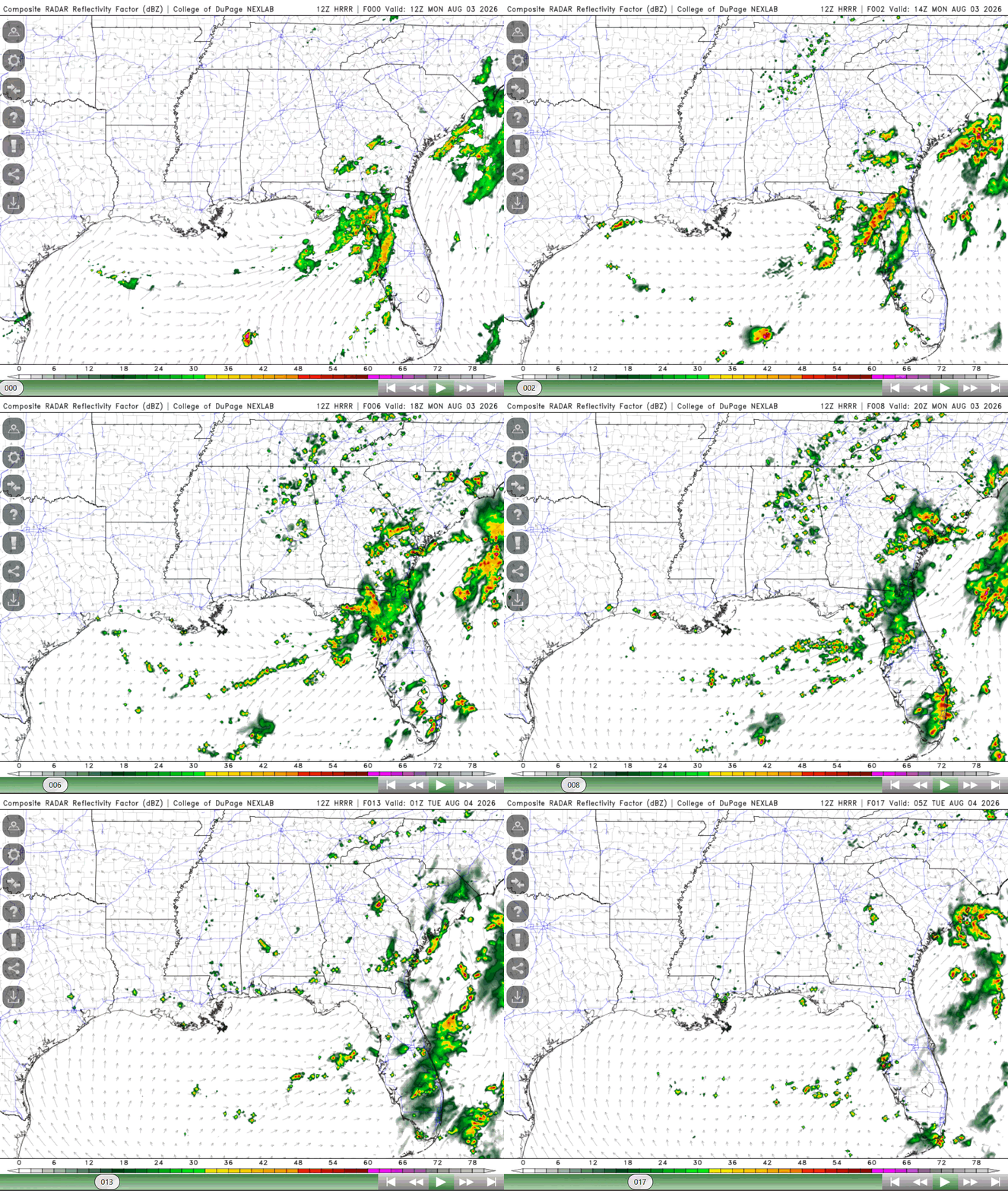
Highs today will remain slightly cooler than as of late, ranging from the 80s to 90s. Lows also a bit cooler, in the 70s for much of the region. The chance of rain today is small, isolated showers and thunderstorms cannot be ruled out for the late afternoon (so not completely zero despite what the graphic says).
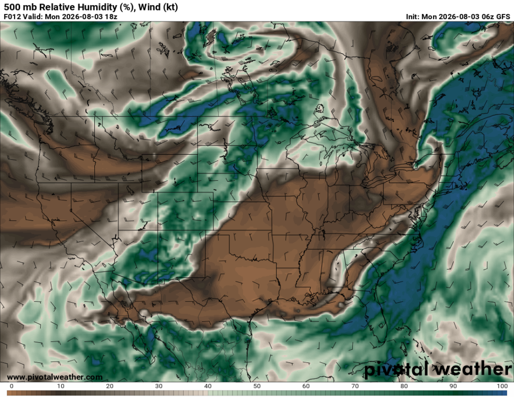
The reason there is a very small chance of rain is that there is dry air (brown areas below) being carried in the midlevels, but the lower levels carry a good amount of moisture that could support some showers and thunderstorms especially near the coast. That moisture will return by the later half of the week, increasing the chance of rain to a more typical summer pattern.
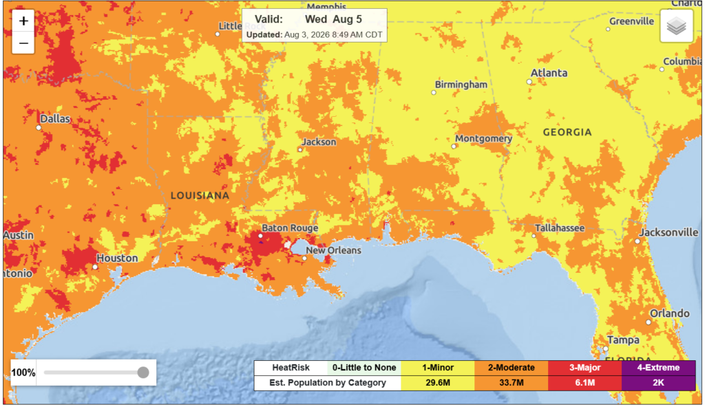
The dry air is also working to keep temperatures below the heat advisory threshold for today. In terms of heat risk, there is really nothing significant, a lot of the region falling under the minor to moderate risk. This is definitely a good chance from what it was last week.
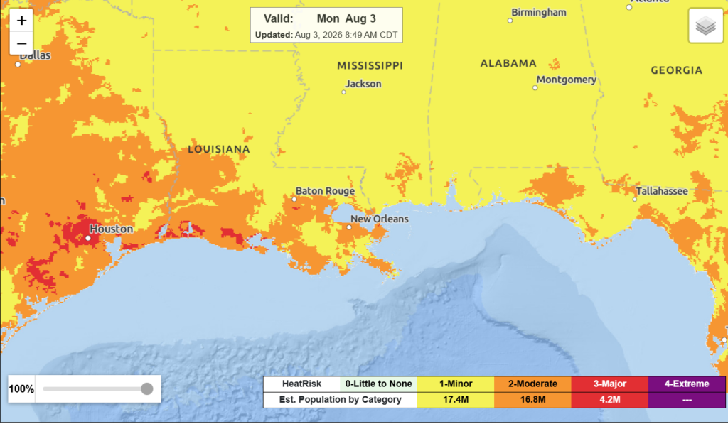
A sea breeze along the coast later today might trigger some showers and thunderstorms near the coastal regions. In general, today is a dry day for a good amount of the region.
TOMORROW

A similar day tomorrow. Highs ranging from the mid 80s to mid 90s and a small chance for rain, but a slight increase from today. Winds will shift from northwesterly to southerly by the end of the day, allowing gulf moisture to start to flow into the region, increasing humidity and precipitation throughout the rest of the week.
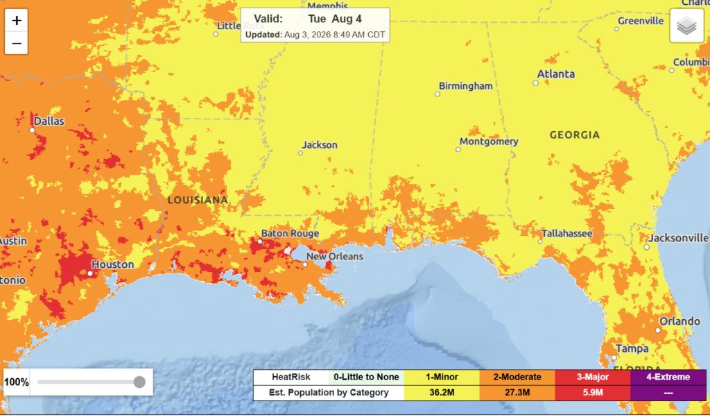
In terms of heat risk, it is more than it was today. Now, much of the region falls under the moderate to major. Ensure that you try to keep cool when outside and stay hydrated. While we have had some relief, it will not last unfortunately.

WEDNESDAY
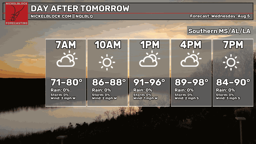
By Wednesday, we expect that the troughing that is currently over the region will move to the east and out of the region, a more established southerly flow will come in effect, bringing with it plently of moisture. Heat indicies will start to climb back up once again with this return of moisture going into the weekend.
The chance of rain is still a bit limited for Wednesday, though not entirely zero. Isolated showers and thunderstorms are possible in the afternoon. Still under the moderate to major heat risk, which will likely keep increasing as the week progresses. Again, make sure to keep this in mind when outside and take care of yourself.

EXTENDED OUTLOOK
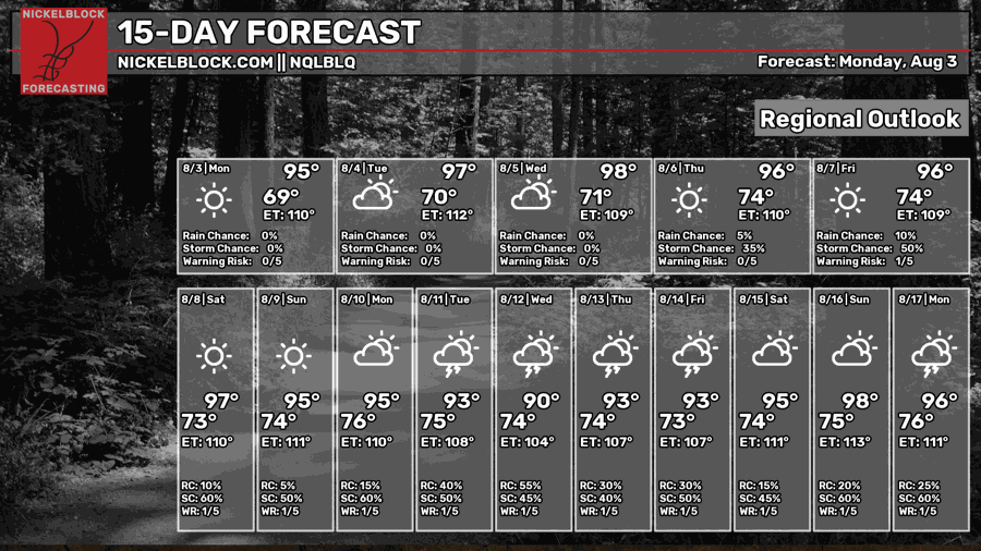
Looking ahead, by the end of the week heat index values will once again reach over 100 and heat stress increases. Isolated to scattered showers and thunderstorms are possible each day, increasing a bit into next week.
Temperatures are set to be above normal next week and precipitation near the average for this time of year. Some parts of Louisiana are actually predicted to be below average for the precipitation.
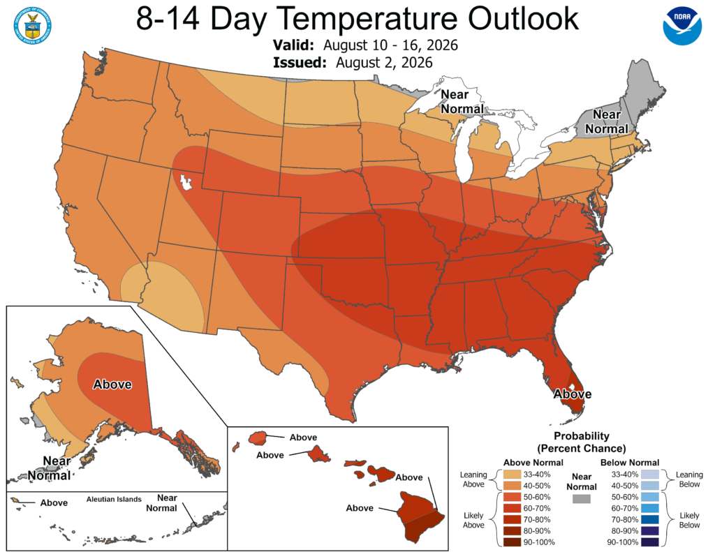
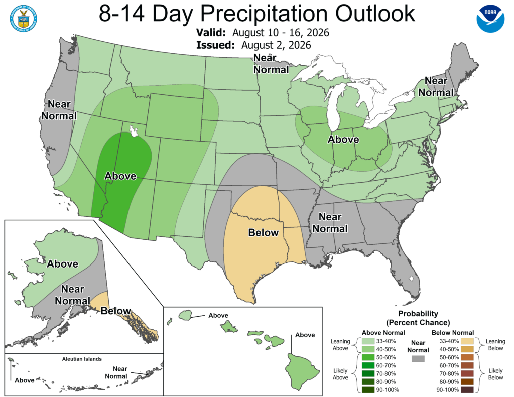
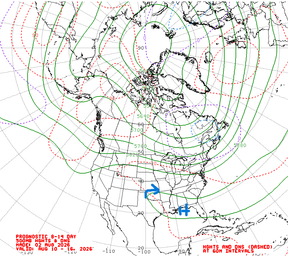
High pressure will dominate over the next couple of weeks keeping temperatures warm and precipitation diurnally driven for the most part. With above average temperatures, it is important to recognize the importance of heat safety. Find ways to keep cool and limit your time outdoors if you are able to. It’s August, it’s going to be hot, that is what to expect.
Make sure to watch my video forecast and have a great rest of your day!


