Howdy!
Looking out the window at the Atlantic, we can see there is a line of clouds and convection along the ITCZ due to a few tropical waves heading to the west from Africa. Looking at the surface analysis by the NHC, we can see the tropical waves denoted in the far eastern Atlantic, and the strong subtropical high over the central Atlantic.
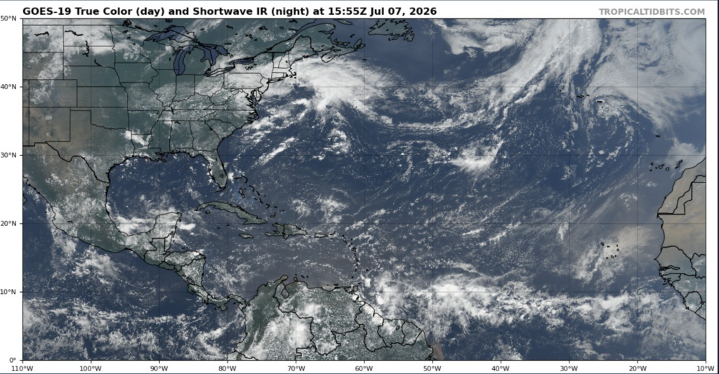
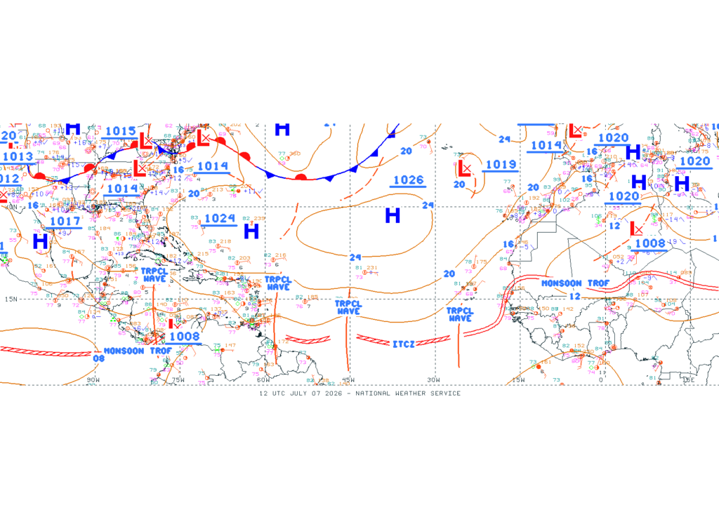
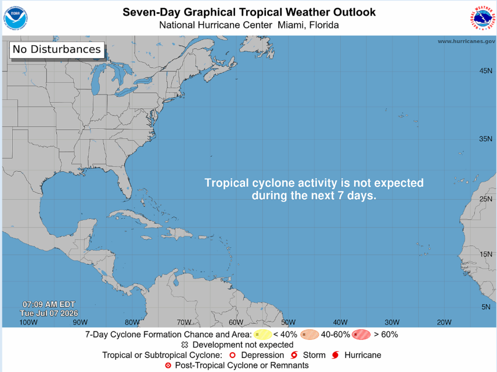
Over the next 7 days, no tropical cyclone activity is expected. The waves indicated above are not expected to trigger any development, therefore for the next 7 days, there is nothing going on in terms of tropical disturbances.
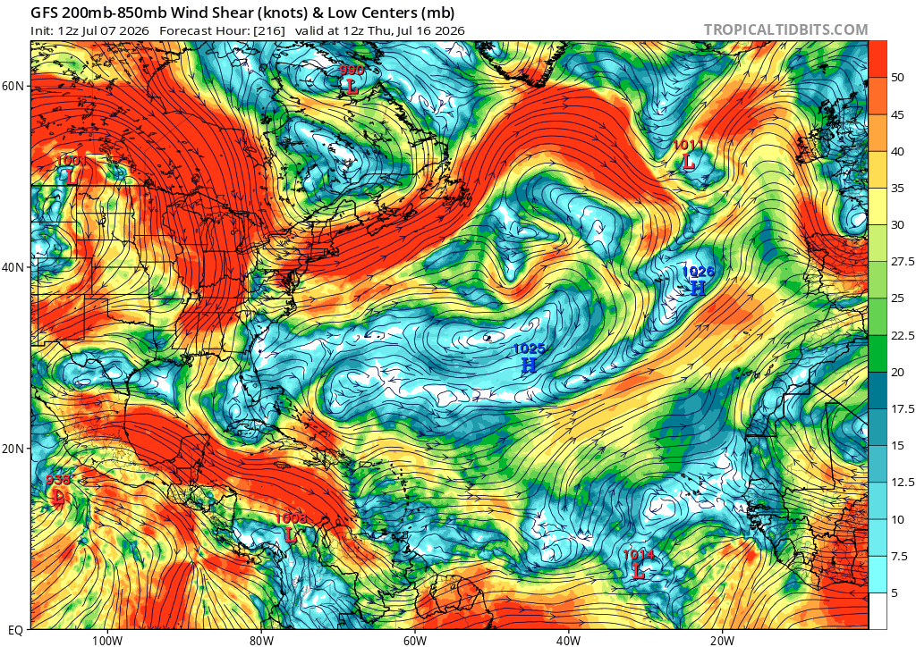
There is still a bit too much shear for anything meaningful to form and stay organized in the way that a hurricane or tropical storm needs. Based on the GFS model, it seems to subside a bit in the eastern Atlantic (where storms initially start to form) by next week but still remains strong over the Caribbean Sea. This will likely change by then.
Also, some larger pockets of dry air in the mid-levels in the eastern Atlantic would suppress the further development of any tropical system. Storms feed off of moist air from all levels, especially for a hurricane as it needs a symmetric vertically stacked structure, so these areas of drier air would not do well in any tropical formation.

Typically, July is a period where conditions gradually become more favorable for hurricane development, and by the end of the month, environmental conditions look to be a lot better for that chance. Currently for the next week or two, not all the conditions are there for development. As the month passes, the tropics will continue to be monitored so make sure to keep checking in and keep up to date!


