This week looks like more of the same, with hot days and heat indices between 100–105, before we all enter the afternoon storm lottery. Some spots will see showers and thunderstorms, while others stay dry. Any storm that develops could produce heavy rain, gusty winds, and frequent lightning.
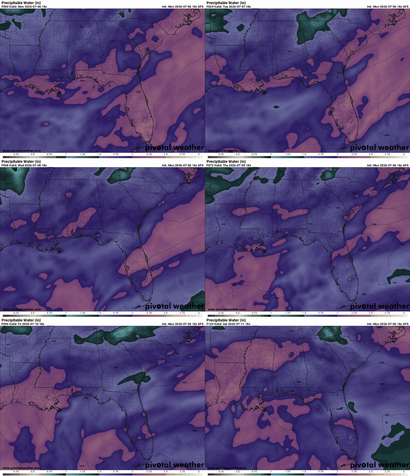
Precipitable water (PWAT) gives us an advantage in determining how much moisture is in the atmosphere at a given time. Values are very high, around 2.0″, and remain elevated through the end of the week (shown by the purples and pinks). This doesn’t look like much of a flooding situation, as these storms will be moving relatively quickly.
By Thursday and Friday, a weak ridge builds in, so storm activity is expected to decrease. With fewer afternoon storms, the heat will intensify, making heat impacts more of a concern later in the week.

TONIGHT
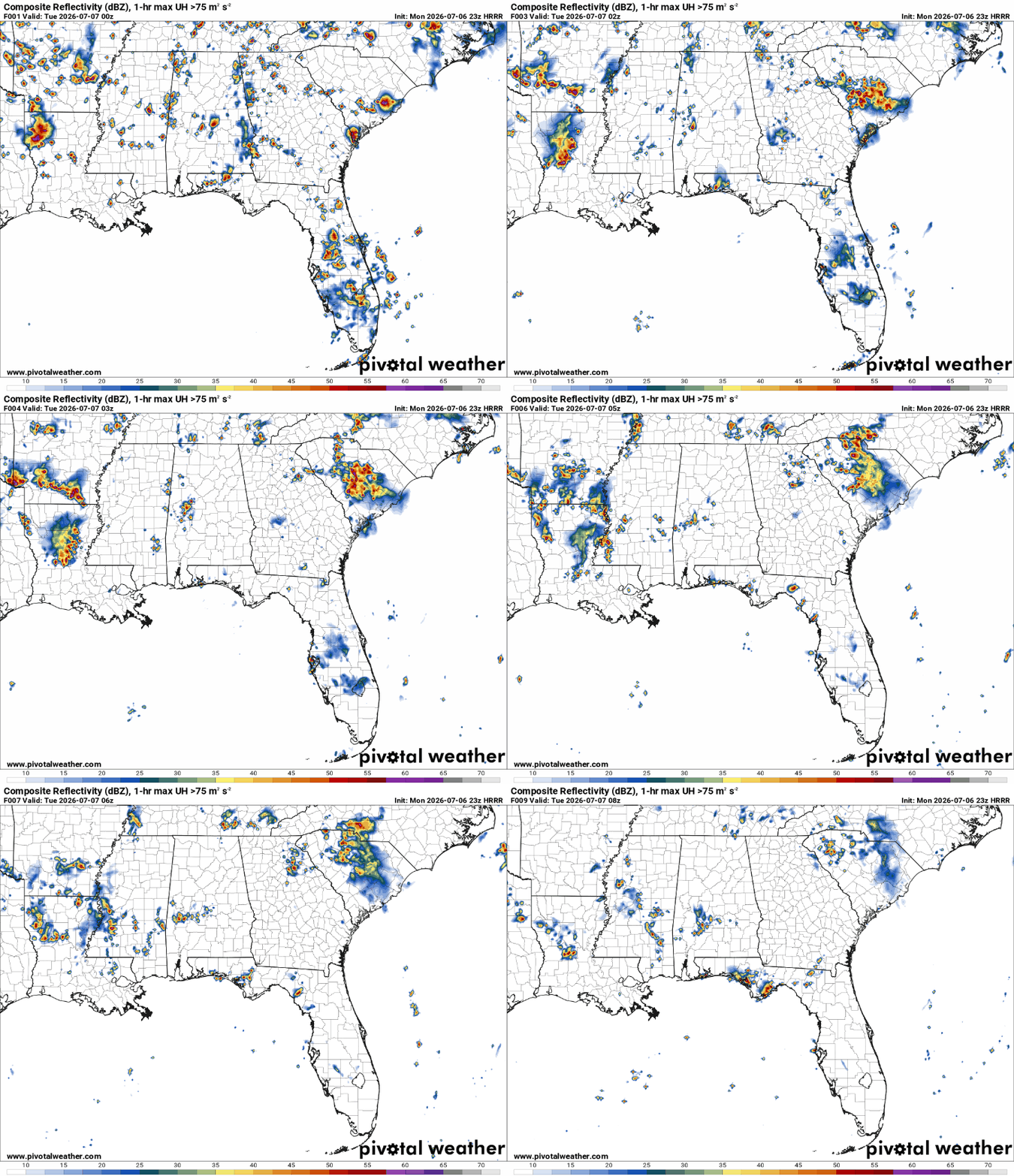
Tonight, all eyes are on the line of strong thunderstorms ongoing east of Shreveport. Though they appear to weaken overnight according to short-range models, they could reach portions of Natchez, Brookhaven, and McComb before completely dissipating. Heavy rain, frequent lightning, thunder that may wake you up in the middle of the night, gusty winds up to 60 mph, and small hail are all possible.
TOMORROW
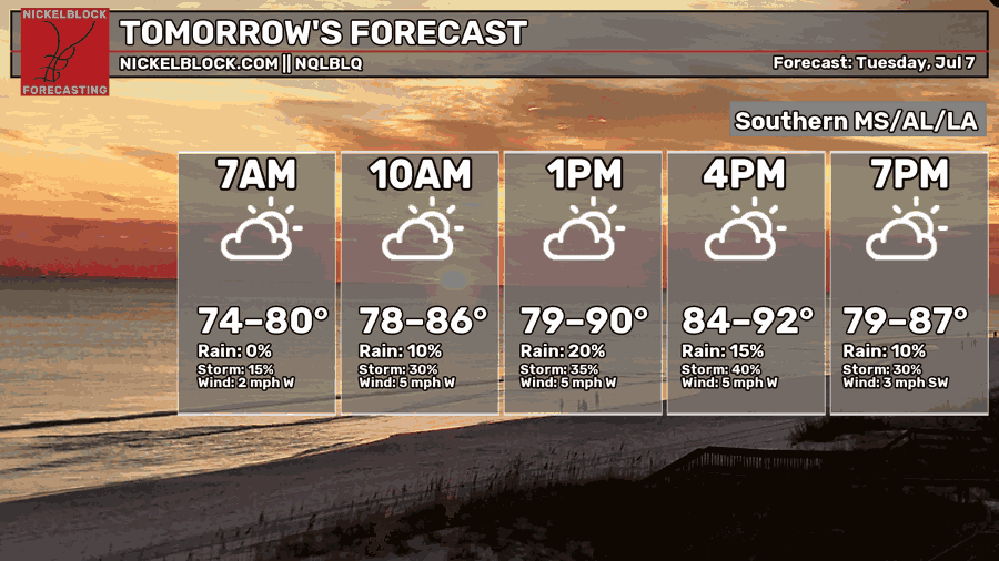
Tuesday, a low and its stationary front are forecasted to be placed in northern LA/MS. Combined with plenty of moisture and outflow boundaries from today’s storms, scattered afternoon/evening showers and thunderstorms are expected across the region. Any storms that develop could bring strong wind gusts, heavy rainfall, frequent lightning, and we can’t rule out a brief, weak tornado.
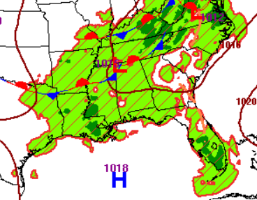
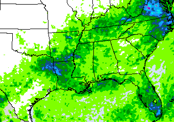
The highest rainfall totals tomorrow are expected across southeastern Louisiana, near Baton Rouge and Houma, as well as along the coast (shown by the darker green areas below).


THE DAY AFTER TOMORROW
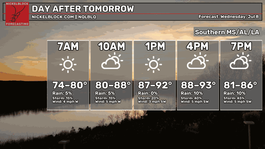
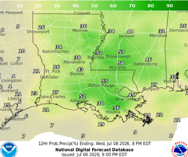
Rain will continue into Wednesday, with much of southeastern Louisiana and southern Mississippi seeing a 50% chance of numerous afternoon showers and thunderstorms. Spotty sea-breeze storms are also expected along the coast.

EXTENDED OUTLOOK
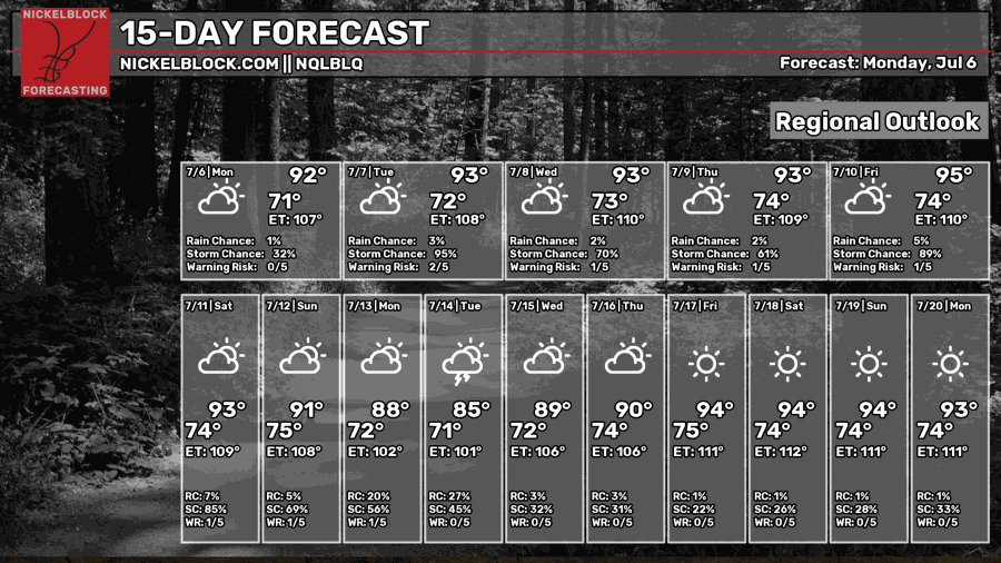
Shower and thunderstorm activity is expected to decrease Thursday and Friday as a ridge slowly builds back in over the northeastern Gulf. Daily temperatures will increase, so we could see heat advisories make a return going into the weekend. Stay hydrated…drink plenty of water!
DAY-BY-DAY FORECAST
Tonight – Lows tonight range from 74 in Hattiesburg to 78 near New Orleans. Mostly clear skies. Could see a lingering severe storm near Mccomb and Brookhaven. Calm southerly winds. Rain chance: 20%
Tuesday – Scattered showers and thunderstorms, mainly in the afternoon near southeastern Louisiana. Otherwise, partly sunny. Highs hovering around 90. Lights winds blowing from the west. Rain chance: 50%
Tuesday Night – Lows around 75. Could see a lingering stray storm. Otherwise, mostly clear skies with light winds blowing from the southwest. Rain chance: 20%
Wednesday – Numerous showers and thunderstorms, mainly in the afternoon. Otherwise, mostly sunny withs highs near 93, may feel closer 105. Light winds blowing from the south. Rain chance: 50%.
Wednesday Night – A stray evening shower remains possible before skies settle into a mostly clear night. Low around 74. Calm southerly wind. Rain chance: 20%
Thursday – Mostly sunny skies. A few afternoon thunderstorms may pop up after 1pm, but much of the day stays dry. Light southwesterly winds. Highs around 93, may feel closer to 105. Rain chance: 20%
Thursday Night – A stray evening shower remains possible before skies settle into a partly cloudy night. Low around 74. Rain chance: 20%
Friday – Mostly sunny skies with scattered showers and thunderstorms, mainly in the afternoon. Highs around 95, may feel closer to 102. Light south wind 5 to 10 mph. Rain chance: 40%
Friday Night – Partly cloudy skies with lows around 74. Light winds from the south.
Saturday –Partly sunny and hot, with a high near 93, but humidity will make it feel like 105. Additional showers and thunderstorms likely, mainly in the afternoon. Rain chance: 30%
Saturday Night – Partly cloudy, with a low around 74. South wind around 5 mph
Sunday– Wet weather returns with showers and thunderstorms likely. Highs stay hovering around 91, may feel like 105. Otherwise, partly sunny. Light west wind. Rain chance: 50%
Sunday Night – Partly cloudy but cannot rule out an isolated storm near the coast. Low near 75. Calm wind.


