All is still quiet in the Atlantic so far; however, the Eastern Pacific has been seeing some steady activity. Besides the quick Tropical Storm Colin that seemingly was gone soon after it officially formed, the rest of the basin has seen no real activity in the two weeks since then. That will change as we begin to close out July and head into August.
Eastern Pacific
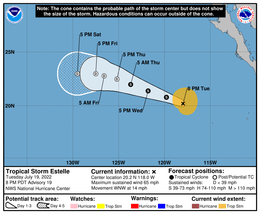
As Darby fizzled out, Estelle was taking shape. It peaked as a category 1 hurricane with max winds of 85 mph before weakening. That trend will continue as the environment ahead becomes unfavorable. Estelle is currently a tropical storm with winds of 65 mph moving WNW towards drier air in the atmosphere. This will soon overcome the system and induce weakening.
The official forecast from the NHC shows the weakening trend as Estelle will lose strength over open water and will not be of any threat to land.
Atlantic
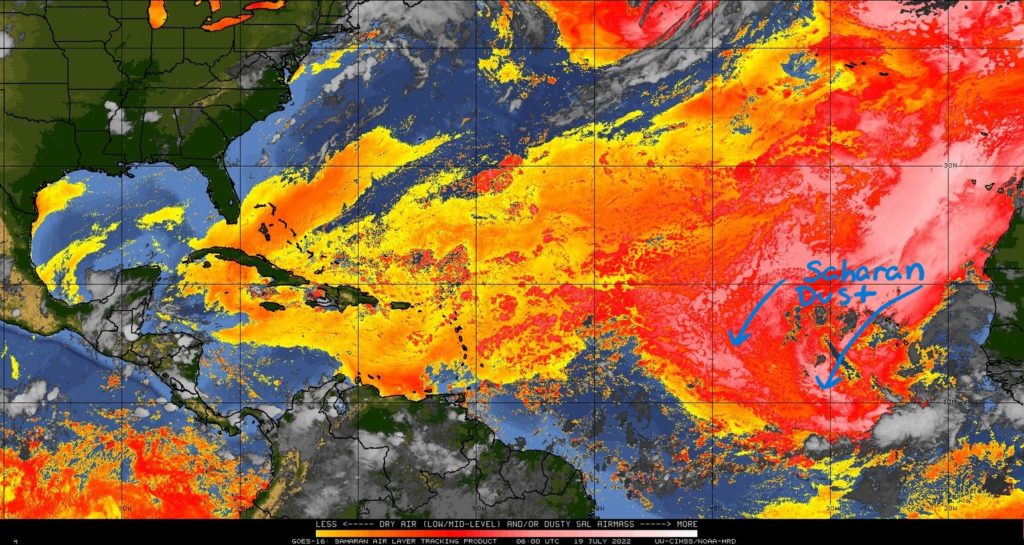
Over in the Atlantic basin, tropical activity has been quiet since early July. Part of the reason for this is the overwhelming amount of dry air that is covering the areas where cyclone formation could take place. There is a small amount of convection attempting to fight off this dry air west of Africa near the Equator.
Contributing to this dry air is the Saharan air layer, SAL. You have most likely heard of this before as it can sometimes reach the Gulf Coast and bring hazy conditions and poor air quality to land. The SAL rolls off the Western African Coast from the Saharan Desert limiting robust convection over the water. The current plume is moving southwest towards the front end of the area of convection.
This dust layer will help to inhibit organization of thunderstorms. However a weak surface low may develop in a tropical wave in the next couple days. This would be located along the monsoon trough in the ITCZ (Intertropical Convergence Zone) just north of the Equator. Remember, the ITCZ is where the trade winds of both hemispheres come together and converge leading to some background spin in the environment.
With a surface low emerging in this region, there could be some potential for development. What could be detrimental to formation would be wind shear. There is an area of increasing shear ahead of these thunderstorms indicated by the positive shear tendency in the image below. There also exists increasing shear in the south Gulf of Mexico and not many areas of decreasing shear. This is aiding in the quiet tropics for now. For the next five days, the NHC is not expecting any tropical development.
Next Week
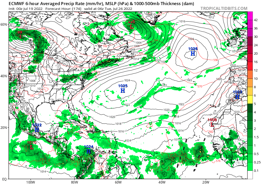
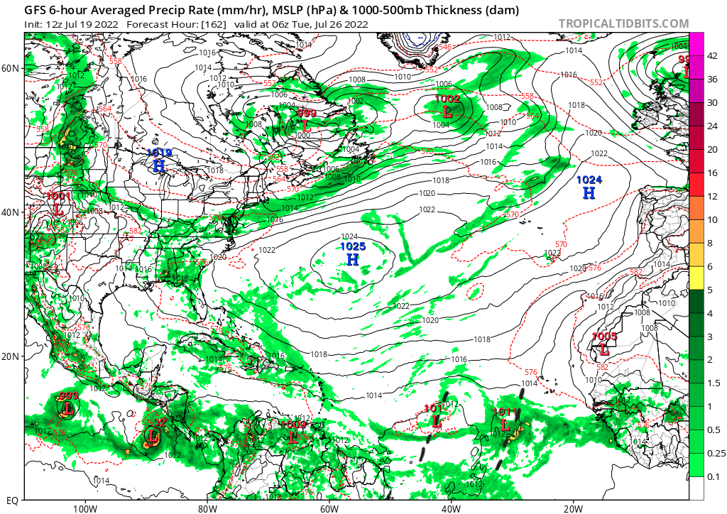
Early next week could see a better chance for tropical development in the Atlantic. By looking at long range models such as the GFS and ECMWF, by next Tuesday, increasing moisture over the Eastern Atlantic could push away some of the SAL. Coupled with more moisture near the ITZC, wind shear is being shown to decrease in the area. Both models are picking up on a wave of thunderstorms moving off the African Coast over this region. They show two tropical wave axes near 40W below. The GFS seems to pick up on this feature more than the Euro, but that could change as this is 162 hours out.
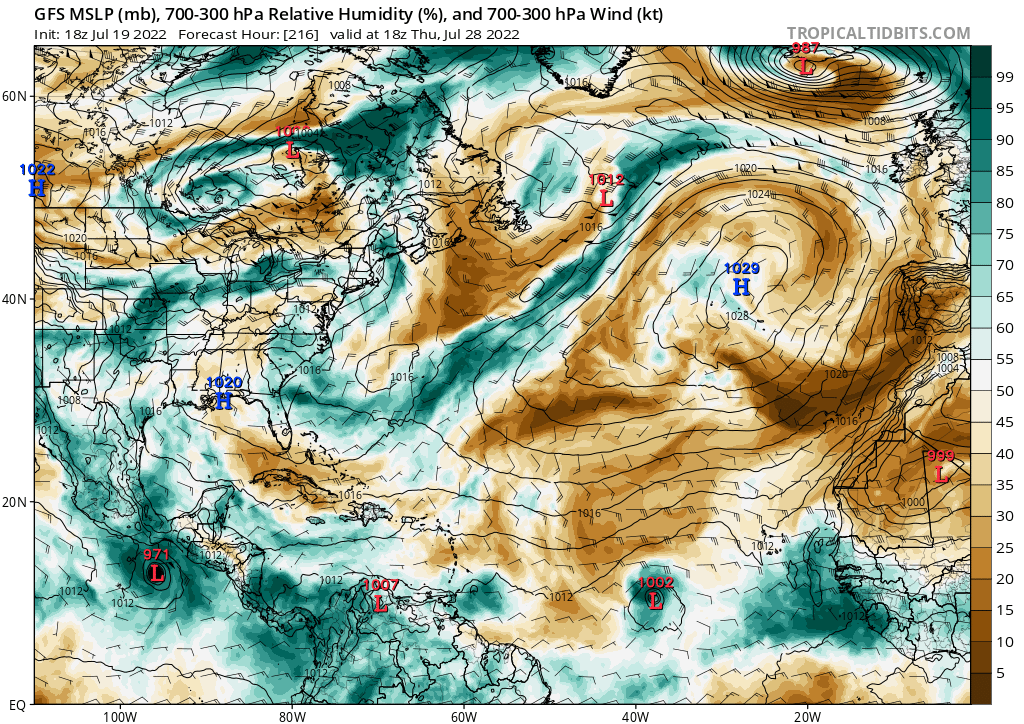
The GFS model is developing this surface low and moving it west below the Bermuda high next Thursday. Ahead of it is some deep layer dry air that could limit how strong this system may get. Remember, this model is showing this possible system 216 hours out. The important thing is to keep track of model trends as the forecast day gets closer before confidence can increase. When something official develops, the NHC will produce forecasts for it. The people at the NHC are the best in the business for tropical weather, so keep up to date on their forecasts as well.
As July is nearing its end, its important to look at climatology for where tropical cyclones will generally develop. Most systems in late July tend to originate from the Gulf of Mexico and near the Bahamas and Bermuda. Then activity starts to increase more in August with the area for cyclone genesis expanding towards the main development region. Tropical waves exit Africa towards this zone with usually weaker trade winds and the warmest sea surface temperatures of the season to assist in development.
It is not too late to formulate a plan and prepare in the event a landfalling cyclone is heading your way. Check out the information from the NWS on how to best prepare here.


