For the majority of those not experiencing oppressive heat (i.e. Texas, western Arkansas, and northwestern Louisiana), conditions will remain very seasonal with average temperatures and daily chances for rain for the next week. Currently, a high pressure ridge is situated off to the west over the southwestern US and a weak upper level low is sitting over the Carolinas. The region of high pressure has been the main reason for the soaring heat off to the west, which will be broken down in the section below.
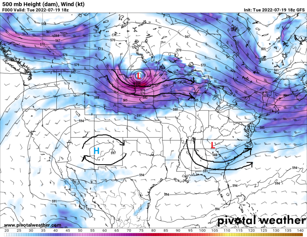
As mentioned, the heat has been the main headline for those in the western part of the region. The high pressure system, as well as temperatures at the 850mb level being between 25°C and 30°C (77°F to 86°F, which is very warm for this altitude) have and will continue to contribute to temperatures up to the upper 100s for the remainder of the week and into next week. Of note, a shortwave trough is slated to move through the Red River region of Texas Wednesday before moving through the Ark-La-Tex area and eventually Louisiana Thursday. This will bring at least some chances for scattered showers and thunderstorms, which may offer a mini break from the heat, even if it is at least for a moment.
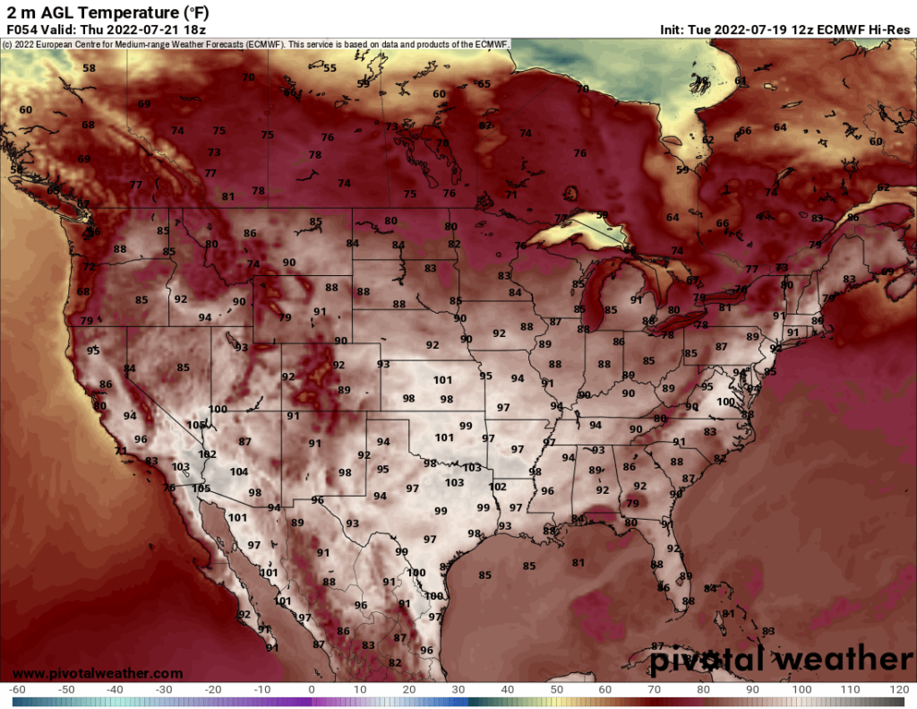
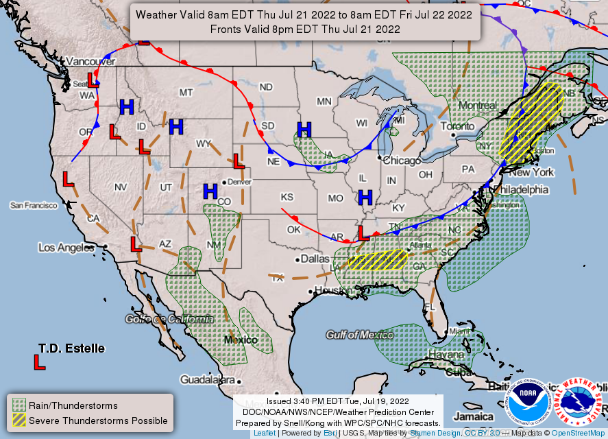
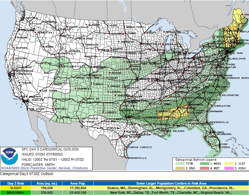
For the rest of the region, temperatures will remain in the vicinity of the upper 80s to upper 90s. Showers and thunderstorms will be possible virtually every day, being caused by the diurnal heating and cooling cycle as well as interactions with the sea breeze for those along the coast. Severe thunderstorms will be possible for much of the southeast Thursday afternoon, with a heightened risk from the Louisiana-Mississippi border to western Georgia, from an advancing cold front coming in from the north. This will be a wind-driven event, with high CAPE (Convective Available Potential Energy; a measure of energy and buoyancy in the atmosphere), DCAPE (Downward Convective Available Potential Energy; a measure of potential storm downdraft strength) and PW values supporting a damaging wind/wet microburst risk. These storms will begin to weaken by the evening and overnight hours.
Towards the end of the week into next week, the upper level ridge will move back east over the southeastern US, which will cause temperatures to rise a couple degrees. Chances of showers and thunderstorms will be possible, due to southerly flow at the surface pulling rich moisture inland from the Gulf of Mexico.
Local 3 Day Weather Forecast (Courtesy: NWS)
| Dallas, TX | ||
| Wednesday | Thursday | Friday |
| High: 107°F | High: 100°F | High: 101°F |
| Low: 84°F | Low: 82°F | Low: 80°F |
| Precip: 20% | Precip: 20% | Precip: None |
| New Orleans, LA | ||
| Wednesday | Thursday | Friday |
| High: 92°F | High: 92°F | High: 92°F |
| Low: 79°F | Low: 79°F | Low: 79°F |
| Precip: 30% | Precip: 50% | Precip: 50% |
| Little Rock, AR | ||
| Wednesday | Thursday | Friday |
| High: 105°F | High: 95°F | High: 97°F |
| Low: 79°F | Low: 75°F | Low: 74°F |
| Precip: None | Precip: 20% | Precip: 20% |
| Memphis, TN | ||
| Wednesday | Thursday | Friday |
| High: 100°F | High: 98°F | High: 101°F |
| Low: 80°F | Low: 76°F | Low: 78°F |
| Precip: 20% | Precip: None | Precip: None |
| Birmingham, AL | ||
| Wednesday | Thursday | Friday |
| High: 94°F | High: 94°F | High: 93°F |
| Low: 77°F | Low: 74°F | Low: 74°F |
| Precip: 20% | Precip: 60% | Precip: 40% |
| Atlanta, GA | ||
| Wednesday | Thursday | Friday |
| High: 89°F | High: 92°F | High: 90°F |
| Low: 75°F | Low: 73°F | Low: 72°F |
| Precip: 30% | Precip: 70% | Precip: 50% |


