It is a great question. And one you’re smart to ask! As a meteorologist who is all about public education, it makes me feel good to know that you are asking the right question. You know that a Tropical Storm starts at 39mph. And you know that a Potential Tropical Cyclone designation is given to any disturbance that has the potential to make landfall within 48 hours, but hasn’t organized itself yet.
So, today, when Potential Tropical Cyclone Three reached maximum sustained wind of 45mph, a lot of people – myself included, at first! – asked, “why isn’t it Tropical Storm Claudette?”
To answer that question, we have to go back to school for a few minutes. Designating a Tropical Storm takes more than just a top-end wind speed reaching the 39mph threshold.
But Nick, the NHC website says, “Tropical Storm: A tropical cyclone in which the maximum sustained surface wind speed (using the U.S. 1-minute average) ranges from 34 kt (39 mph or 63 km/hr) to 63 kt (73 mph or 118 km/hr).”
I know. And you’re right! That is what it says. But we have to go back further in the lifecycle of a tropical system in order to figure out what is and is not a Tropical Storm.
We need to define a “tropical cyclone” first. Amd for that, we can go back to the NHC.
Tropical Cyclone: “A warm-core non-frontal synoptic-scale cyclone, originating over tropical or subtropical waters, with organized deep convection and a closed surface wind circulation about a well-defined center. Once formed, a tropical cyclone is maintained by the extraction of heat energy from the ocean at high temperature and heat export at the low temperatures of the upper troposphere. In this they differ from extratropical cyclones, which derive their energy from horizontal temperature contrasts in the atmosphere (baroclinic effects).”
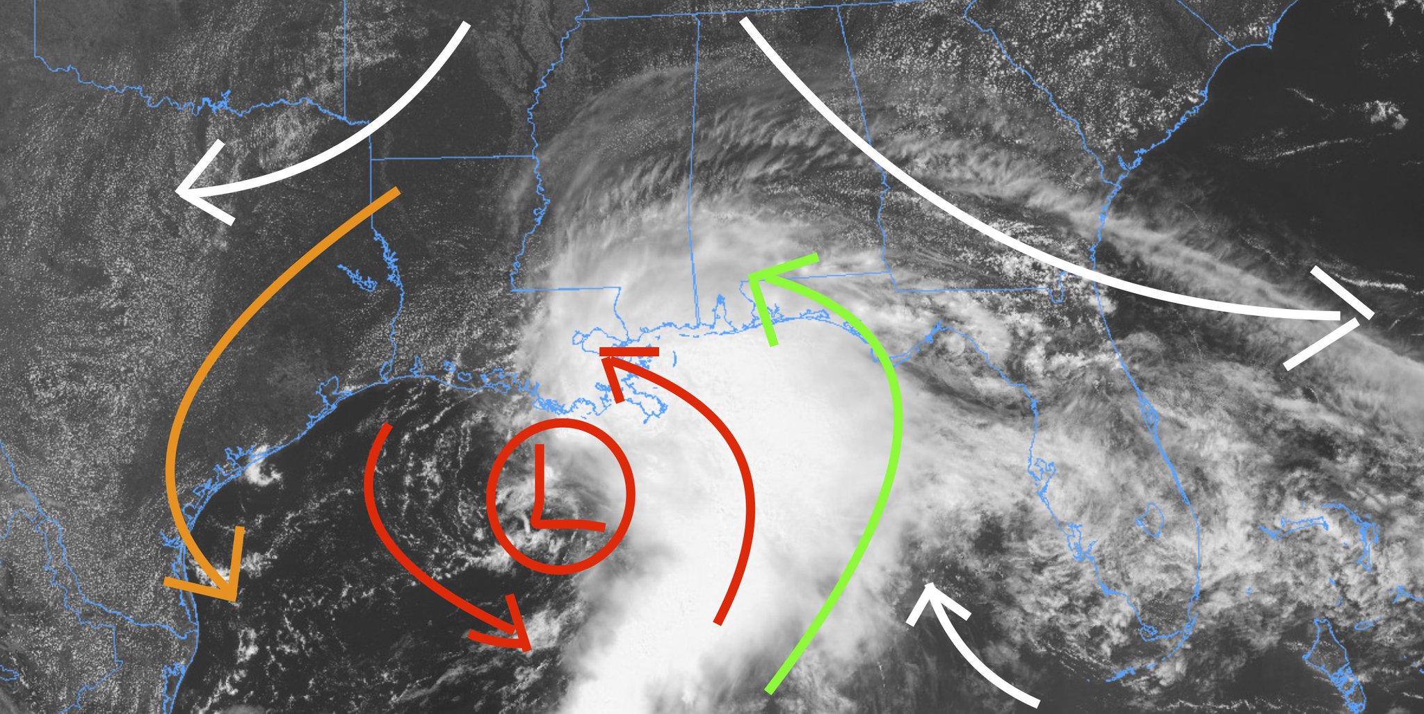
And the important parts there are the “organized deep convection” and “a closed surface wind circulation” parts.
Let’s take a look

You can see that the center area of low pressure doesn’t really have a closed circulation. For comparisons, here is a look at Tropical Storm Cristobal from last year.

Notice that, while Cristobal has a messy center, it is enclosed.
And now we need to find “organized deep convection” within the storm.

Notice that the only deep convection is either down south into the Gulf or a little patch on the southeast side. None of it is terribly organized.
And they NHC highlighted that in their latest discussion.
A few hours ago, an ASCAT-A pass indicated that maximum winds were about 40 kt well east of the ill-defined center of circulation, and the initial wind speed was increased to that value at the intermediate advisory at 18Z. Recent surface observations just offshore of southeastern Louisiana have been reporting maximum winds between 30 and 40 kt. Based on a combination of these data, and since the structure of the system has not changed much during the past few hours, the initial intensity is held at 40 kt for this advisory. Although the disturbance has wind speeds of tropical storm intensity, it has not been named a tropical storm yet since its center is ill defined and broad as evident in the Air Force Hurricane Hunter data and surface observations.
Courtesy: nhc.noaa.gov
So, that is why! Until we have both of those things, this will remain a PTC, and not a tropical storm. No matter how fast the wind speed gets!


I’m glad you explained THAT mystery! I was beginning to think it was because it was headed for the state that starts with ‘Miss’!