Hello everybody, the weather pattern is starting to change this week as the high pressure is starting to move away and a cold front boundary is coming down south. This new weather pattern will bring rain relief for the coastal areas. And that rain will determine the temperatures, though regardless, temperatures will be around 90F.
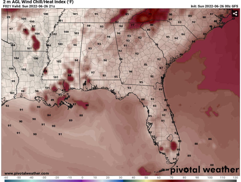
Even though there will be rain will be happening today, but don’t forget to stay hydrated and be around the AC. The heat index temperatures will go up to low 100s. If you are lucky with the rain, some places in the coastal areas will have heat index values in the mid 80s to mid 90s.
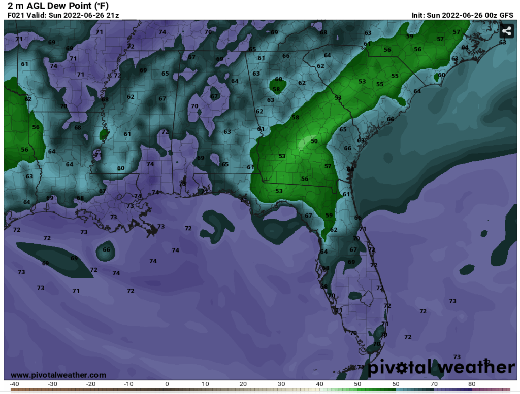
The moisture in the coastal areas will be a big factor for the increase in the chance for precipitation today. From GFS model shows dew point values for the coastal areas from mid 60s to mid 70s in the afternoon and evening.
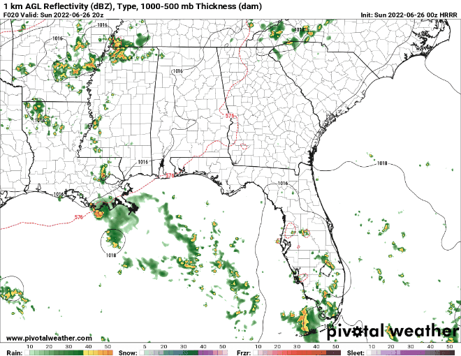
Today will be the start of a rainy week and having colder temperatures than the scorching temperatures from past few days. In some places will have heavy showers to light rain and be careful of any severe thunderstorms that might happen today.
Day To Day Forecast
Sunday
Mostly cloudy with the temperatures in the upper 80s and low 90s. The heat index values will be upper 90s to low 100s. There will be a 70-percent chance of showers and scattered thunderstorms.
Monday
Partly cloudy with temperatures in the low 90s. The heat index values will be mid 90s. There will be a 50-percent chance of showers and scattered thunderstorms.
Tuesday
Partly cloudy with temperatures in the upper 80s to low 90s. The heat index values will be in low 90s to mid 90s. There will be 40-percent chance of showers and scattered thunderstorms.
Wednesday
Partly cloudy with temperatures in the upper 80s. The heat index values will be in low 90s to mid 90s. There will be 50-percent chance of showers and scattered thunderstorms.
Thursday
Partly cloudy with temperatures in the mid 80s to upper 80s. The heat index values will be in upper 80s to low 90s. There will be 40-percent chance of showers and scattered thunderstorms.
Friday
Partly cloudy with temperatures in the upper 80s. The heat index values will be in upper 80s to low 90s.There will be a 50-percent chance of showers and scattered thunderstorms.
Saturday
Partly cloudy with temperatures in the mid 80s to upper 80s. The heat index values will be in upper 80s to low 90s. There will be 30-percent chance of showers and scattered thunderstorms.


