Hello everyone, even though the hurricane season have not reach its peak months yet. There is some tropical activity is starting to happen in the Gulf of Mexico and Southern Caribbean Sea. Like the past few days of the tropical depression in the Gulf of Mexico traveled through southern Texas for heavy rainfall. There are several factors still exist on limiting on any tropical development in the Atlantic Ocean.
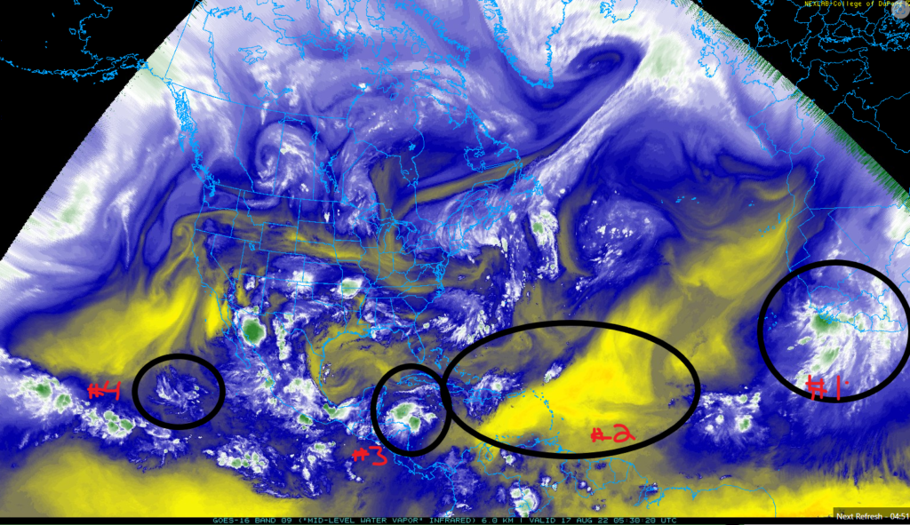
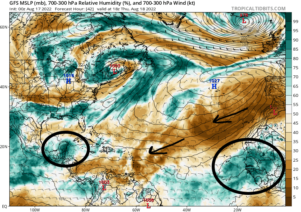
- A new upcomer tropical wave is coming from the coast of Sengal and The Gambia into the Atlantic Ocean. It got some room from the Saharan Air Layer to start developing into something stronger.
- The Saharan Air Layer has defeated many tropical waves that has passed through it in the Atlantic Ocean. It seems like it moving to the southwestern from the northeast coast of Africa to find any tropical waves in its path.
- The tropical wave in southern Caribbean Sea is moving northwestern from the coast of Honduras to the Gulf of Mexico. It have a 20 percent chance in the next 5 days for any tropical development.
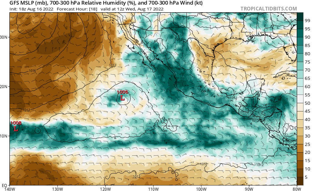
- The post tropical cyclone Ivette is having its last moments in Eastern Pacific Ocean.
Atlantic Ocean and Gulf of Mexico
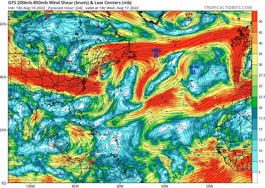
From the tropical wave from the coast of Africa will be dealing with heavy wind shear moving west to disturb the tropical wave from organizing itself. After it get past that heavy wind shear, there will be weaker wind shear near Caribbean Sea. The tropical wave in the southern Caribbean Sea will be dealing with light to moderate wind shear. The wind shear is moving to the south as the tropical wave slowly moving to the northwest into the Gulf of Mexico for little wind shear for better tropical development.
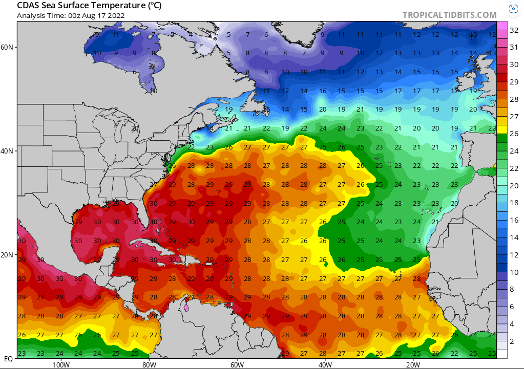
The sea surface temperature is very favorable for both of the tropical wave’s locations. The tropical wave in the Caribbean Sea will be having better development as it is going move into 29C (84.2F) to 30C (86F) hotter temperature waters. The tropical wave in the off the coast of Sengal and The Gambia will be at barely above the minimum sea surface temperatures for any tropical development. The minimum Sea surface temperature for any tropical development should be above 26C (79F).
The high-pressure system in the northern Atlantic Ocean will be sending drier relative humidity from the Saharan air layer from the Northern Africa to southwestern of the Atlantic Ocean. The Saharan air layer will be denying any favorable places in the Atlantic Ocean for the tropical waves to be stronger. It seems like there is a need of another layer of moisture that can move the drier relative humidity to allow the tropical waves to pass thorough Atlantic Ocean. It might be possible that the low-pressure system in the US Northeast might disturb the Saharan air layer in Atlantic Ocean.
There will be dry relative humidity in the Gulf of Mexico that might weaken the tropical wave in the Caribbean. With the extra moisture from the southeast, it will help strengthen this tropical wave in the Gulf of Mexico.
Pacific Ocean
The post tropical cyclone Ivette will have its last moments in the Pacific Ocean for today. As it will be entering a massive wind shear to shred up this weaken storm.
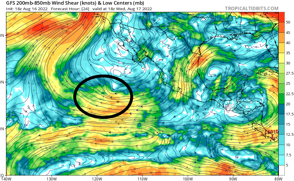
Also, post tropical cyclone Ivette will be entering the massive dry relative humidity and surrounding it from not developing any further tropical development. The eastern Pacific Ocean will be having a quiet tropical activity for the next few days. The reason for this the National Hurricane Center declares there won’t not be any tropical development in the next 5 days. It could be that there won’t be any notable strong tropical waves will be entering in the eastern Pacific Ocean at the moment.