Howdy!
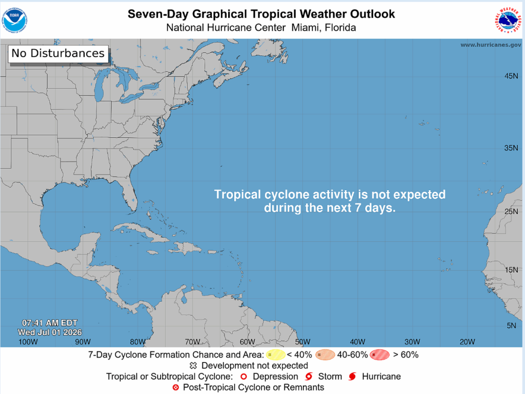
We are officially one month into the Atlantic hurricane season. The area off the coast of the southeastern U.S. that was previously being monitored is no longer expected to develop into anything, so for the next 7 days no tropical activity is expected.
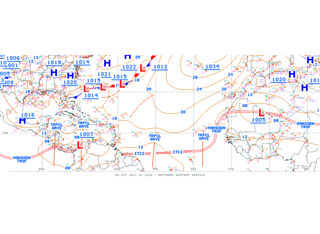
A few tropical waves have been identified by the NHC in the eastern Atlantic and over South America that is producing convection. These tropical waves are not expected to develop into anything.
Just to get a better picture of the convection associated with the tropical waves (and in the Atlantic in general), below is an infrared image of the Atlantic. Infrared imagery is good for looking at cloud top temperatures, and the more red/dark red colors represent the coldest cloud tops. Cold cloud tops are associated with vertically stacked clouds that can produce convection.
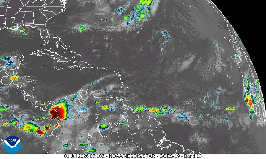
We can see convection off the coast of western South America that is associated with the wave there, then some slight convection heading into northeastern South America ahead of that tropical wave there. Convection is present off the coast of Africa along the ITCZ.
This image is also useful in seeing any jet streams in the upper levels (through cirrus clouds), for example there are fast winds heading northeast over the Caribbean Sea and Lesser Antilles.
For our region and the Atlantic, no tropical activity is expected for the next 7 days. In contrast, the pacific is seeing some activity with Tropical Depression Four-E currently. Thanks for reading and enjoy the rest of your Wednesday!


