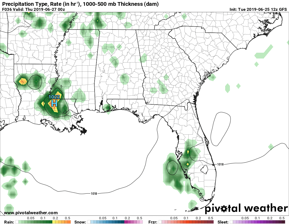
So as Amber and I are looking at several different models for Wednesday’s chance of rain, we notice an enclosed high pressure system forming out near the lower Mississippi River. We’re both thinking “Why is that there and why is there a blob or rain with it?” In any forecaster’s job, there are going to be interpolations that will drive us crazy when we’re trying to see if little odd events are actually true. While she and I point out the chance of rain in our videos, I highly doubt it’s going to be this massive blob we observed (the North American Model didn’t pick up on it at all) and more like scattered chances of rain that develop from the sea breeze in the afternoon. Now Amber with your short term forecast and me with the long term!
Short Term Forecast
For the next two days we will be in a typical Mississippi summertime pattern. Warm days with some possible afternoon showers.
Tomorrow – Wednesday June 26th the high temperature will be in the middle 90’s around 93 degrees. Clouds will hang out around the area for part of the day keeping the temperatures lower, IF the clouds do move out our temperatures will be a little higher than 93. Winds in the afternoon will be out of the SE around 5 mph with a slight chance of a shower in the afternoon rain chances only around 30 percent. The overnight low for Wednesday will be 68 degrees.
Thursday June 27th much the of the same story, high temperature of 90 degrees with some clouds around the area staying with us for most of the day with will help keep us cooler than we would be without them around. A slight chance in the afternoon of seeing a shower or two rain chances lower than yesterday at only 20 percent. Winds will be out of the NW around 5 mph and the overnight low around 67 degrees.
Long Term Forecast
Good afternoon Pinebelt! I’m your meteorologist Noah with your weekend and early week forecast.
Friday we could see a chance of rain in the later afternoon hours as the dewpoints rise later in the day. High of 90, low of 68 and winds East at 5 mph.
Saturday we’ll see cloudier skies keeping the day slightly cooler with a possible chance of an afternoon shower with a high of 90 and a low of 69. Winds Southeast at 5 mph.
Sunday begins the warm up as the ridge is here to stay with partly cloudy skies and a chance of an afternoon thunderstorm. High of 92, a low of 71 and winds Southwest at 5 mph.
Monday starts off the week hot and only a few clouds in the sky which means a small (but I bet at least one town is going to get it) chance of a shower. High of 94, low of 72 and winds northwest at 5 mph.
By Tuesday the ridge only strengthens but winds are pulling from the west northwest keeping the day overall drier with a few clouds in the sky. High of 91 and a low of 73.


