It is shaping up to be a rather wet back half of the week as scattered thunderstorms can be expected through the weekend. An upper-level trough is working its was eastward with a shortwave dropping down from the upper-Midwest. This will bring some moderate northwesterly winds over the area in Thursday.
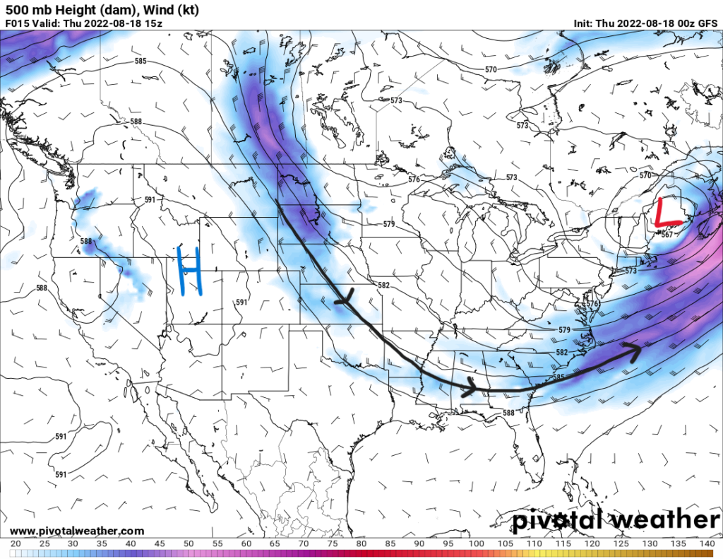
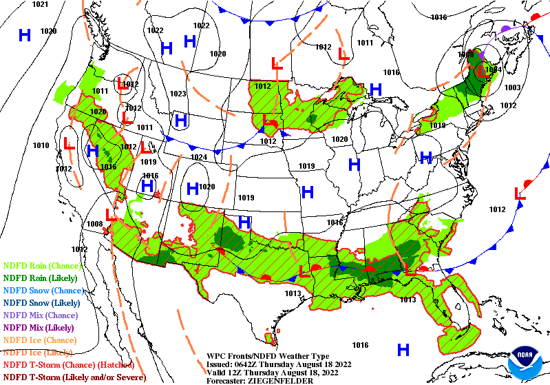
Near the surface, a stalled frontal boundary is oriented west to east across the Southeast. This will be one of the forcing mechanisms for convection in the afternoon. A surface high over the Gulf of Mexico will bring southwesterly winds onshore while more northerly winds are behind the front. This will support some convergence for storms to initiate as they move generally southeastward throughout the day.
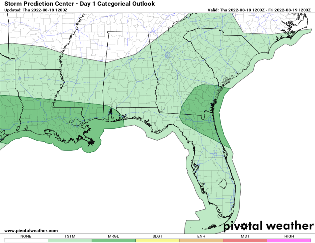
There will also be a risk for severe weather associated with these thunderstorms. The Storm Prediction Center has outlined a marginal risk (1/5) for the coastal areas. Dewpoints in the 70s south of the boundary will help support an unstable environment with CAPE values around 2000 J/kg. Damaging wind gusts will be the main threat as strong updrafts will produce strong downdrafts. Some of the stronger storms could also possibly produce some hail.
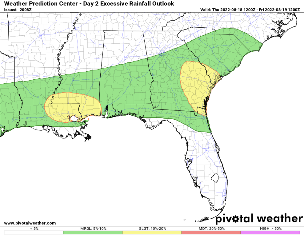
To go along with the severe threat, flooding will be an issue as well. Precipitable water values south of the boundary along the coast will be around 2″ to 2.25″ supporting heavy rainfall. Storm motion could be slow moving to allow for some training that poses the risk for flash flooding in prone areas. Rainfall totals could be above 1″ will locally heavier amounts. The Weather Prediction Center has outlined the area in a slight risk (2/5) for excessive rainfall.
As for temperatures, increased storm and cloud coverage will keep temperatures in the upper 80s and low 90s throughout the area. Similar temperatures will persist through the weekend as will rain chances.
Day-to-Day Forecast
Thursday
Mostly cloudy with a 80-percent of scattered thunderstorms throughout the day. Highs in the upper 80s and low 90s. Lows in the mid 70s.
Friday
Mostly cloudy with a 90-percent chance of thunderstorms. Highs in the upper 80s. Lows in the mid 70s.
Saturday
Partly cloudy with a 80-percent chance of thunderstorms in the afternoon. Highs in the upper 80s. Lows in the mid 70s.
Sunday
Partly cloudy with a 60-percent chance of precipitation. Highs in the upper 80s and low 90s. Lows in the mid 70s.
Monday
Partly cloudy with a 60-percent chance of precipitation. Highs in the upper 80s and low 90s. Lows in the mid 70s.
Tuesday
Partly sunny with a 60-percent chance of precipitation. Highs in the upper 80s. Lows in the mid 70s.
Wednesday
Partly sunny with a 50-percent chance of precipitation. Highs in the upper 80s. Lows in the mid 70s.


