Howdy! Hope you all had a fun time celebrating the Fourth of July yesterday! Make sure to watch my video forecast below.
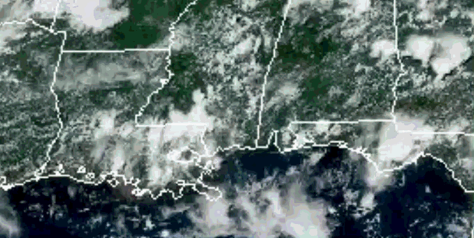
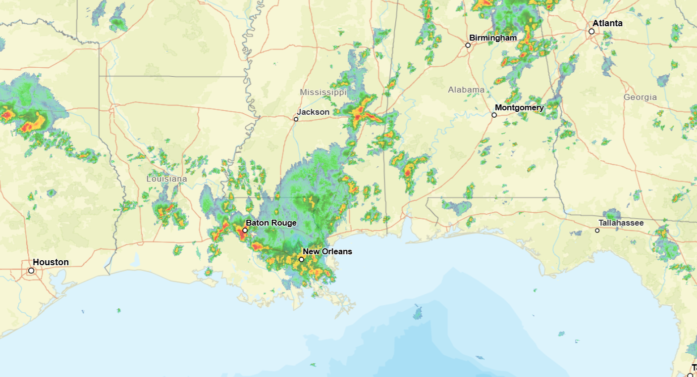
Looking out the window, we can see that there is some activity going on currently, some showers and thunderstorms building up in much of southern Louisiana and Mississippi, some of which have a severe thunderstorm warning along with them. We can see the storms building up over Louisiana in the satellite image below which is always super cool to see.
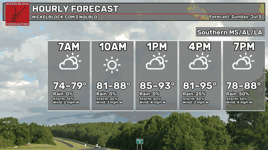
No big change to the forecast since yesterday. Today is looking to be a hot and humid day, chance to see showers and thunderstorms for pretty much the entire region today. Heat indices will reach above 100, highs in the upper 80s to mid 90s depending on where the rain will fall.
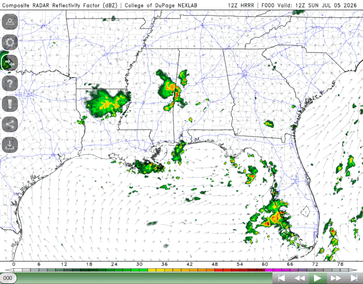
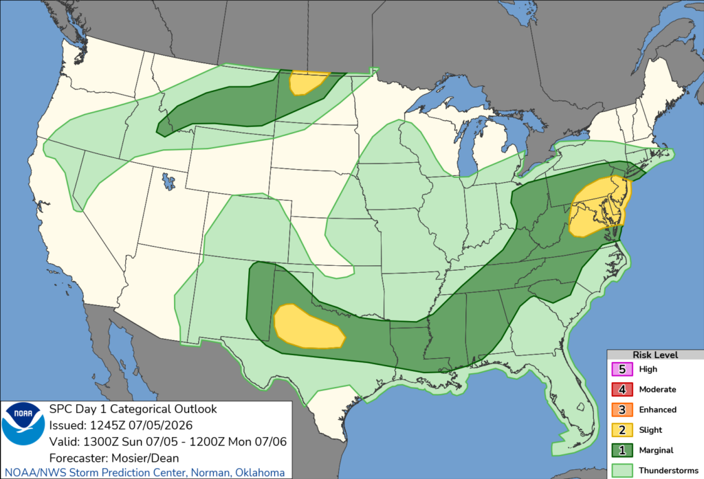
There is a very moist airmass over the region currently that will support destabilization and buoyancy to support the development of stronger thunderstorms. The SPC has put most of Louisiana, Mississippi, and Alabama under a marginal severe weather risk, meaning there is a chance that these storms develop into severe storms producing locally heavy rainfall, lightning, and strong winds (winds being the main threat especially for central portions of Mississippi and Alabama).
This is no change since yesterday, and tomorrow the chance for showers and thunderstorms will continue. This will be the general trend for the next few days! Thank you so much for reading and have a good rest of your Sunday!


