While no new developments have popped up over the weekend, we are continuing to monitor Tropical Depression Five-E as it ramps up today while two systems out in the Atlantic struggle to develop. Let’s take a further look.
Tropical Storm Dora

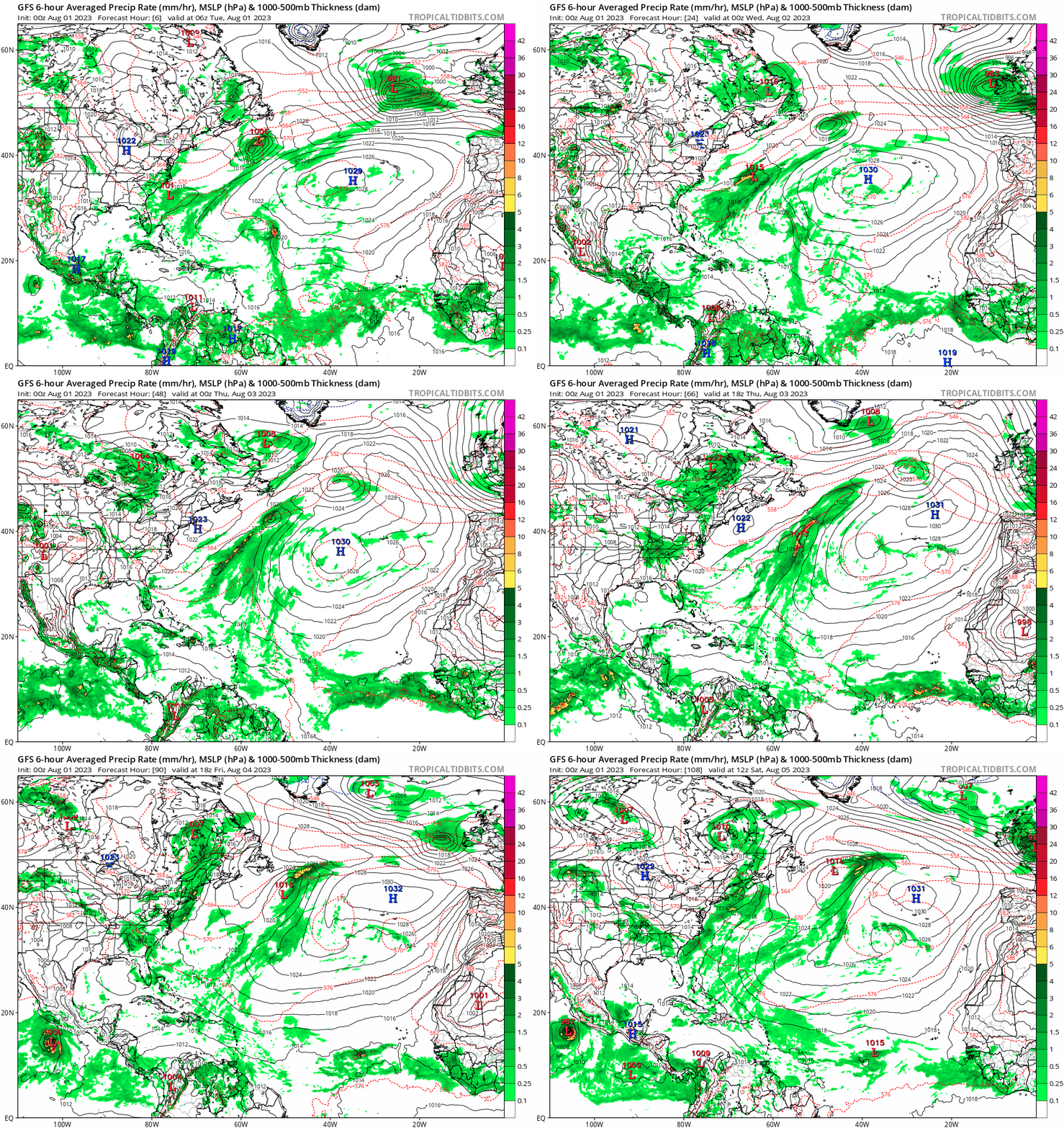
In the Pacific basin, Tropical Storm Dora has been spinning up over the weekend off the southern coast of Mexico with another disturbance further in the Central East Pacific. Forecast data suggests it will likely hit reach Category 2 strength winds by Wednesday. This storm is making its way almost due west but veering slightly northward today before returning back southwest around 13 N latitude. Low shear ahead of its projected track will allow this storm to really flourish while the strong shear further northwest prevent the aforementioned disturbance from really making any impact.


Atlantic Storms Invest 96 and 97
Invest 96 and 97 are two storms that are currently expected to spurt out the next few days as they both travel up and out east into the cold North Atlantic waters. Invest 96 is sitting around 23 N 54 W as it heads north northwest near the current location of Invest 97 off the northeast coast of Nova Scotia. By Thursday, Invest 96 will be turning back west around the North Atlantic High with 97 expected to be long gone. Invest 96 could possibly see some development but model agreement is pretty low and unlikely to be any severe. For now, the mainland US is looking safe from any storms for the time being.

Extended Outlook
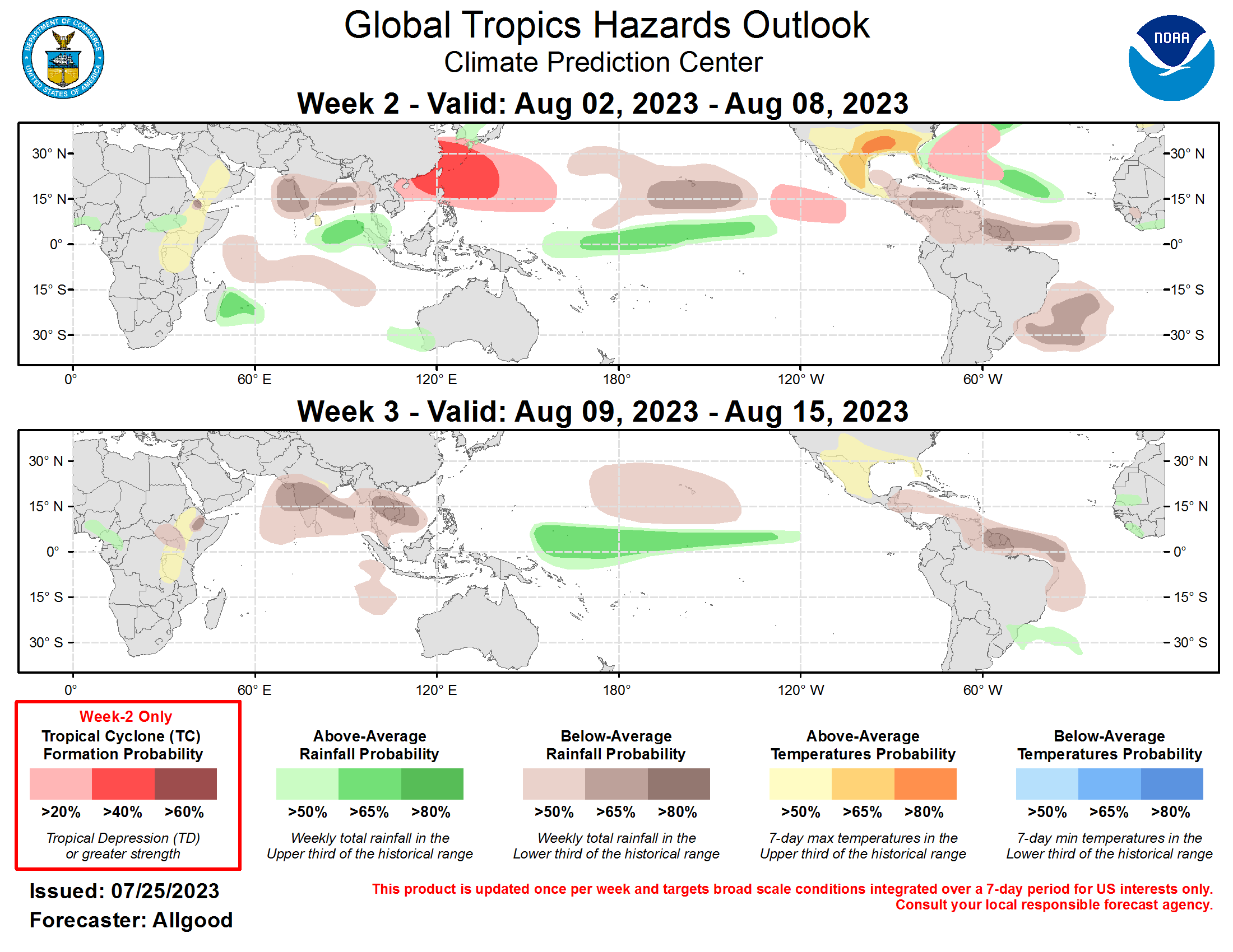
Overall, things in the Atlantic and Pacific are looking relatively somewhat strong for possible cyclone formation for the August season. As waters continue to warm up into September, some tropical waves off the west coast of Africa could likely spark up some cyclones in the Central Atlantic. The East Pacific is also looking at possible cyclone activity as a pattern of a westerly wind burst event (where as trade shift shift to flow west to east due to a kelvin wave) could spark some cyclones later this week. Most interestingly enough is these somewhat rare events can lead to twin tropical cyclones in strong El Nino events such as this year. So definitely keep an eye out later this week.

Conclusions
Overall, the Atlantic is looking bleak for the near future while the further ahead into the week looks more promising. Tropical Depression Five-E will be making its way into hurricane status today as further ahead could see even more interesting tropical development from the kelvin wave. This August is already turning out to be an interesting one.

