
As of early this afternoon, the national hurricane center has not designated any areas in the Atlantic basin as a potential area for tropical development in the next 7 days. Remember, it’s still early in the season.
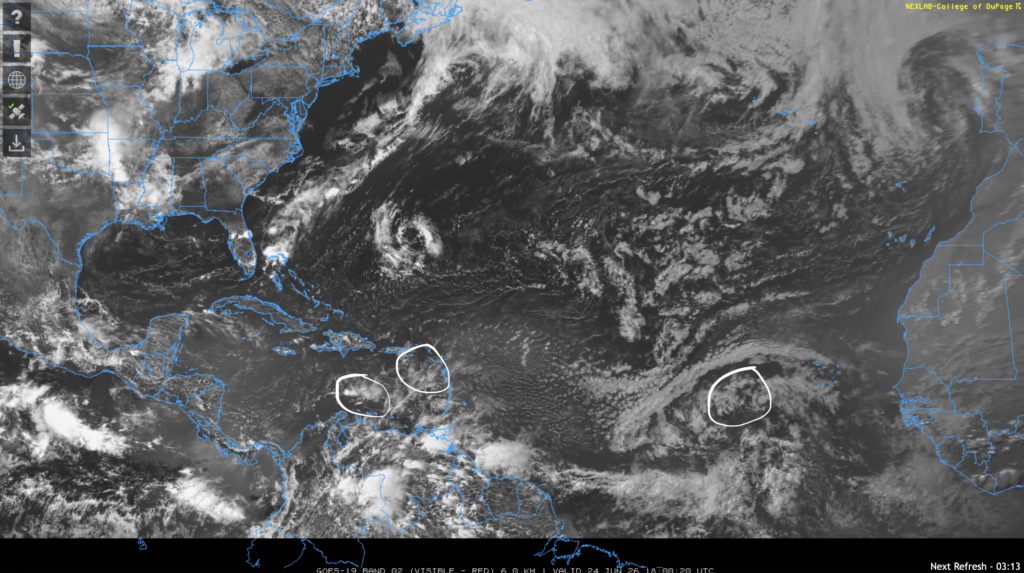
The NHC has pointed out three tropical waves in the Atlantic basin which are circled in the above image. One is in the eastern Atlantic moving west at 15 kts, one that is nearly stationary southeast of Puerto Rico, and another north of Venezuela that’s also stationary.
None of these tropical waves are expected to form into tropical cyclones, meaning that they do not pose a threat to our region.
Looking Ahead
Overall, conditions for tropical development this week look unfavorable.

Ridging in the subtropical Atlantic ocean will take place this week. Ridging is usually associated with high pressure and sinking motion, which is the opposite of what tropical cyclones need to develop.
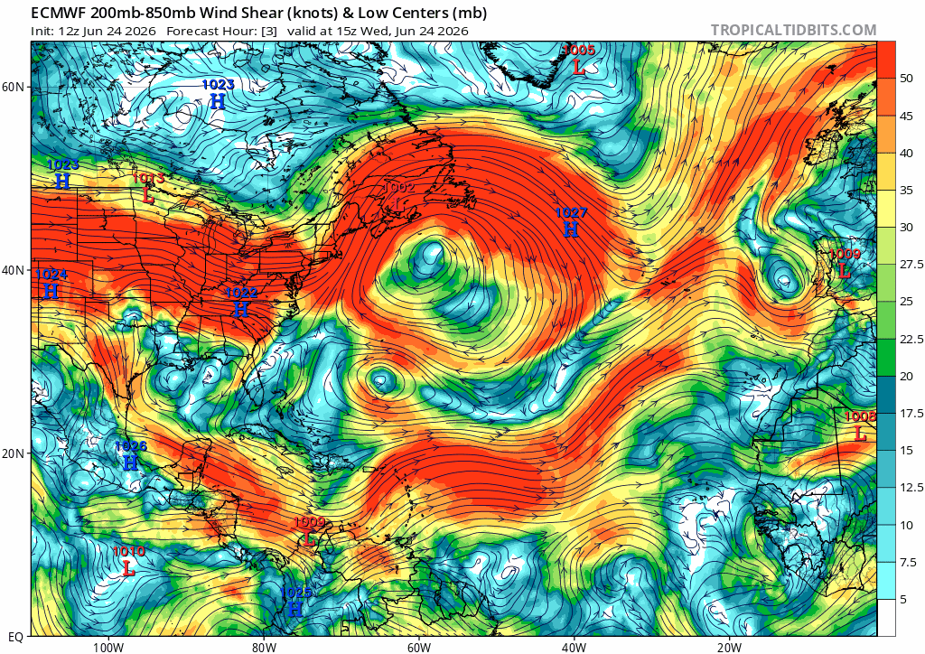
This week, the 200-850 mb wind shear looks to be pretty strong across the basin. Particularly strong areas of wind shear exist in the Caribbean sea and eastern Atlantic ocean, two common places for tropical cyclone development. Sea surface temperatures are also warm enough to support development in the gulf of Mexico, east Atlantic, and Caribbean sea, but there aren’t many tropical waves from Africa that don’t get torn apart by wind shear at this time of year.
ENSO Update
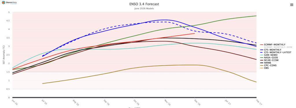
The image above is the current June 2026 weather model prediction for the sea surface temperature anomaly in the Niño 3.4 region of the Pacific ocean, the main area analyzed when studying El Niño and La Niña, the positive and negative phases of the El Niño-Southern Oscillation respectively.
I last visited this topic in another tropical forecast of mine at the beginning of this month. Since then, we’ve gotten a few new model forecasts. Most of them show a temperature anomaly between 3 and 4ºC in the Niño 3.4 region during the predicted peak, which is around November of this year. For context, the record breaking 2015-2016 El Niño event saw a temperature anomaly of 2.5ºC.
A strong El Niño event in the tropical Pacific ocean usually correlates to a below average Atlantic hurricane season. However, it’s still important to take the necessary precautions early, as it only takes one impactful hurricane to turn an otherwise quiet season into a memorable one.


