We knew it was bound to happen sooner or later.
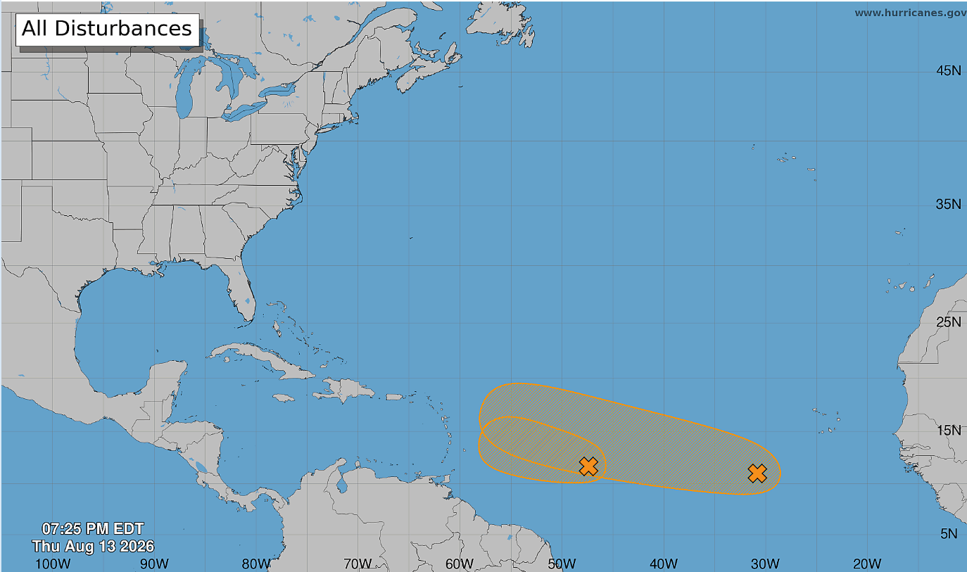
The National Hurricane Center has outlined two areas in the Atlantic to keep an eye on. They are currently listed at 50 percent chance for development though the NHC states that those chances have decreased since the last forecast. These systems are gradually tracking west-northwest but are little more than a disorganized cluster of weak thunderstorms.
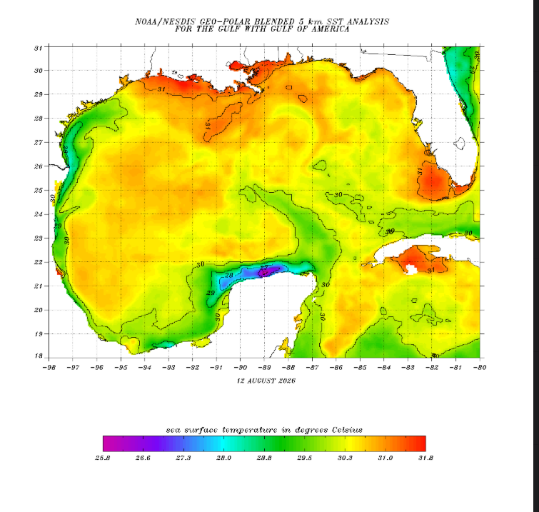
Gulf waters are toasty. This is to be expected in mid August though. It does mean that there is a lot of potential fuel for any tropical system that makes it way into the Gulf.
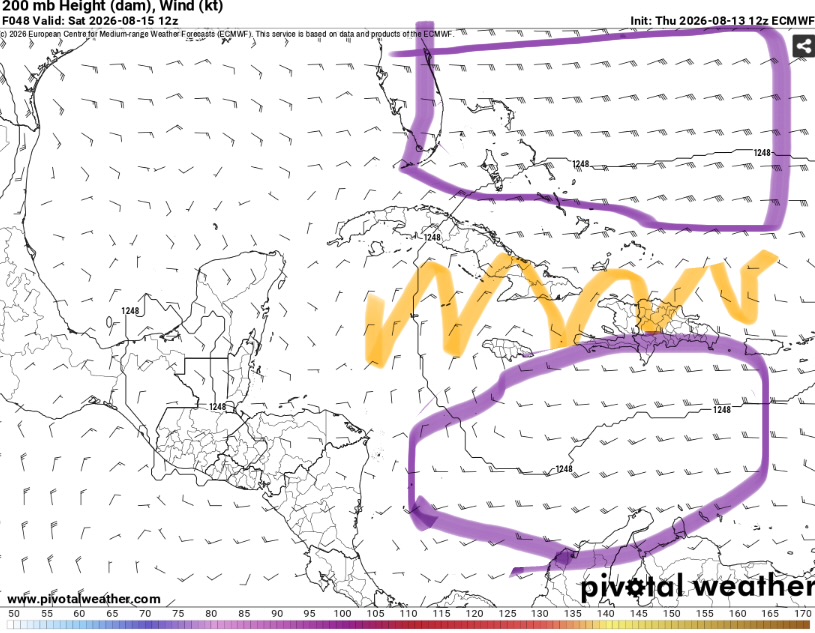
The good news is that ahead of these systems there is expected some be at least moderate wind shear given several tropical upper air trough’s (TUTT’s).
This will weaken any circulation that manages to develop as the strong upper level winds will tear apart the structure of the cyclone by keeping it from staying upright.
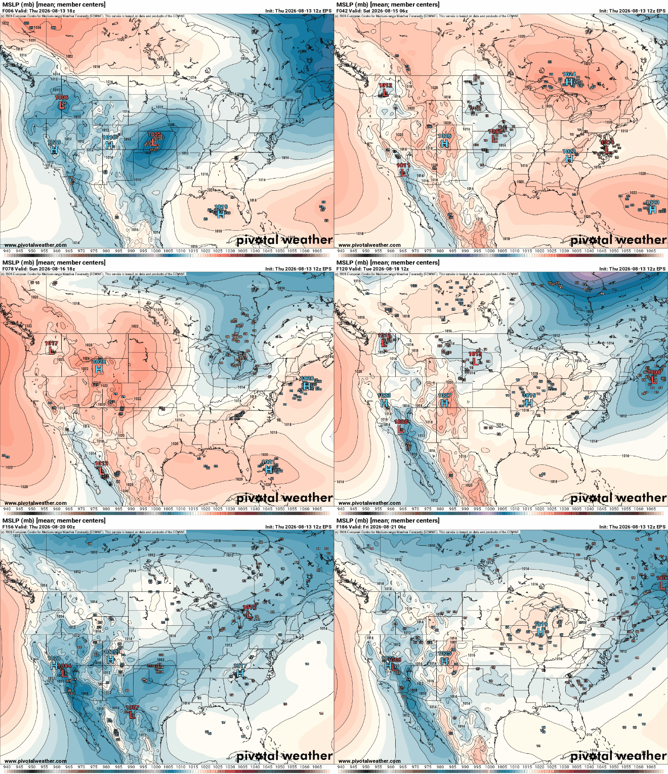
Indeed, the European ensembles do not show anything impacting our area or making it’s way into the Gulf. This doesn’t mean you shouldn’t pay attention but overall any impacts to our area appear low (at this point).
We’ll keep you updated as these systems evolve and on any potential impacts.


