The Pacific is cooking up the potential for a tropical depression south of Hawaii in a few days. Meanwhile, we’ve got two highlighted areas of potential back here in the Atlantic. The National Hurricane Center has identified two areas over the Atlantic for potential tropical cyclone development over the next 7 days. The highlighted areas are overlapping…so breaking them down below should help clarify what they’re watching.
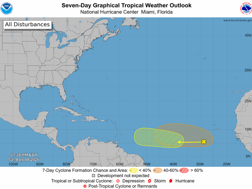
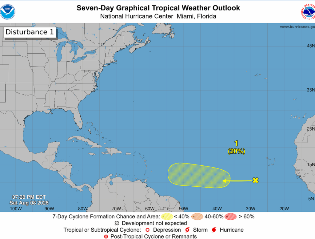
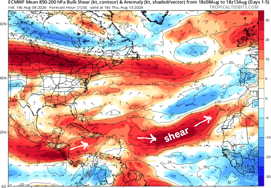
Near the yellow highlighted region, X marks the spot for a tropical wave with a 20% chance of development over the next week (shown below). It’s forecast to head west towards the Caribbean, likely getting torn apart by strong wind shear and dissipating.
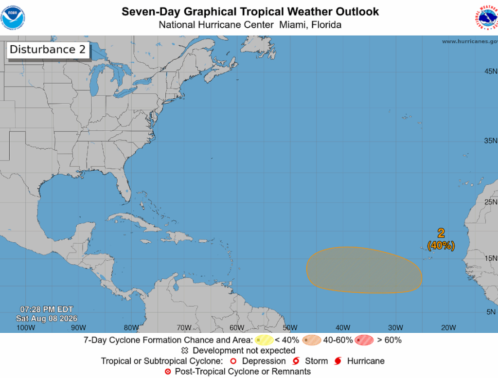
The orange highlighted area below is for a tropical wave that is anticipated to move off the coast of Africa sometime Tuesday. There’s currently a 40% chance of development, and a tropical depression could form late next week.
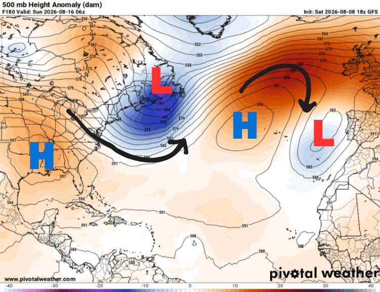
Models favor this one, however, it’s not expected to have any impacts on us, as a treacherous journey is in store ahead of it. The farther it heads west across the Atlantic, the more it will have to contend with increasing wind shear and pockets of dust.
If it does survive the shear, the consensus in the models is that it will curve northward out to sea, staying clear of the gulf, thanks to a trough of low pressure forecast to be around.
We are still a few days out, so check back in for further updates on their journey (hopefully short-lived ones).


