

Hi Everone, I hope you are having a great week. Looking at the tropics, there is only one system to keep an eye on. Hurricane Dora continues to make its way toward the west as it passes to the south of Hawaii. As for the Eastern Pacific, Tropical Storm Eugene has dissipated miles from land. Some development could form in the Eastern Pacific in the next couple of days. Looking at the Atlantic, not much is expected in the next few days.
The Atlantic Basin

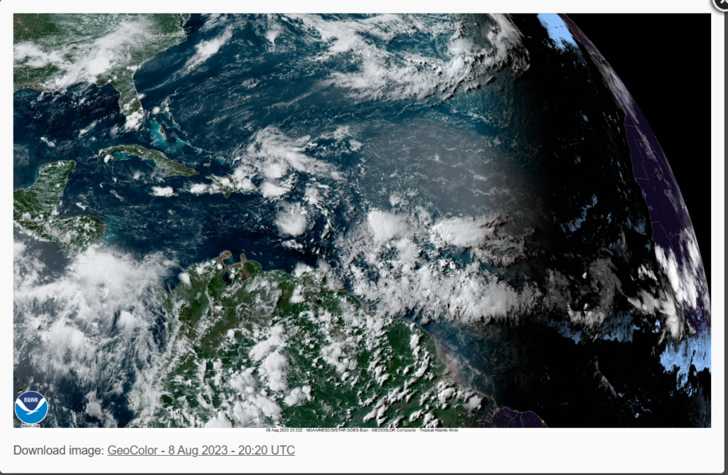
Looking at the Atlantic Basin, not much action is anticipated in the next couple of days. Although no storms are likely to form soon, we are watching a couple of tropical waves moving off the West Coast of Africa. If the conditions allow, some formation could form in the next week or two. The reason why we haven’t seen formation in the last couple of weeks is due to Saharan dust, wind shear, and dryer air aloft. Remember that we are in August, which means hurricane season will quickly ramp up before peaking in mid-September. Now would be a great time to check and or prepare a hurricane survival kit.
The Pacific Basin
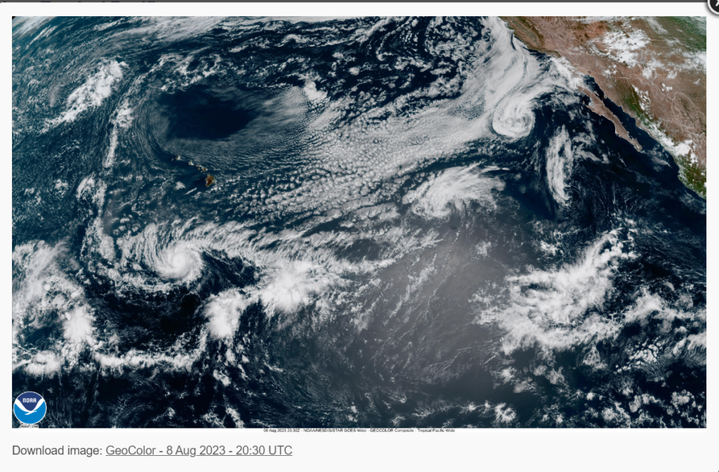

Looking at the Pacific Ocean, there is quite a lot more action. As of 11 AM Hawaiian Time on August 8th, 2023, Hurricane Dora is located at latitude 11.5 north, longitude 158.1 west, or about 500 miles off the coast of South Point, Hawaii. Dora is currently moving in a westward direction at about 22 MPH (19 Knots) and has maximum sustained winds of 130 MPH (115 Knots). Dora is expected to weaken as it moves northwestward as it impacts cooler waters and the subtropical jet stream. Although Dora moved well south of Hawaii, impacts are still expected, with high winds and dry conditions across the leeward side of the Islands. As of 12 PM Hawaiian Time Tuesday, a wildfire is spreading across the Northwest coast of the Big Islands of Hawaii, leading to evacuations of multiple residential areas. Looking at the Eastern Pacific, Tropical Storm Eugene has dissipated and does not pose a threat to land. No development is expected in the next couple of days; however, an area of low pressure could form off the coast of Mexico. Gradual development is possible over the next week, so a tropical system could form in the next 7 days.
Extended Outlook

Over the last couple of weeks, the Atlantic Basin has been relatively calm, with no disturbances to speak of in the short term. Looking at the long term, a couple of tropical waves are expected to roll off the coast of Africa, which could form into tropical systems in the next week or two. The issue is that strong winds shear is expected to be in place, which will inhibit tropical development. We just need to keep an eye on the tropics. Looking at the Eastern Pacific, there is a much greater chance of development as a low-pressure system is forecasted to move off the coast of Mexico, which could form into a tropical system. Wind shear is not as present in the Eastern Pacific, which will aid in the development of the system.
Conclusions
As Hurricane Dora moves south of Hawaii, high winds and fire danger will be present until this evening. The eastern Pacific will need to keep an eye on a possible area of low pressure moving off the coast of Mexico, which could develop in the next week. The Atlantic Basin will remain relatively quiet for the time being.


