Another summer day across Mississippi, Alabama, and Louisiana as continue their march through summer. This is due in part to the ridge that has taken up residence in the region permitting higher temperatures and sweltering conditions. Outside of the ridge, some scattered showers and thunderstorms could show themselves over the region as predominately northwest flow transports subtle shortwaves across the region and raising our storm chances. Let’s break down the details below.
[wpcode id=”41149″]
Short Term Outlook
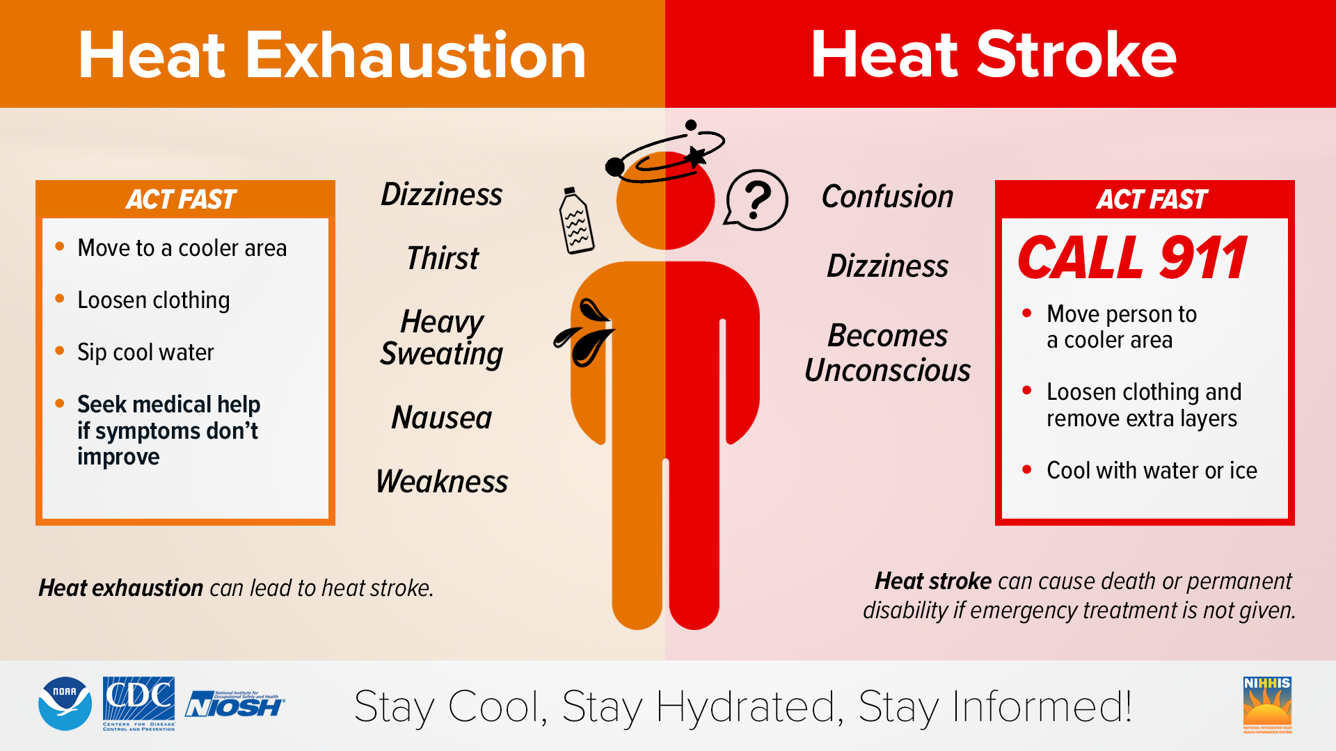
Over the next day or so we can expect temperatures to be in the upper 90s to low 100s. With heat indices in the 105-110 range due to dew points being in the upper 60s to low 70s. While these temperatures are typical of the summer pattern we find ourselves in, they are still harmful to be in long term. Heat illness and heat stroke are possible with heat index values of 105-110 and extra caution should be taken if working outside. Take breaks, stay hydrated, and wear light clothing in order to find the required relief.
In addition to the heat, there are storm chances these next few days. Most areas should see scattered showers and thunderstorms develop, and mostly stay below severe limits, but portions of Mississippi and Alabama have a marginal chance for severe weather. These regions could see storms develop and possess damaging winds and severe hail which can be harmful to people and property. Should you find yourself in a severe thunderstorm warning, it’s important you listen to the warning, seek appropriate shelter, and wait for the storm to pass.

Extended Outlook
Looking ahead into the extended range, we see a similar pattern emerging for the region. Days will be marked with highs in the upper 90s to low 100s with heat indices of 105-110 remaining possible. Each day will have the risk for scattered showers and thunderstorms to develop with most staying below severe limits, but a damaging wind gust or hail event cannot be ruled out. This pattern is largely not expected to change for the foreseeable future so if you have developed a routine for handling this type of weather that works for you stick with it as summer is here for at least the next week.
[wpcode id=”41149″]
REGIONAL-DAY-TO-DAY FORECAST
Wednesday: Mostly sunny and hot. High temperatures in the mid to upper 90s. Heat indices may reach up to 105°F. A shower or thunderstorm remains possible. Chance of rain 30%
Wednesday night: Partly cloudy. Low temperatures in the upper 70s to low 80s.
Thursday: Partly cloudy and hot. High temperatures in the upper 90s to low 100s. Heat indices may reach up to 110°F.
Thursday night: Partly cloudy. A stray shower or thunderstorm is possible. Low temperatures in the upper 70s to low 80s. Chance of rain 20%.
Friday: Partly cloudy and hot, with a chance of showers and thunderstorms. High temperatures in the upper 90s to low 100s. Heat indices may reach up to 110°F. Chance of rain 30%.
Friday night: Mostly cloudy, with a chance of showers and thunderstorms. Low temperatures in the upper 70s to low 80s. Chance of rain 30%.
Saturday: Mostly cloudy and hot, with a chance of showers and thunderstorms. High temperatures in the upper 90s to low 100s. Heat indices may reach up to 110°F. Chance of rain 30%.
Saturday night: Mostly clear. Low temperatures in the upper 70s to low 80s.
Sunday: Mostly cloudy and hot, with a chance of showers and thunderstorms. High temperatures in the upper 90s to low 100s. Heat indices may reach up to 110°F. Chance of rain 30%.
Sunday night: Overcast skies. Low temperatures in the upper 70s to low 80s.
Monday: Mostly cloudy and hot. A stray shower or thunderstorm is possible. High temperatures in the upper 90s to low 100s. Heat indices may reach up to 110°F. Chance of rain 20%.
Monday night: Partly cloudy. Low temperatures in the upper 70s to low 80s.
Tuesday: Mostly sunny and hot. A stay shower or thunderstorm is possible. High temperatures in the upper 90s to low 100s. Heat indices may reach 110 degrees. Chance of rain 20%
Tuesday Night: Partly cloudy. Low temperatures in the upper 70s to low 80s.


