Late into June and two tropical storms are in the Atlantic. Tropical Storms Bret and Cindy are making a scene in the Caribbean. High chances of heavy rainfall and wind are high with these storms. However some obstacles stand in the way of greater formation in the Atlantic. Across in the Pacific, some good mixing ingredients are building some disturbances worth noting.
[wpcode id=”41149″]
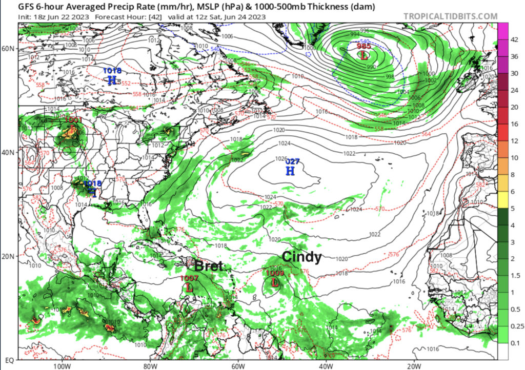
Busy Atlantic with Tropical Storms
The Atlantic is seeing two tropical storms, Bret followed closely by Cindy. Tropical Storm Bret (as of this writing) is closest to South America in the Caribbean. The storm is sustaining winds up to 45 mph with a pressure of 1005 mb. It is moving west at about 20 mph on the southern end of a low level ridge. The westward motion is expected to continue just north of South America in the central Caribbean Sea. The center of the storm is not very developed which means this storm will start to lose its intensity in the coming days.
Tropical Storm Cindy is currently following right behind Bret but is expected to make a more northwest shift and miss much of the Caribbean. The storm is sustaining winds up to 50 mph with a pressure of 1003 mb. It’s moving west-northwest at about 16 mph. Conditions around the storm are favorable with warm ocean temperatures, lots of air moisture, and weak shear nearby.

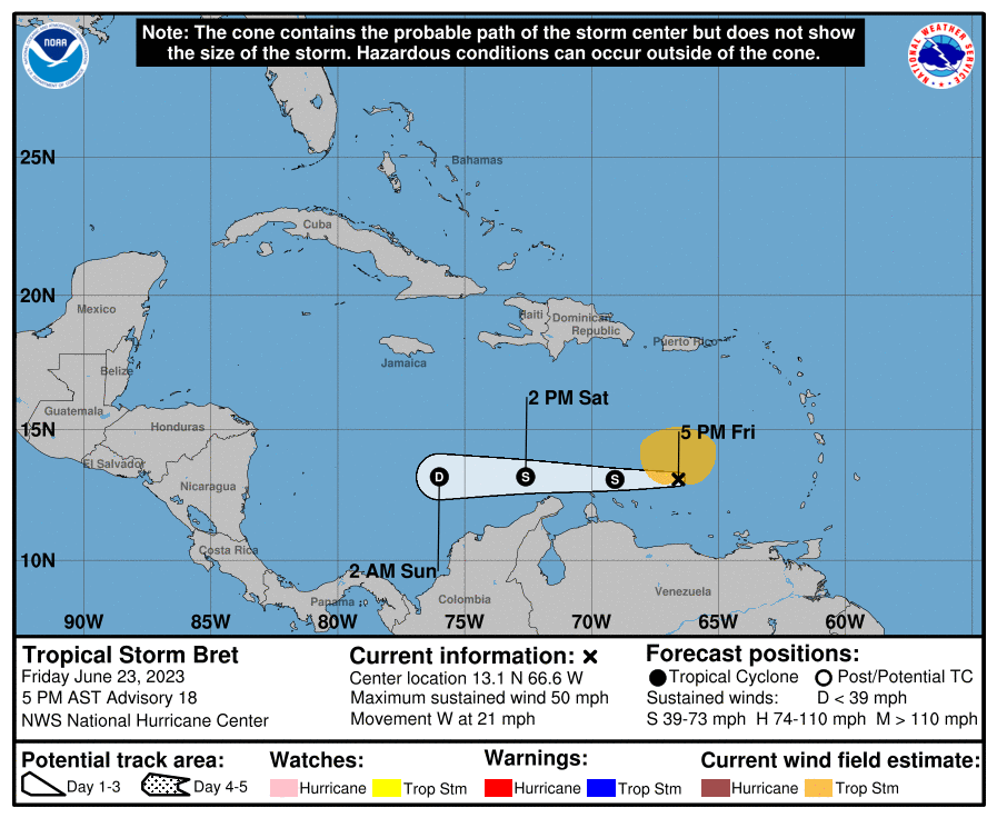
Bret is projected to disband and turn into a tropical depression after the weekend. Bret is forecasted to stay just south of many of the larger Caribbean islands such as Haiti, the Dominican Republic, and Jamaica. These areas are still projected to get some of the outer storms of Bret so Tropical Storm weather is not out of the question for these islands. However the cone predicts the less intense storm will hit parts of Central America. Some of the weather produced by the storm can be severe so caution is needed.
The future disband of Bret is due to a few factors, the main one is the hefty wind shear in the upper atmosphere that is creating destruction to the storm. Another main factor is the dry air in the surface that slows down the fuel the storm is receiving from the warm Atlantic waters. Even as Bret slows down development, the chance of some remnants producing heavy rain and wind in some of the forecasted areas is not out of question. Bret could also redevelop into a Tropical Storm again early next week although that is unlikely.
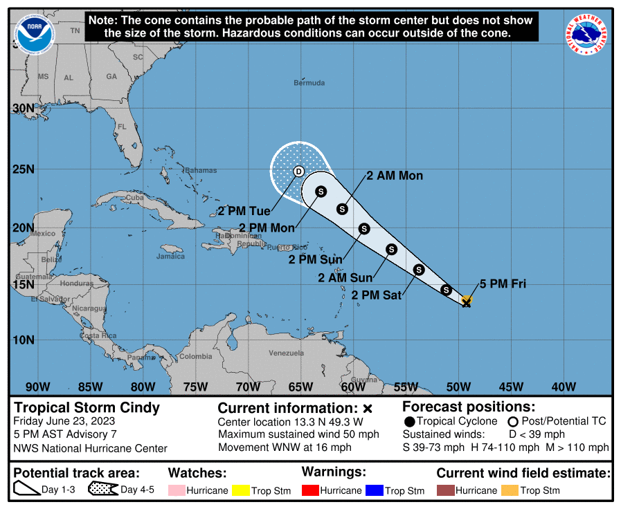
Cindy is showing better signs of staying as a Tropical Storm longer than Bret. However the storm is less likely to bring a massive amount of rain to the Caribbean islands as it is expected to turn north and avoid much of the islands. Currently Cindy is predicted to turn into a tropical depression by Tuesday and avoid much of the Caribbean. This is due to a sharp shear near a trough that will destroy any chances of this storm developing anymore.
[wpcode id=”41149″]
Possibile Pacific Action?
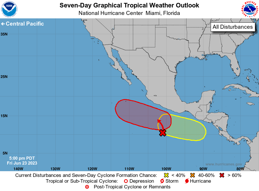
In the Pacific we are looking at two possible disturbances. The first one is off the southwestern coast of Mexico. A trough of low pressure is producing this large area of showers and thunderstorms and is likely to boarded within the next week. Due to the low shear, high moisture, and warm water, this storm has all the ingredients to form into a tropical storm or greater. This disturbance only has a 30% chance of formation in the next two days but 90% chance of formation in the next week so this will definitely be on to watch.
The second disturbance is an area of low pressure several hundred miles off the coast of El Salvador that has the chance to develop into next week. It currently has a 0% chance of formation in the next two days but 20% chance in the next week. This will be one to look out for later next week.
[wpcode id=”41149″]
Extended Outlook
Plenty of things to look out for in the next few weeks. As we watch Tropical Bret this weekend the likelihood of Bret containing as a Tropical Storm is unlikely after this weekend. Early next week Cindy is predicted to drop to depression status. The only thing to worry about with these storms into next week is the remnants producing some heavy rains. After these storms the Atlantic is predicted to stay pretty quiet for the rest of June into July due to the drier air mass covering the area.
The Pacific will have more action later next week with two possible developments which we discussed. With low shear, warm waters, and plenty of moisture in the air the possibility for more storms seems very probable. Many forecast models are showing a lot of action in this region within the next few weeks. The tropics hazards outlook predicts some cyclone activity so it will definitely be worth keeping an eye out for.

[wpcode id=”41149″]
Conclusion
As we start the weekend we will be watching the progression of both Tropical Storm Bret and Cindy. Both storms will be big rain producers no matter their category. This weekend we will be able to see what paths they take into the next week and how strong they will be. Most likely they will dissipate but it’s something worth watching. The Pacific is just starting to warm up and some developments will be of interest in the coming week. Be sure to keep updated as we get deeper into hurricane season. Hurricane preparedness tips can be found on on this site, just check out the Hurricane Preparedness Tips!


