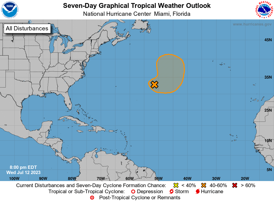
Both basins will continue to have areas to watch as we progress over the next couple of weeks, with Tropical Storm Calvin in the Eastern Pacific making its way westward towards Hawaii, and the Central Atlantic may see continued progressive development of an area of interest east of Bermuda. This disturbance does not look to be a major cause of concern at this time, while Tropical Storm Calvin may possibly affect portions of Hawaii by early/mid next week. Beyond these two areas currently being monitored, the long-term outlook looks to be mostly quiet for now.
Current Tropical Conditions
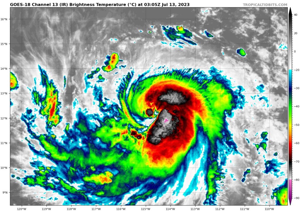
Beginning with the only named storm currently, Tropical Storm Calvin continues to steadily make its way west to open waters of the Eastern and Central Pacific. As of writing this forecast, Calvin is roughly 700 miles southwest of Baja California moving off to the west at 17 mph. Favorable upper-air conditions, very warm SSTs should allow Calvin to reach hurricane strength sometime overnight or this morning. Progress on this storm will be watched closely over the coming days as it inches closer to the Hawaiian Islands by next week.
Out in the Atlantic, we got a disturbance roughly 700 miles east of Bermuda that may become organized enough into at least a tropical depression. Movement of this disturbance will largely be stationary, or at least be confined to a small area of ocean, as a dome of high pressure off to its north is preventing any progress or movement off to the north and east. Overall, conditions in this area of the Atlantic are not entirely stellar for rapid or deep maturation of this system, but anything can change during this time of the year in the blink of an eye.
Extended Outlook
Primary interest will be on the progress of Tropical Storm Calvin and how organized, or disorganized, it is by the time it reaches the islands of Hawaii by early/mid next week. During this period, Calvin will run into moderate to strong upper-level wind shear and will look to seriously put a hamper on its intensity before it affects the easternmost islands. Elsewhere in the Pacific, more areas of interest may be possible over the next week and a half, as conditions will remain more favorable in the Eastern Pacific for development, although greater influence and interference from the subtropical jet appears possible as well.
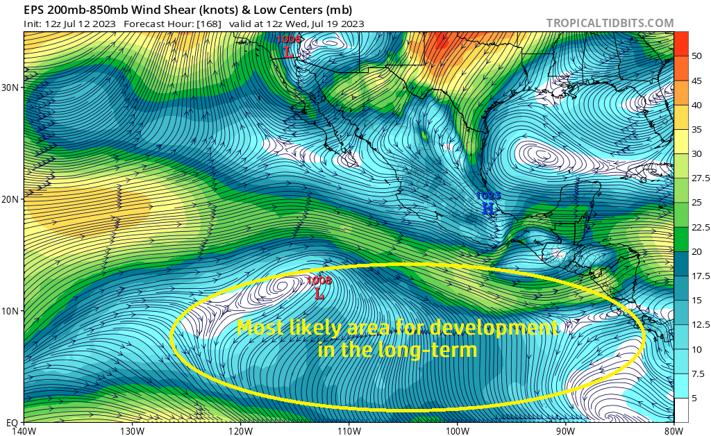
In the Atlantic, this current area of interest will more or less meander over the same 300 or so miles of ocean for the duration of its life before falling apart. Outside of this, main potential areas we could see tropical systems originate from would be coming off the west coast of Africa, or possibly closer to the Caribbean. However, even though these areas and immediately surrounding them may have somewhat favorable upper-air wind shear, it is still very dry over the Atlantic basin and will provide another hurdle for any opportunistic system over the next two weeks. For these reasons, the next two weeks may keep the trend of being muted in the wake of anomalously warm ocean temperatures.
Conclusion
Main attention over the short and long-term will be on the progression of Calvin as it moves westward towards the islands of Hawaii. Calvin will more than likely become a hurricane sometime overnight tonight (Wednesday night/Thursday morning). Not to be lost in this, an area of interest in the Central Atlantic will try an attempt at organization over this week before it too weakens. This disturbance will more or less meander in the same spot for most of its life, as it is being blocked by high pressure, inhibiting any further movement north or east. Looking ahead by week 2, the Eastern Pacific may look to keep showing signs of life being the more favorable region for tropical development, as opposed to the Atlantic, which will still have high wind shear and dry air permeate the basin.


