As Tropical Storm Arthur has officially made landfall near Matagorda Bay, Texas, prepare for heavy rainfall and potential flooding across the south. As this storm pushes inland and hopefully dissipates into a tropical depression, severe impacts including intense rainfall, flash flooding, gusty winds, coastal flooding and even the possibility of tornadoes are likely.

Today
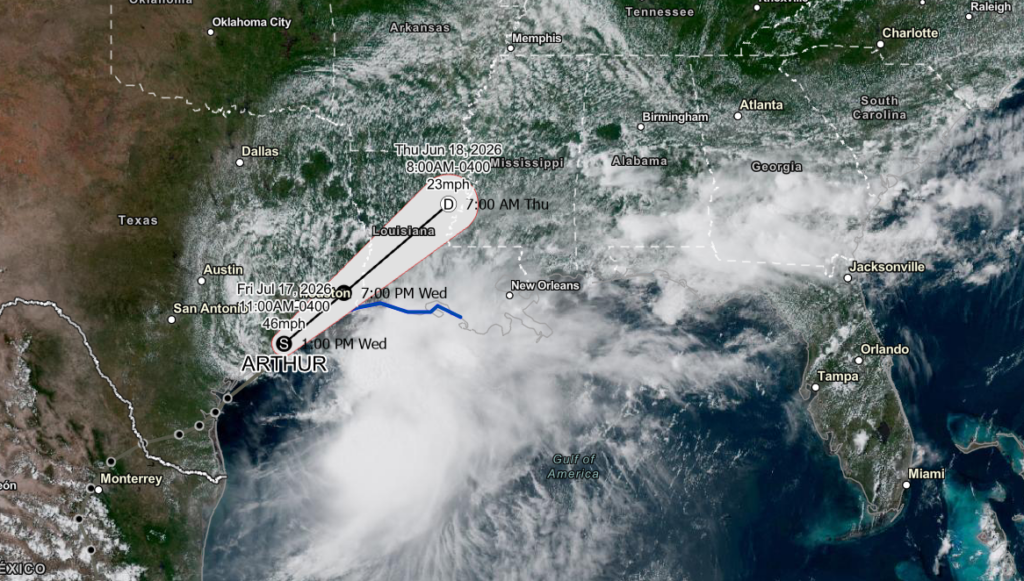
As expected, all eyes are on the Gulf Coast today, and apparently, so are Arthur’s. Currently, this storm is tracking up the Texas coastline at around 9 mph and aiming to cruise into Louisiana at around 7pm tonight. With maximum sustained winds of 45 mph and a centralized pressure of 1001mb, this storm is generating heavy rain, coastal flooding, and localized flash flood threats from Texas to the Florida Panhandle.
Concerning this evening’s weather across the region, scattered showers and thunderstorms that escape Arthur’s outer bands are possible across Alabama, Mississippi, and Northern Louisiana. Coastal and Western Louisiana on the other hand, prepare for rounds of thunderstorms moving Northeast off the Gulf with this storm. These bands bring the potential for strong winds, heavy downpours, and coastal and inland flooding that will continue traveling northeast into parts of MS and Central LA through the night.
Expect strong thunderstorms overnight as the Eastern side of this storm pushes inland, with Coastal Louisiana and SW Mississippi being the hardest-hit areas. By 7 AM tomorrow, we will hopefully have Post-Tropical Storm Arthur lingering between Winnsboro and Natchez with 25 mph maximum sustained winds and moving NE at 15 mph.
Tomorrow
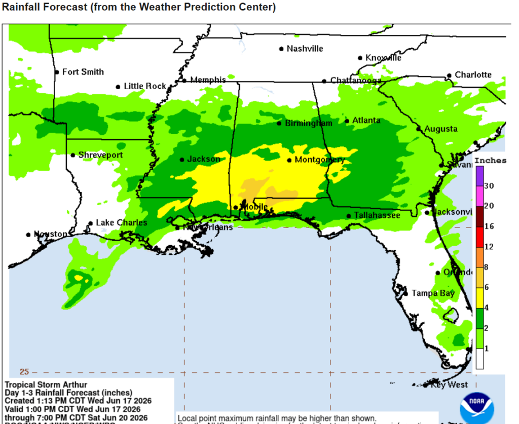
Heading into Thursday, our storm is expected to dissipate overnight and into early tomorrow morning, although we will still feel its impacts throughout the day. Below is the rainfall forecast from the Weather Prediction Center for our area until Saturday evening. A majority of this precipitation will occur overnight Thursday into Friday morning, which is why even if this storm does dissipate into a Post-Tropical Storm, we will continue to be impacted through the rest of the week.
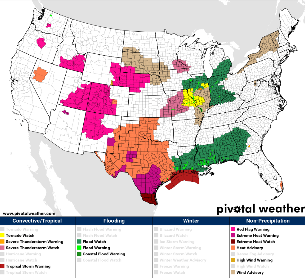
Flooding associated with this storm will be the biggest concern across the region considering the amount of precipitation that some areas have received over the past few days. As seen below, much of the area is under flood watches, coastal flood watches, isolated flood warnings and even tropical storm warnings. Areas with the highest risk regarding flooding would be in Eastern MS, Central/Southern AL, and Northwestern Florida. If you live in a low-lying area or near a lake or river, take extra precautions, as flash flooding could become a risk as this storm moves further inland.

Friday
To end the workweek, expect more heavy rain, especially over Southern AL and Northwestern FL, before this system rains itself out. Thursday night into Friday morning will bring the bulk of the heavy downpours for the area and is expected to dissipate into widespread showers as the day continues. Lots of rain with the potential for flooding will continue to be the main concern across Southern MS/AL/LA until the remnants of this storm disperse.
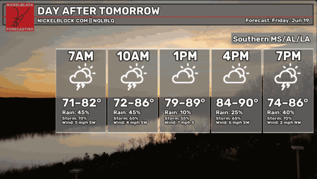
Conditions across the region are looking to be overcast with intervals of thunderstorms and showers. For Friday morning, the main idea is that the further East you are, the heavier the rainstorms will be.
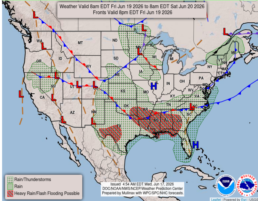
Our surface analysis chart for Friday from the NWS shows heavy rain and flash flood warnings across our area. The stationary front hanging over the Northern edge of our coverage area will keep the moisture South while the high pressure and associated outflow boundary off the coast of Florida will contain the moisture West, ensuring our area receives all the leftovers from this tropical storm.

Extended Forecast
Looking into the weekend and beyond, the weather finally seems to clear up as this system moves out by Saturday at the latest. Expect a drier few days before we end up back in our typical summer setup.
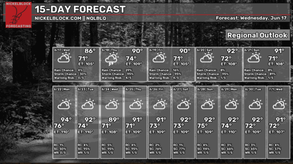
Overall, after the nastiness of this week is finished, we will be back to our normal summer schedule with warm temperatures and afternoon showers. Expect high heat index values due to the combination of high temps and humidity, which will make the outside air feel heavy and hot. Be sure to drink lots of water, especially when participating in outdoor activities as the summer heat ramps up these next few weeks.


