Hello everyone and happy Friday! Honestly I’m sure many of you have put the Atlantic Tropics in the back of your mind, as the season has been very underwhelming in terms of storms, being almost two months since our last named system. However, we are not out of the woods yet as we approach the height of the season, so its still important to keep an eye on things just in-case anything happens to develop.
Firstly, we will take a look at the systems of interest from the NHC, and then work on dissecting the tropics ourselves and finally taking a look at the future model guidance.
From the NHC
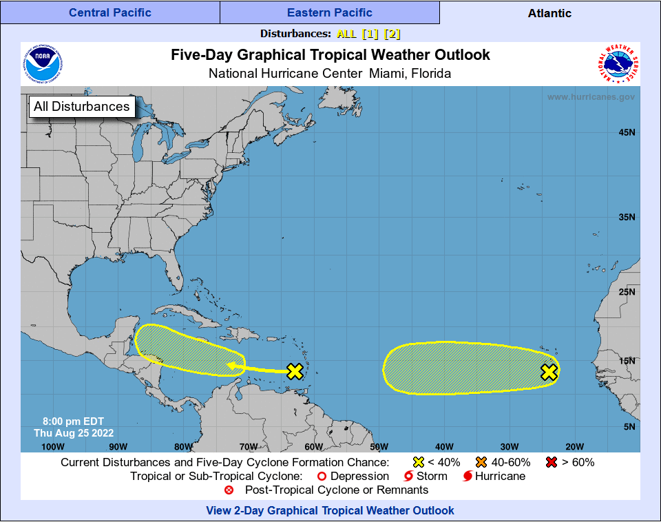
Currently as of writing this on Thursday night, the NHC is monitoring two tropical waves in the Atlantic Basin. The first being a area in the Caribbean Sea, just to the west of the Leeward Islands. The NHC is currently giving this system a 20-percent chance of formation within the next 5-days as it continues to move towards the northwest. Our next disturbance comes just off the coast of Africa and to the south of the Cape Verde Islands. This is a tropical wave that could possibly develop as it moves westward out into the open Atlantic. The NHC gives this disturbance also a 20-percent chance of formation within the next 5-days.
Current Tropical Conditions
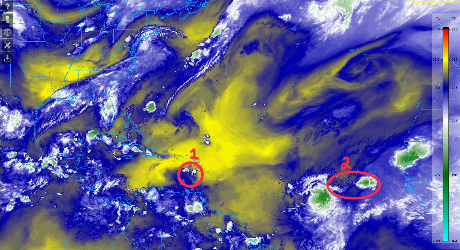
Looking at the mid-level water vapor imagery, we can pick out the two disturbances that the NHC has highlighted in their outlook. The disturbances have been numbered 1 and 2 which is consistent with what the NHC has numbered the disturbances in their outlook. We can currently see that these disturbances are quite small and disorganized, which is one factor into their 20-percent chance of development in the next 5-days. Disturbance 1 is likely to encounter a region of dry air in the Caribbean Sea as it continues to move to the west, as is Disturbance 2.

Taking a look at the current wind shear across the tropical Atlantic, we have a large swath of favorable, low wind shear values across portions of the east Atlantic and into the Caribbean Sea. Disturbance 1, which is located in the Caribbean Sea just to the west of the Lesser Antilles, is in a favorable area in terms of wind shear. Disturbance 2 near Cape Verde is also in a mostly favorable area in terms of wind shear, with only a small portion of its path marked with slightly higher wind shear values.
Model Guidance
When looking at the model guidance for the Tropics, it is important to remember that until a system gets properly developed with a defined circulation and form, its harder to know where a potential system could end up, as models forecast track much better when the system has a defined center to it, instead of just a cluster of showers and thunderstorms.
That being said, we can still take a look at how the conditions will play out in the future, and use that information to better assess whether or not our current disturbances of interest have a better chance of developing.


If we compare the wind shear for the next 4-8 days and see where our disturbances are forecasted to be, disturbance one is moving northwestward and both ensembles indicate that shear will remain light in those areas, with 10kts being the average amount of wind shear. For disturbance 2, the system might see some higher levels of shear as it continues to approach the Caribbean islands, as both ensembles show some higher 20-30kt values of wind shear to the east of the Lesser Antilles.


If we take a look at the projected relative humidity values for next Friday, starting with the Euro (ECMWF) model, we can see the large area of dry air still persistent to the north of the Caribbean, with smaller areas of more moist air in the Caribbean sea and closer to the African coastline. The American (GFS) model shows a similar solution, with slightly more moisture in the Caribbean and into the Gulf of Mexico, as this model run shows a system moving towards the Gulf.
One thing I’d like to mention and reiterate is that when we are looking this far out in time, deterministic models such as the GFS and the ECMWF are not to be taken definitively as many times these models will show tropical storms this far out that will never actually occur. The main take away from this would be to see that there are areas of moisture that storms could use for further development, however we will have to wait and see if anything gets going and then worry about potential landfall or tracking any system.
Conclusions
With a quiet and tame season so far, having two disturbances to track and watch out for from the NHC certainly brings something to talk about looking into the future, however the chances as of right now aren’t the best being only 20-percent for each disturbance. Nevertheless, it is important to never let your guard down this time of year, as things can quickly change this time of year, especially as we approach the height of the season where conditions generally are the best for tropical development. For that reason, it is important to continue to monitor the current and future disturbances that is brought to our attention.


