With the holiday weekend coming up, we’re basically back to that classic summer setup of hot temperatures and a few pop-up storms each afternoon. However, don’t get too excited, because heat index values could climb up to 105 degrees this weekend, so make sure to stay hydrated while celebrating!
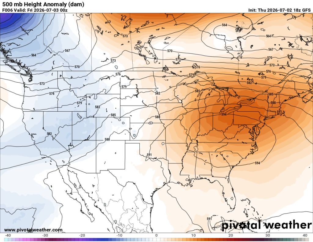
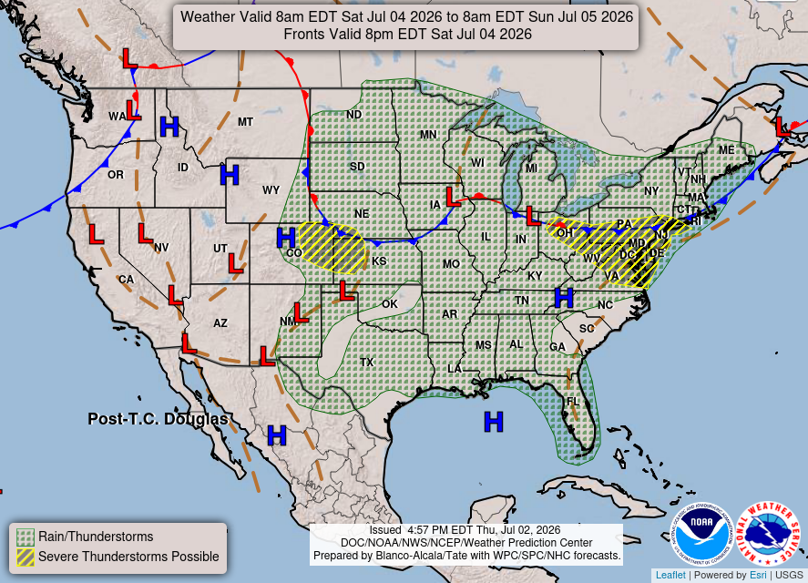
The overall risk for severe storms and heavy rain stays low since there’s no strong forcing in place. The forecasted surface map for this weekend shows a low-end chance of rain/thunderstorms across the region, with high pressure over the Gulf. While high pressure and ridging do help limit storm development, strong daytime heating and moist Gulf air will overcome the suppressive nature of this high and still support a few spotty afternoon thunderstorms.
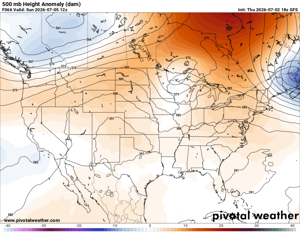
The upper-level ridge that is responsible for keeping storms at bay going into the weekend is expected to break down a bit on Sunday. So as expected… we will see showers and thunderstorms increase late this weekend and into early next week.
3-DAY TRAVEL FORECAST
AIRPORTS
KIAH / KHOU (Houston) –Spotty afternoon showers and storms possible each day. Some intermittent flight delays are possible for lightning. But most flights between 5a and 2p should not be impacted by weather.
KSHV (Shreveport) – Afternoon showers and storms possible each day. Some intermittent flight delays are possible for lightning. But most flights between 5a and 1p should not be impacted by weather.
KBTR (Baton Rouge) – Spotty afternoon showers and thunderstorms are possible each day. Some intermittent flight delays may occur due to lightning, but most flights between 5 am and 1 pm should not be impacted by weather.
KMSY (New Orleans) – Scattered storms continue through sunset. Otherwise, afternoon showers and thunderstorms are possible each day. Some intermittent flight delays may occur due to lightning, but most flights between 5 am and 1 pm should not be impacted by weather.
KJAN (Jackson) – Afternoon showers and storms possible each day. Some intermittent flight delays are possible for lightning. But most flights between 5a and 1p should not be impacted by weather.
KMOB (Mobile) – Afternoon showers and storms possible each day. Some intermittent flight delays are possible for lightning. But most flights between 5a and 3p should not be impacted by weather.
KBMH (Birmingham) – Tonight, scattered storms will continue through sunset, some with strong wind gusts and heavy downpours. Otherwise, afternoon showers and thunderstorms are possible each day. Some intermittent flight delays are possible due to lightning, but most flights between 3 am and 1 pm should not be impacted by weather.
KTLH (Tallahassee) – Afternoon scattered showers and thunderstorms possible Saturday. Some intermittent flight delays are possible due to lightning, but most flights between 8 am and 2 pm should not be impacted by weather.
KATL (Atlanta) – Several strong to severe storms will continue this evening, with lightning potentially causing delays through now until around 10 p.m. Afternoon pop-up storms are possible each day. Flight delays are possible, but most flights between 8 am and 3 pm should not be impacted by weather.
HIGHWAYS
I-10
Mostly sunny other than hit-and-miss storms between 1-10pm from Houston to Tallahassee possible each day. Highest coverage will be along coastal Louisiana and Mississippi (around 30%) during the afternoon. Be prepared for brief rounds of heavy rain, lightning, and gusty winds.
I-20
Hit-or-miss storms are possible each day from 1–10 p.m., highest chances are near Birmingham and Atlanta. Be cautious when driving along, as these storms could have gusty winds and sudden downpours.
I-49
Afternoon scattered storms are expected all along I-49 on Friday. Saturday looks drier, though we cannot rule out a few pop-up showers. Watch for rapidly changing conditions and slow down if visibility becomes poor.
I-55 & I-59
Looks pretty good other than isolated showers and thunderstorms that may pop up between 1–10 pm. On Friday, these storms will be mostly concentrated in the far northern parts of Mississippi and south, near Laplace. On Saturday, expect an even 30% chance of storms across the interstate. Slow down and drive carefully if caught in the rain!
I-65
Several strong to severe storms will continue this evening near and north of Birmingham. These storms will feature brief heavy rain, strong winds, and frequent lightning
Friday will bring a similar setup, with scattered strong to severe storms near and north of Birmingham during the afternoon. Watch for ponding on roadways. Saturday looks good aside from a spotty afternoon shower or storm.
I-75
Several strong to severe storms will continue this evening until sunset near and north of Atlanta. These storms may produce heavy rainfall, wind gusts up to 60 mph, and small hail.
Going into this weekend, the drive between Gainesville and Macon looks mostly dry. But as you get closer to Atlanta and Gainesville, watch for scattered afternoon showers and thunderstorms.
CITY FORECASTS
Houston, TX
Tonight – This evening, expect scattered showers and thunderstorms until around sunset, giving way to mostly clear skies overnight. It will be a warm and muggy night with a low around 80 and a light southeast wind. Rain chance: 20%
Friday– Patchy fog possible in the morning. Hot and sunny day with a high of 95, but it may feel closer to 104. There is a low-end chance of a pop-up storm during the afternoon. Winds will be light and out of the southeast. Rain chance: 20%
Saturday–Another sunny and hot day, with a high of 96, but may feel closer to 106. Light southeast winds. Mostly clear skies are expected that night with a low around 80.
Shreveport, LA
Tonight –Scattered showers and thunderstorms possible through about 10 p.m., then skies will clear. Overnight low around 76 with a light southeast wind. Rain chance: 20%
Friday–Hot and sunny with a high near 93, but it may feel closer to 100. There is a low-end chance of a pop-up afternoon thunderstorm. Light southerly winds. Rain chance: 20%
Saturday–Sunny skies with a high near 93, may feel closer to 102. Scattered afternoon thunderstorms are possible and winds will be calm. That night, a lingering storm may be possible early, becoming partly cloudy by late evening. Low around 77. Rain chance: 30%
Baton Rouge, LA
Tonight –Scattered showers and thunderstorms will continue until sunset, then give way to partly cloudy skies. Low tonight around 75 with calm southeast winds. Rain chance: 50%
Friday–Sunny and very hot conditions expected tomorrow. High near 95, may feel closer to 102. There is a low chance of a stray afternoon or evening storm. Rain chance: 15%
Saturday– Another hot and humid day is expected. Skies will be mostly sunny with highs near 95, but it may feel like 105. Drink water! Scattered storms are possible after 1 p.m. That night, a lingering storm may be possible early before clearing to mostly clear skies. Low around 77. Rain chance: 30%
New Orleans, LA
Tonight –Scattered showers and thunderstorms may linger around until sunset, then give way to partly cloudy skies. It will be warm tonight with a low around 80. Winds will be from the southeast at 5–10 mph. Rain chance: 30%
Friday–Sunshine with a chance of a stray storm between 1–3 p.m. High near 92, may feel closer to 102. Winds will be from the east at around 5 mph. Rain chance: 20%
Saturday– Another hot and sunny day with a high near 94, feeling closer to 102. Low-end chance of scattered storms in the afternoon. Winds will be calm and northerly. That night, a lingering storm may be possible before skies clear overnight, with a low around 80. Rain chance: 15%
Jackson, MS
Tonight – Mostly clear skies tonight with a low around 75 and calm winds.
Friday–Sunny and hot tomorrow with a high near 95, but it may feel closer to 105. There is a low-end chance of a stray afternoon storm. Calm easterly winds. Rain chance: 15%
Saturday– Another hot day with a high of 94, feeling closer to 106. A mix of sun and clouds with a chance of afternoon pop-up thunderstorms after 1 p.m. Winds will be calm and northerly. That night, a lingering storm may be possible before skies clear overnight with a low around 75. Rain chance: 20%
Birmingham, AL
Tonight –Scattered showers and thunderstorms continuing until sunset, then giving way to clear skies. Main threats are damaging wind gusts and heavy downpours. Warm tonight with a low around 77 and calm winds. Rain chance: 30%
Friday–Humid and sunny with a heat advisory in effect. High near 96, but it may feel like 105. A stray thunderstorm is possible, mainly after 1 p.m. Calm winds. Rain chance: 30%
Saturday– Heat advisory in effect with a high near 95 but may feel closer to 100. A stray shower or thunderstorm is possible in the early afternoon, otherwise mostly sunny skies. Overnight looks to be mostly clear with a low around 75. Rain chance: 30%
Mobile, AL
Tonight –Mostly clear skies tonight with a low of 77 and calm winds from the south.
Friday–Beautiful day with sunshine and a high near 96 but it may feel closer to 105. A stray thunderstorm is possible, mainly between 4–10 p.m. Calm southerly winds. Rain chance: 20%
Saturday–Another sunny and hot day is in store. High near 96, feeling like 105. A stray thunderstorm cannot be ruled out in the afternoon and evening hours, though chances remain low. Calm southerly winds. That night is expected to be mostly clear and warm with a low around 78. Rain chance: 15%
Tallahassee, FL
Tonight –Mostly clear skies with a low of 75. Light winds will be blowing from the east.
Friday–Very hot with a high of 97, but it will feel closer to 102. Sunny skies and calm winds.
Saturday–Another sunny and hot day. High of 97, may feel closer to 105. A stray thunderstorm is possible, mainly between 2–8 pm, before becoming mostly clear overnight. Light winds from the south. Rain chance: 30%
Atlanta, GA
Tonight –Several strong to severe storms will continue this evening but should dry out by around 10 p.m. Damaging wind gusts, large hail, frequent lightning, and heavy rain are all possible. Muggy tonight with a low around 80. Rain chance: 20%
Friday–Heat and sunny skies are the main story. A heat advisory is in effect as highs reach 97, but it may feel like 105° Stray thunderstorms are possible between 3–7 pm. Rain chance: 30%
Saturday–Another sunny and very hot day in store with a heat advisory still in effect. Highs near 98, may feel like 105. Conditions should stay dry, but a stray afternoon storm can’t be ruled out. That night looks mostly clear and warm with a low around 78, though it may feel near 90. Rain chance: 15%


