Greetings from London! I’m five hours into the future right now, having just finished a late dinner after a long day!
Back home along teh central Gulf Coast, we have a cold front moving through the area this afternoon / evening that will really be cooling things down int eh coming days. On top of that, we also have a chance for a few brief showers tonight and into tomorrow morning.
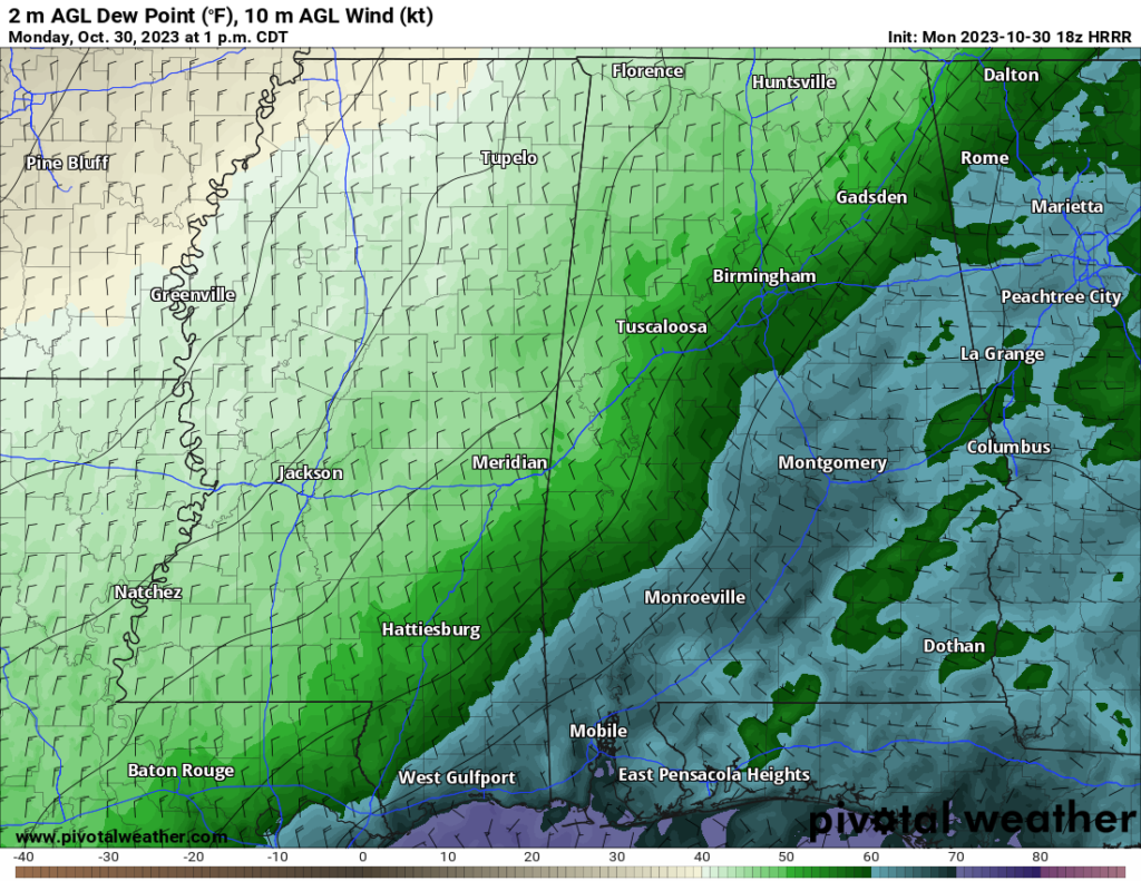
For tonight, wind from the north around 10 to 15mph will blow pretty consistently overnight. On the dewpoint map above, you can see how we have traded out blues and purples for greens and browns — signifying dry air is moving into the area.
That dry air and northerly wind will help temperatures drop down to about 45F to 50F overnight tonight and into tomorrow morning.
Tomorrow, that north wind is going to continue, gusting up to 20mph at times. So if you have any Halloween decorations hanging outside, they may have a tough time holding on through the whole day. Temperatures will top out around 60F. Given the dry air and the gusty wind, we are looking at wildfire dangers tomorrow.
The National Weather Service has issued something called a “Red Flag Warning” for tomorrow int eh area. It means that weather conditions are ripe for any potential wildfire to spread quickly, so it is important to avoid any outdoor burning and “stay vigilant” when it comes to seeing / smelling smoke int he air.
Then tomorrow night we get a reinforcing shot of cooler air. And that should knock temperatures back to around 35F to 40F overnight.
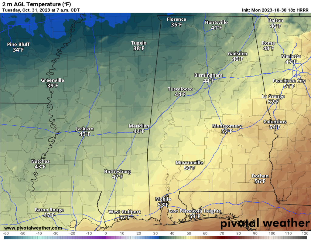
That means it will be in the low 50s for those Trick-or-Treaters, and breezy. A good night to wear a sweatshirt under your costume if you’re going to be out and about.
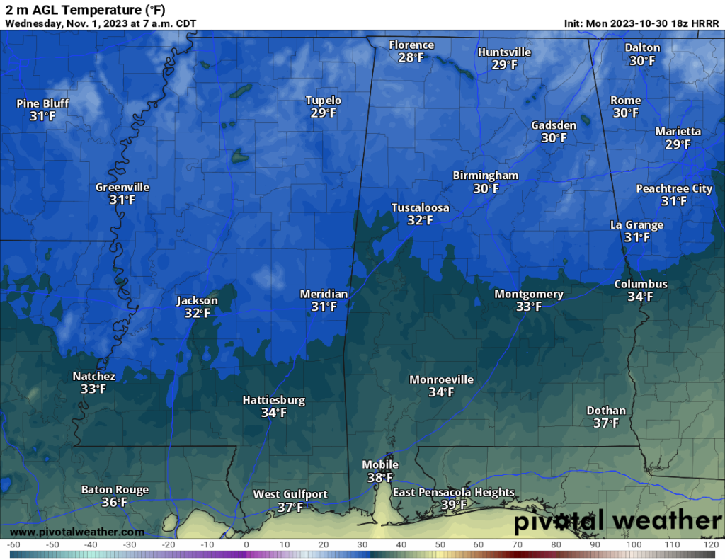
By Wednesday, we turn clear, clam and cool with highs around 60F again. Then things get pretty chilly Wednesday night and into Thursday morning. Temperatures will drop down into the 30s! Some model guidance has parts of the area down to around the freezing mark. The NAM computer weather model, for example, below shows that happening.
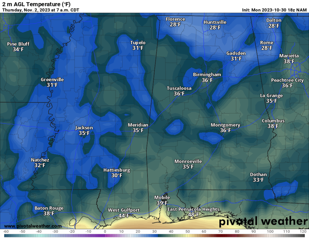
The real question is, “Will that really happen?”
I’m skeptical. But I think there is a shot. So if you have any plants that don’t like the cold, tonight is the night to bring them in, and keep them in for the next few days.
The reason some of this high resolution data is showing temperatures so cold iis two-cold. Firstly, they can – at times – under-estimate the amount of temperature modification that happens as the cooler air moves over warmer land and, secondly, these models can also tend to really dry out the air overnight (at times, too much).
So, while we have been really, really dry the last few months, I do question if we are dry enough to allow the dewpoints to fall low enough to allow temperatures to cool that low int eh given airmass. But I do think there is enough ‘umph’ from the cold to make it pretty chilly for us. And chilly enough to bring some of those plants inside and make sure you have the jacket / coat handy as you head out he door the next few mornings.
And hey, if we get to freezing it would be about 10 days earlier than normal. Not a “big difference” in the grand scheme of things.
And it will be short-lived. As we move through the day on Thursday, we warm back into the 60s. And then we rebound back into the 70s on Friday and through the weekend.


