Fire Weather is a term used by meteorologists that covers any weather that may contribute to the spread of wildfires. The Storm Prediction Center issues outlook for Fire Weather just like it does for Severe Weather.
The SPC defines severe weather as “conditions which, when combined with the antecedent fuel conditions, favor rapid growth and spread of a fire should an ignition occur.”
Low humidity, high winds, and dry vegetation (fuels) are the big three sources of a more severe Fire Weather conditions. In the video above, all three of those things were present in 2011 when this fire spread through Bastrop State Park near Austin, Texas.
Definitions & SPC Outlooks
While the SPC notes that the more often than not, fires are started by non-weather-related things, the SPC does forecast dry thunderstorms, which are considered the only meteorological ignition source.
The outlooks do look a bit like the Severe Weather Outlooks from the SPC, too. And they haven’t changed much during the last 10 years.
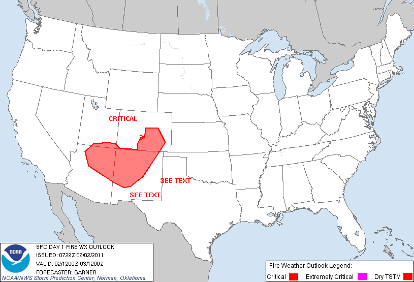
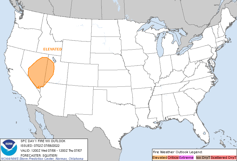
The SPC uses a Five-tier scale for fire weather threats in the Day 1 and Day 2 Fire Weather Outlooks: Elevated, Critical, or Extremely critical for temperature, wind and relative humidity (RH), as well as a Isolated or Scattered (critical) for dry thunderstorms. So, a bit like the Severe Weather Outlooks, the scale goes from lower (Elevated) to highest (Extremely Critical).
The SPC will only issue a Critical or Extremely Critical fire weather area if conditions will last for more than three hours. The outlook type depends on the severity of both the forecast weather and the antecedent conditions relative to the given geographic region.
Meteorologically speaking, the Big Three things that decide if a fire is going to spread rapidly are (1) the magnitude of the sustained wind speeds, (2) the duration and level of lower relative humidity, and (3) the temperature.
The SPC notes that, generally, for national guidance purposes, sustained wind speeds of 20 mph or greater, RHs lower than a threshold value (varying from 15-35%) and temperatures above 50-60° F, depending on the season, will necessitate the issuance of a critical delineation. The criteria for RH varies regionally, depending on the predominant fuel type and climatology

A breakdown of specifics for each threshold is below:
Elevated for temperature, wind, and relative humidity:
- Sustained winds 15 mph or greater (10 mph Florida)
- Minimum relative humidity within 5% of regional thresholds
- Temperatures above 45-55° F, depending on the season
- Dry fuels (as defined below)
- Duration of 3 hours or more – or critical conditions expected for a duration of less than 3 hours
Critical for temperature, wind, and relative humidity:
- Sustained winds 20 mph or greater (15 mph Florida)
- Minimum relative humidity at or below regional thresholds
- Temperatures above 50-60° F, depending on the season
- Dry fuels (as defined below)
- Duration of 3 hours or more
Extremely Critical:
- Sustained winds 30 mph or greater (25 mph Florida)
- Relative humidity at or below 1/3 lower than regional thresholds
- Temperatures at or above 60-70° F, depending on the season
- Very dry fuels (as defined below)
- Duration of 3 hours or more
- Extremely critical may also be considered for borderline weather conditions where exceptional drought exists
- Extremely critical delineations are made when wind, relative humidity and temperatures significantly deviate from climatological normals.
Isolated Dry Thunderstorms:
- 10-39% coverage of cloud-to-ground lightning strikes with rainfall at-or-below 0.10”
- Temperatures above 45-55° F, depending on the season
- Dry fuels
Scattered (Critical) Dry Thunderstorms:
- 40% or higher coverage of cloud-to-ground lightning strikes with rainfall at-or-below 0.10”
- Temperatures above 50-60° F, depending on the season
- RH at or below regional thresholds
- Dry fuels
Avoid Outdoor Burning
This is why when Fire Weather Conditions are discussed by the SPC, a local NWS office or you’re favorite meteorologist (maybe even one who works for this site!) it is important to avoid any outdoor burning. Because the meteorologists with the SPC are indicating that wildfires can spread very easily.
But even more, that wildfires can also start very easily, too.
That means a typical bonfire in the backyard that would normally be harmless if monitored correctly, could spread quickly, grow easier, and get out of control faster than normal. All bad things.


