
Good afternoon! Based off of the title, you can probably guess (or feel) that it is hot hot hot out there today!
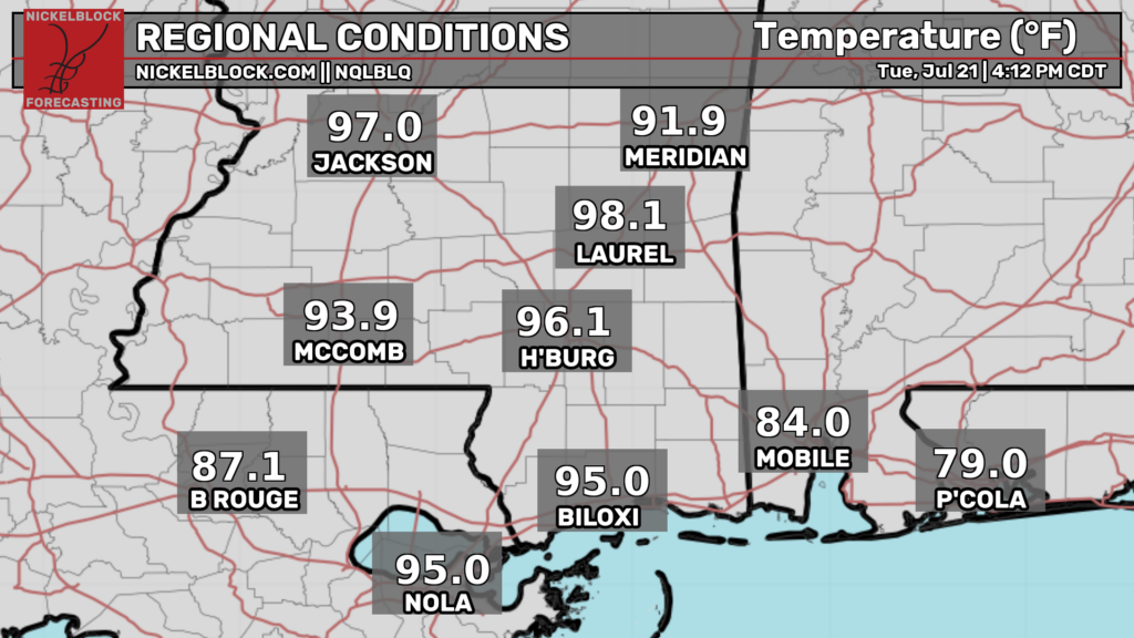
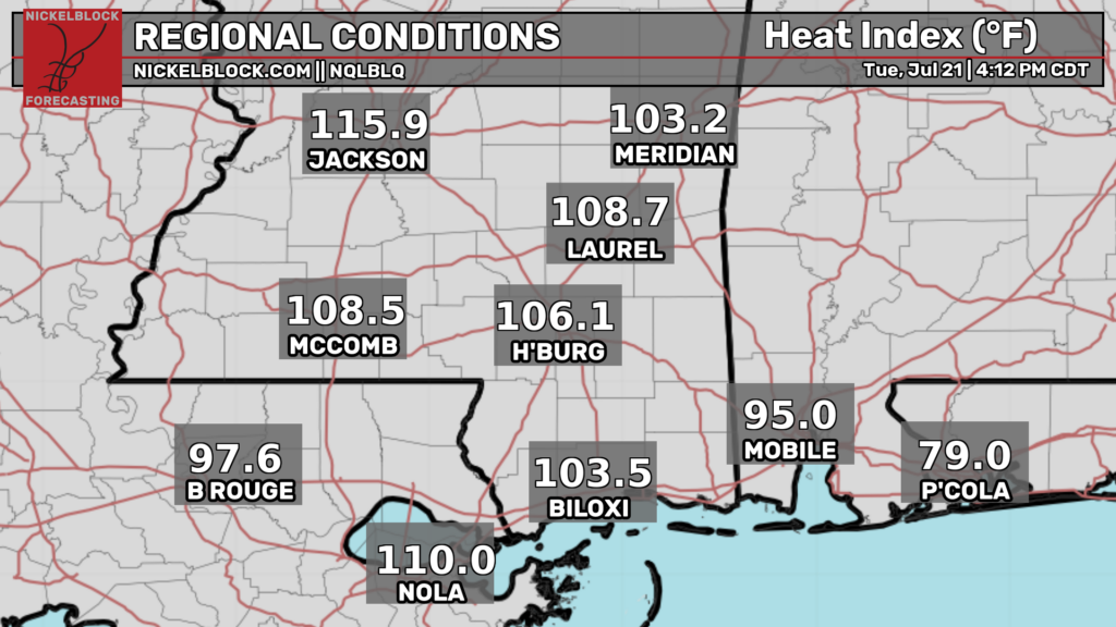
Temperatures are currently in the mid-upper 90s across most places in our region. The heat index is even more eye popping, with most places seeing heat index values well over 100ºF. Right now, Jackson’s heat index value is an inferno like 116ºF! It goes without saying, but be sure to take the necessary heat precautions to protect yourself from this heat for the rest of the day today, and most days this week.
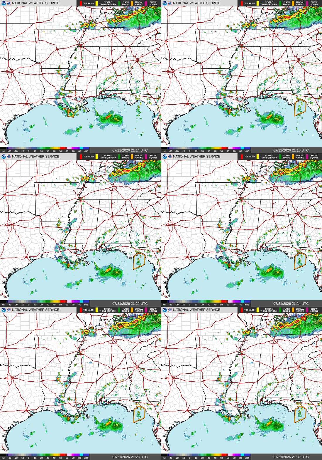
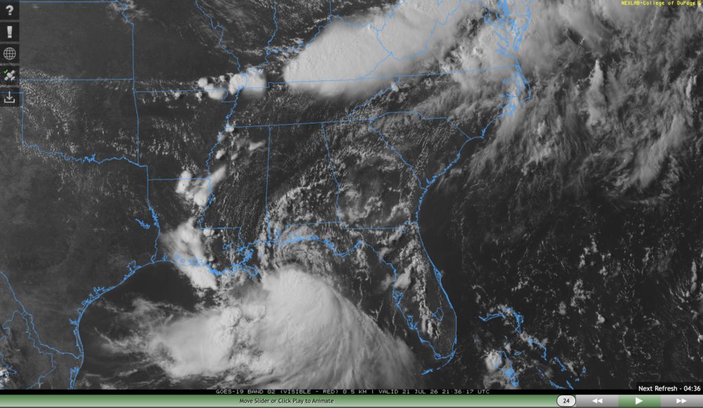
While skies are mostly sunny throughout our area, if you look at satellite imagery, we can see that tropical storm Bertha sits to our south, just south of the western Florida panhandle. The outer bands of Bertha are producing some minor storms and showers in south central Alabama as well as in central Louisiana.
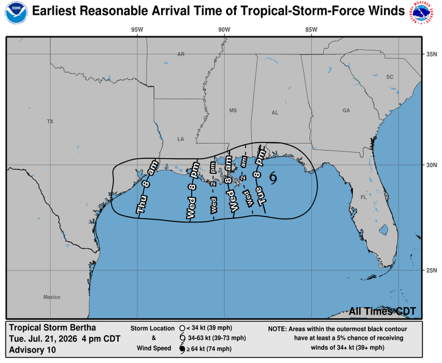
Bertha will track slightly northwards tonight, delivering tropical storm force winds (39 mph+) to the Mobile area beginning around 8 tonight and to the Biloxi area past midnight. Bertha will likely make landfall in the far southeastern Louisiana delta region midday tomorrow and will continue to skirt the Louisiana coast tomorrow.
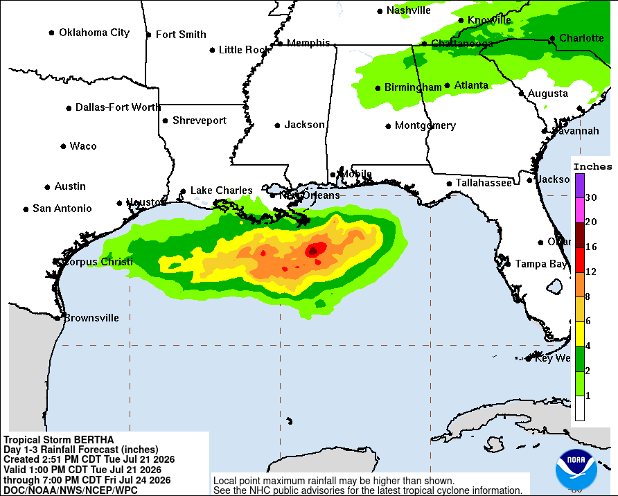
Luckily, most of the convection associated with Bertha is south of her core, so our area is unlikely to see excessive rainfall totals. The highest totals can likely be found in far southern Louisiana, where totals could exceed 2″.
Regardless of rainfall totals, if you are closer to the coastline between the FL panhandle and Alexandria, LA, it’s a good idea to prepare tonight in case you lose power. Charge your cell phones, fill up a bathtub with water, and get some flashlights ready.

Tomorrow
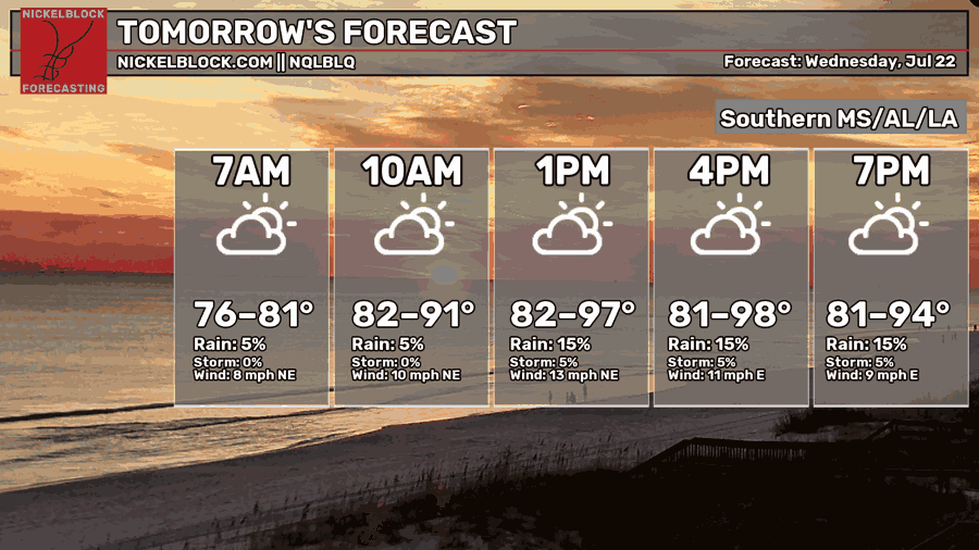
Afternoon high temperatures will be hot again tomorrow like they were today, with highs climbing into the upper 90s in some spots. Extreme heat warnings are in effect for the western half of Mississippi as well as most of Louisiana. Be sure to take the necessary precautions for excessive heat and avoid strenuous outdoor activity for long periods of time.
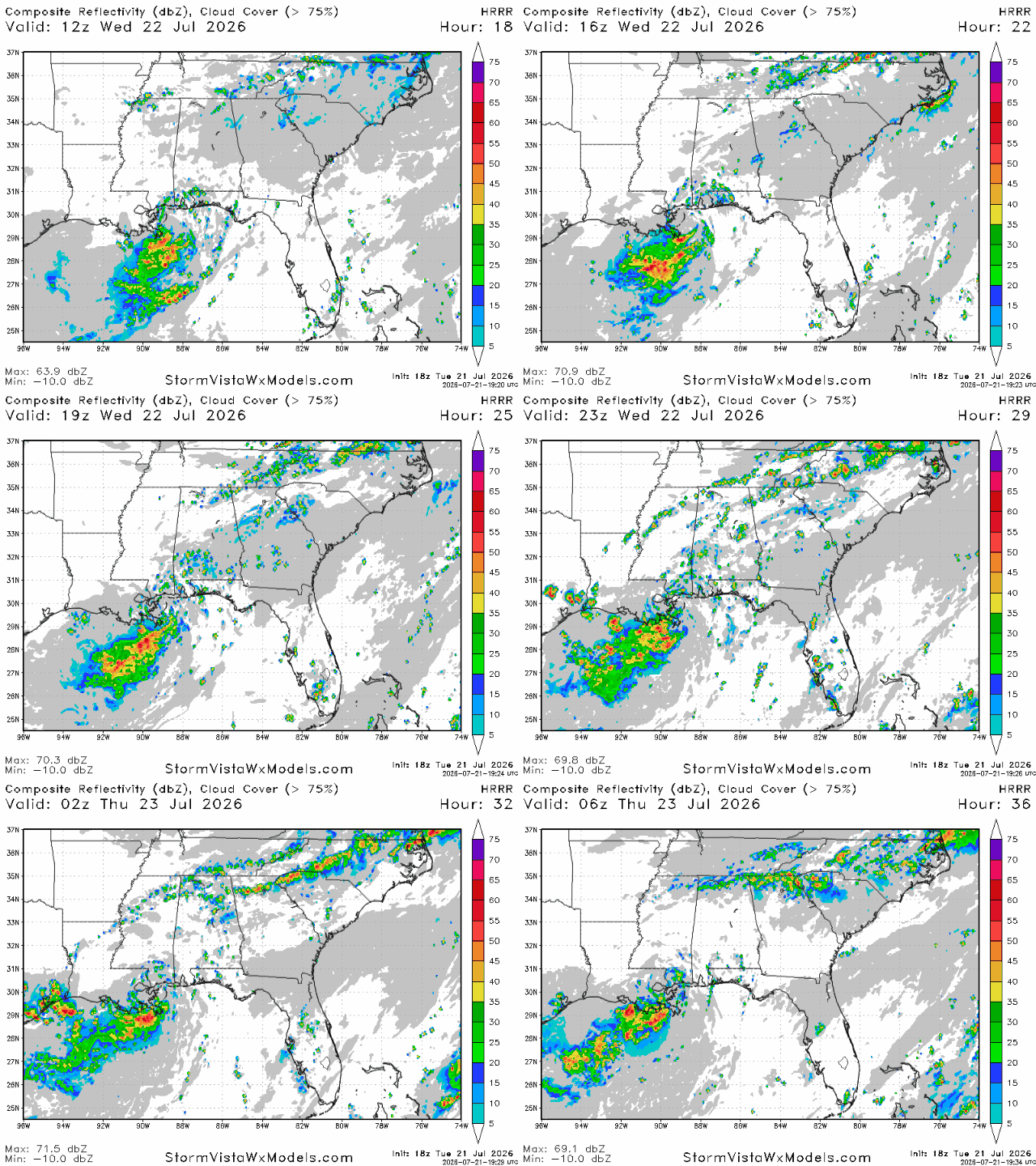
Tropical storm Bertha is expected to make landfall tomorrow around lunchtime in extreme southeastern Louisiana. Bertha will continue to slowly move west throughout the day, eventually reaching the middle of the state by the coast by midnight tomorrow night. Locally heavy rainfall totals can be expected very close to the coast, but because Bertha’s main convection area is to the south, very little rainfall is expected north of the immediate coast.
Some weak storms are possible tomorrow afternoon and evening in places further north, but tomorrow will generally be a sunny and hot day for most.
Thursday
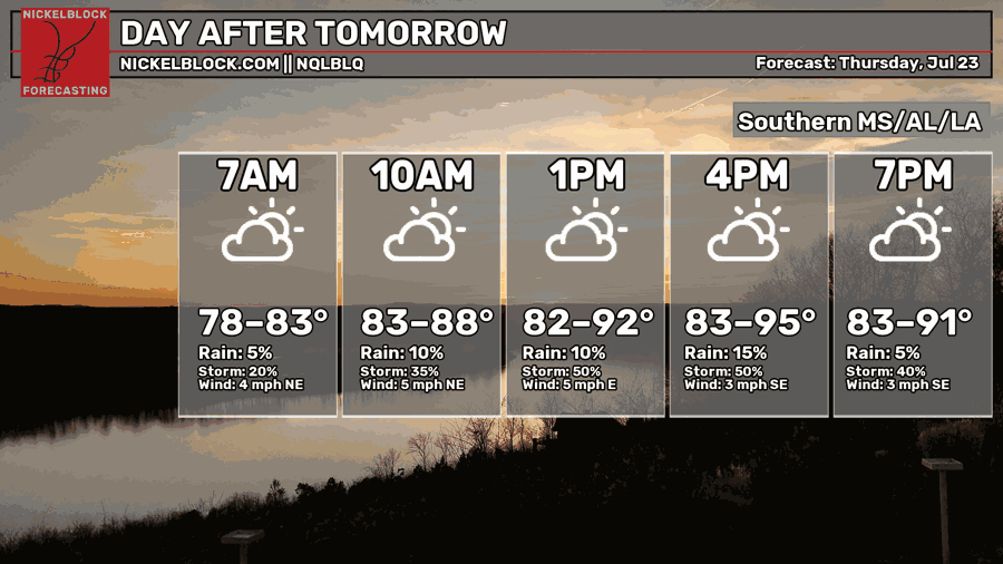
On Thursday, we cool down slightly, with afternoon high temperatures in the low-mid 90s. While temperatures will still be hot, it will be a slight improvement from today and tomorrow.
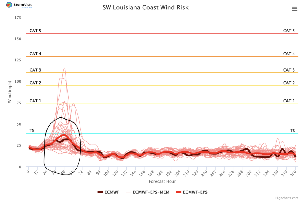
Tropical storm Bertha is likely to pass by the southwestern Louisiana coastline on Thursday. The ECMWF ensemble models show the highest risk for tropical depression and tropical storm force winds on Thursday morning until the afternoon. It’s worth noting that Bertha will be slightly weaker by Thursday due to land interaction that takes place on Wednesday.
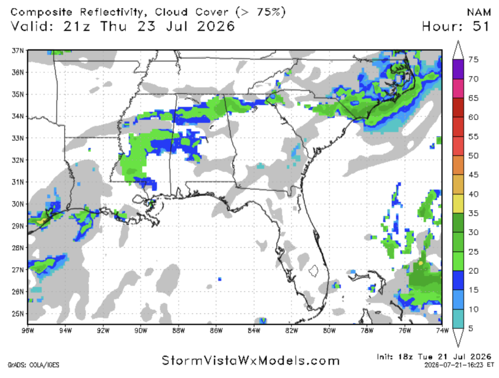
Some storms are also possible on Thursday, not associated with Bertha. Storms on Thursday may fire up in the afternoon and evening in areas to the north between Jackson and Birmingham. These storms will be south moving as the ridge of high pressure we’re under will steer them in that direction. This ridge is what is preventing Bertha from moving further north and what is baking us with this extreme heat. Most storms should be gone by 10-11 pm.

Extended Outlook
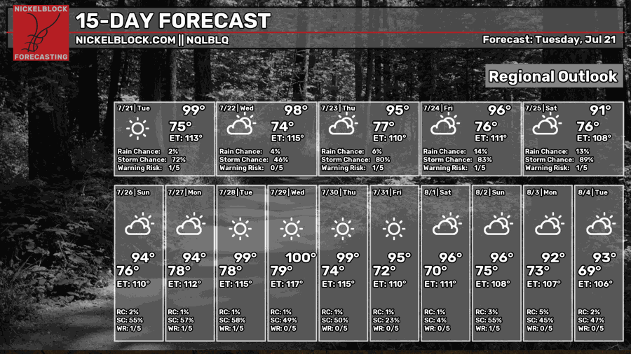
Unfortunately, over the next 2 weeks, the roasting will continue. Most days until the beginning of August are likely to see high temperatures in the mid to upper 90s, with practically no breaks, making it the hottest stretch of the summer so far.
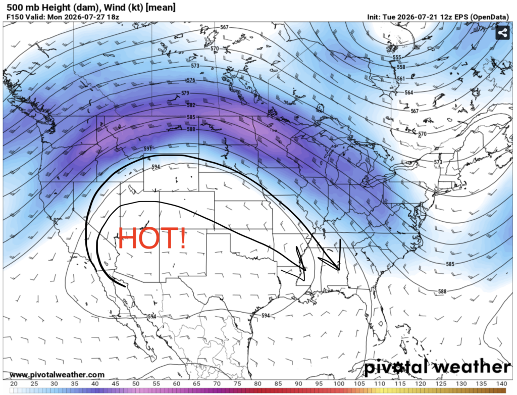
The main culprit behind this heat is a strong ridge of high pressure centered over the southwest. This ridge will bring in some hot air to our region over the next two weeks, and will be quite stubborn after that. Expect hotter temperatures the further west you go in our region and slightly cooler and wetter conditions the further east you go.
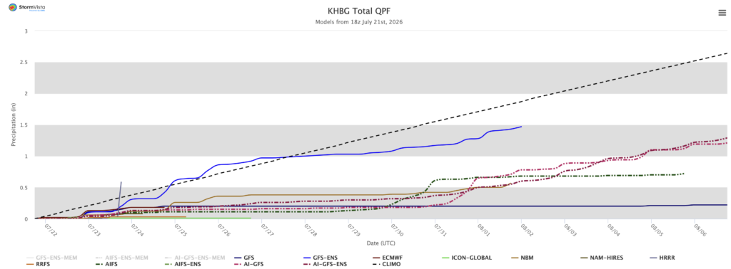
On the precipitation front, things may start to dry out again. In Hattiesburg (center of our region), most models only predict about an inch of rain to fall between now and the beginning of August, well below the climatological average. Drought is not going to come back due to the heavy rain we saw in May and June, but lawns may start to look a bit yellow by August.


