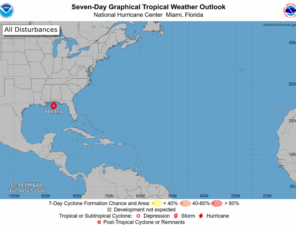
What was once Tropical Depression Two is now Bertha. Spinning just off the coasts of Florida and Alabama, Bertha is roughly 125 miles southeast of Mobile, Alabama.
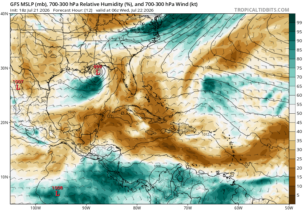
Bertha has quite a funny look to her… she’s a bit lopsided (no offense). Most of the rainfall and strongest winds are occurring to the southeast of the low-pressure center. Meanwhile, not much is happening on the north side.
The latest insight into Bertha comes from the Hurricane Hunters (as of 7 PM):
- Winds: Sustained at 60mph
- Movement: Crawling West at 6mph
- Central Pressure: 997 mb
Based on these stats, Bertha has reached tropical storm strength (defined as sustained winds between 39 and 73 mph).
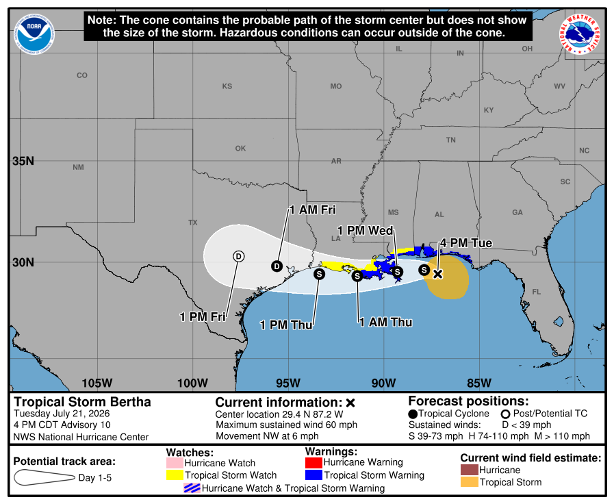
The National Hurricane Center projects Bertha will move westward while hugging the coastlines of Mississippi and Louisiana through Thursday.
The current timeline has Bertha located over Black Bay around lunchtime on Wednesday. She is then projected to continue her westward march, reaching the Houston area as a Tropical Depression overnight Thursday.
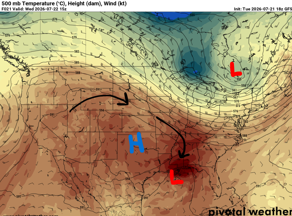
A ridge will build to the north of Bertha over the next few days. Around high pressure, winds flow clockwise, which will steer Bertha westward through Friday.
The National Hurricane Center says any significant strengthening is unlikely and has Bertha gradually weakening over the next few days. This makes sense, as the environment is not great for growth. Persistent wind shear is keeping Bertha lopsided and dry air is in place over the next day or two.
Tropical Storm Warnings are in effect for areas along the immediate coast between Tallahassee, Florida, and Morgan City, Louisiana, from Wednesday morning through Thursday morning.
This means tropical storm conditions are expected, including: minor to moderate storm surge, strong winds with gusts up to 40 mph (isolated power outages possible), a few storms with heavy rainfall that could lead to instances of flash flooding, and brief tornadoes can’t be ruled out.
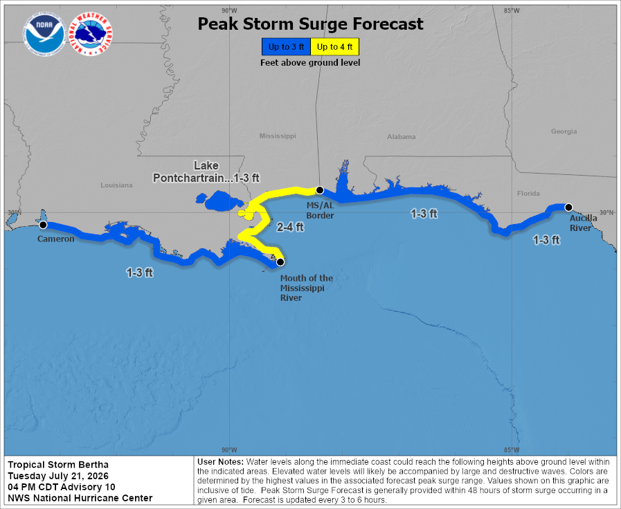
Of all the impacts, coastal flooding is the greatest concern. The potential exists for 2-4 feet of water above ground in some surge-prone areas. Numerous roads and low-lying areas may become flooded, especially east of the Mississippi River.
Yes, the greatest rainfall totals should remain offshore since Bertha is lopsided. However, rainfall amounts of 2 to 4 inches, with higher amounts possible in any heavier rainbands, could lead to areas of flash flooding along the southern LA/MS/AL coast.
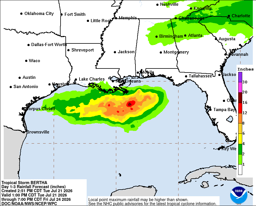
Those near Lake Charles and Houston should be sure to check back in as Bertha progresses westward this week!
Those north of I-10 could see some outer rainbands, but your main focus should be on the extreme heat expected.
Other than Bertha, the Atlantic is quiet. Check back in tomorrow for further updates on Bertha’s track!


Thank you Ella for the update concerning Tropical Storm Bertha. I must say that I am disappointed that Hattiesburg will not see any relief from the high temperatures nor rainfall from this storm. Thanks again!