Good afternoon! At this point in the summer, it goes without saying, it is HOT outside right now, and over the next couple of days it’s only going to continue to heat up.
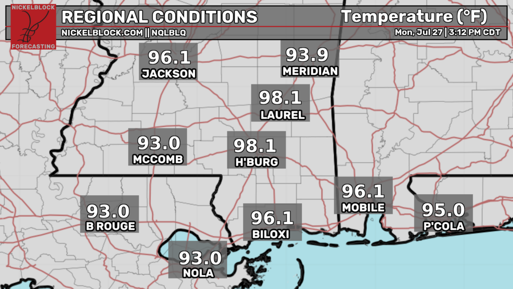
As of 3p CDT, temperatures are already in the mid-upper 90s across most places in our region. The “winners” so far are Laurel and Hattiesburg, both of which currently have temperatures of 98ºF. These temperatures will continue to heat up for the next hour or two. Some places may touch 100ºF this afternoon.
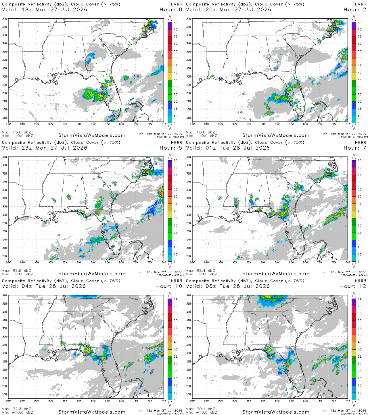
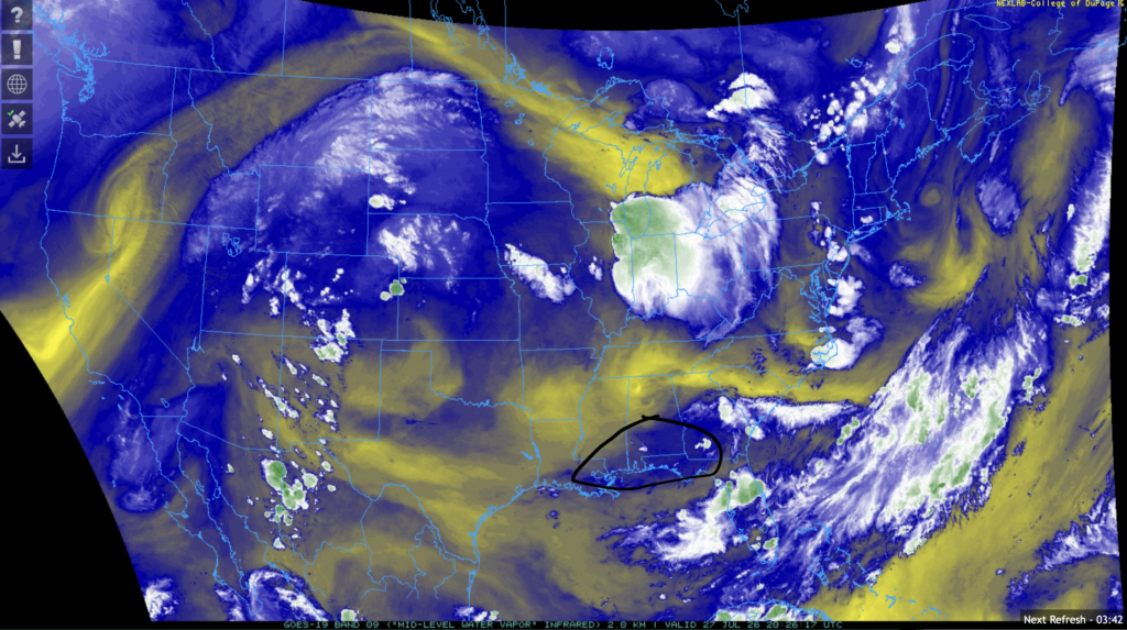
A few storms are likely tonight to break the heat. The main area that is likely to see storms is the area circled in the image on the right, which is where mid level water vapor is present. The Florida panhandle and the Tallahassee area is the area likeliest to see the most potent storms. Less potent storms are also possible further west along the coast.
Rainfall totals will likely be around a quarter of an inch in the FL panhandle area, with amounts less than that likely the further west you go along the coast. Totals may be higher in spots hit directly by thunderstorms.

Tomorrow
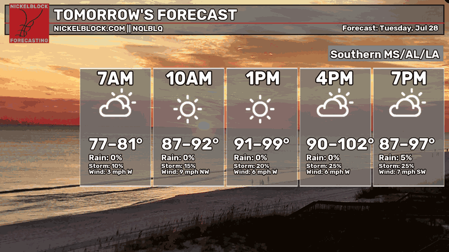
It’s very possible that tomorrow will be the hottest day of the summer for many spots in our region. Afternoon high temperatures will likely exceed 100ºF for many spots, with morning lows dropping only into the upper 70s.
It’s so so important you stay hydrated, wear cool clothing, and avoid too much physical activity outdoors for long periods of time tomorrow. Also, be wary of taking your four-legged friends on walks on pavement and concrete. If it hurts your feet, then it hurts their paws!
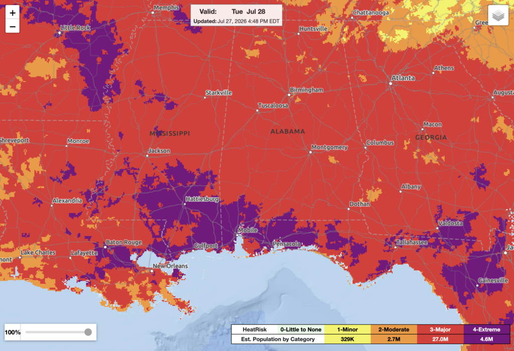
As such, nearly all of our region is in a major or extreme HeatRisk for tomorrow. Major cities that have an extreme HeatRisk for tomorrow include Tallahassee, Mobile, Hattiesburg, Gulfport, Biloxi, and Baton Rouge. Other major cities such as Birmingham, Atlanta, Jackson, Starkville, and New Orleans are under a major HeatRisk for tomorrow.
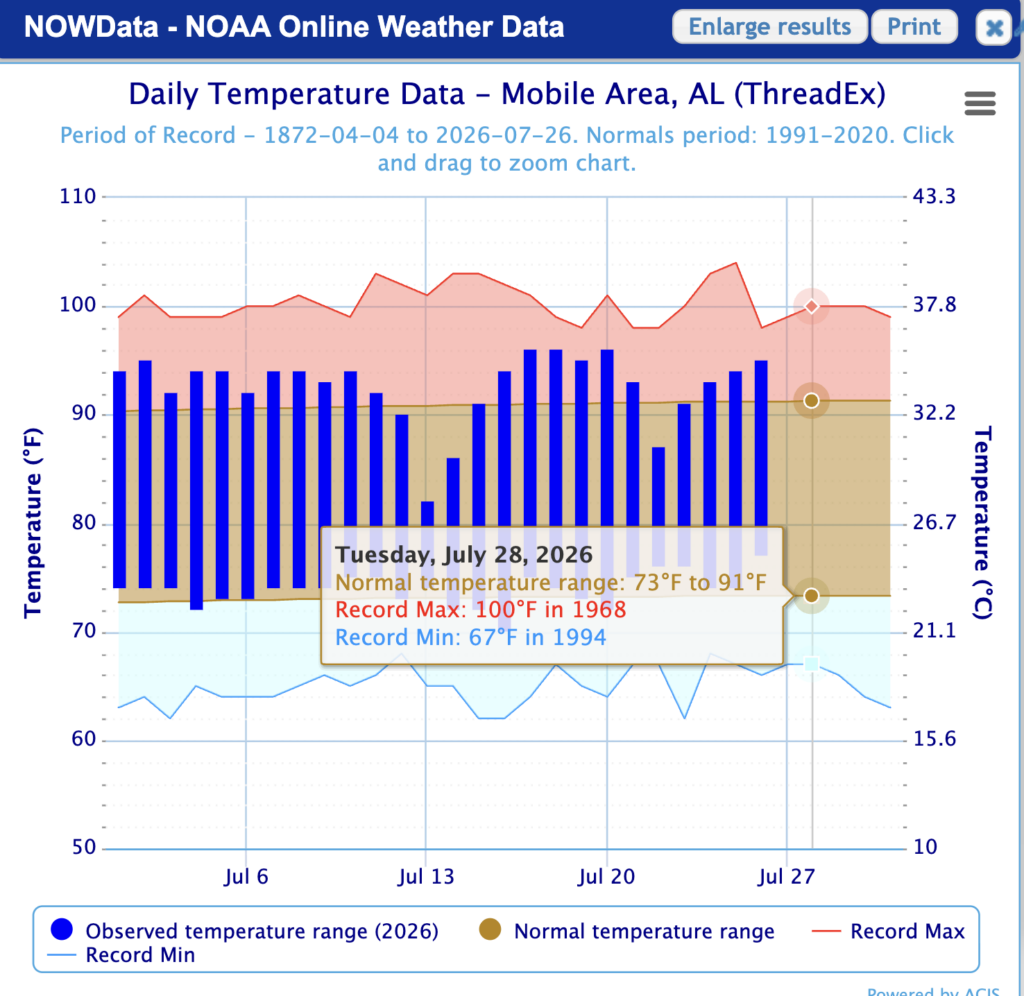
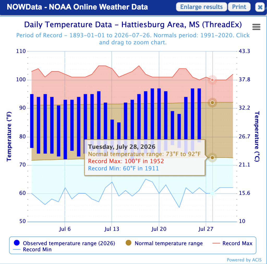
Some record high temperatures for July 28th are possible tomorrow for some places in our region. In Mobile, the record high was 100ºF in 1968, and in Hattiesburg, the record high was 100ºF in 1952. Both of these records are in jeopardy tomorrow!
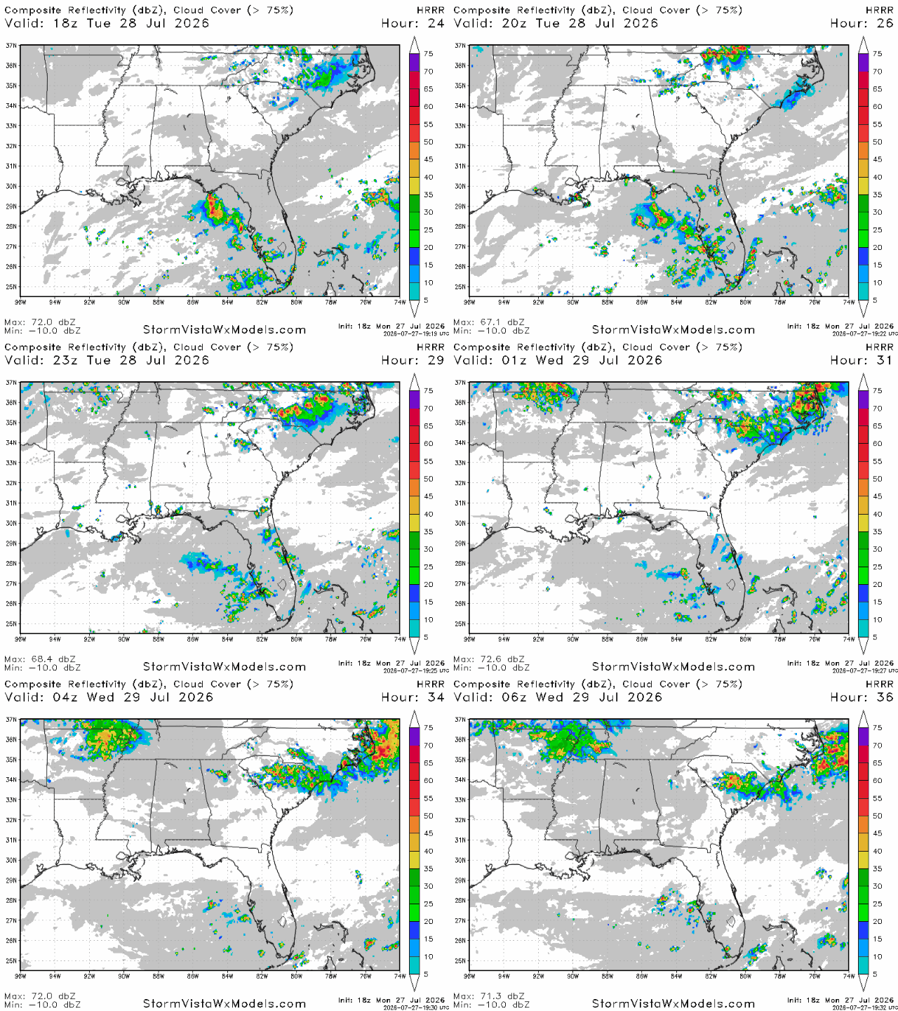
Unfortunately, no storms are likely tomorrow afternoon and evening to break the extreme heat we’re going to get tomorrow.
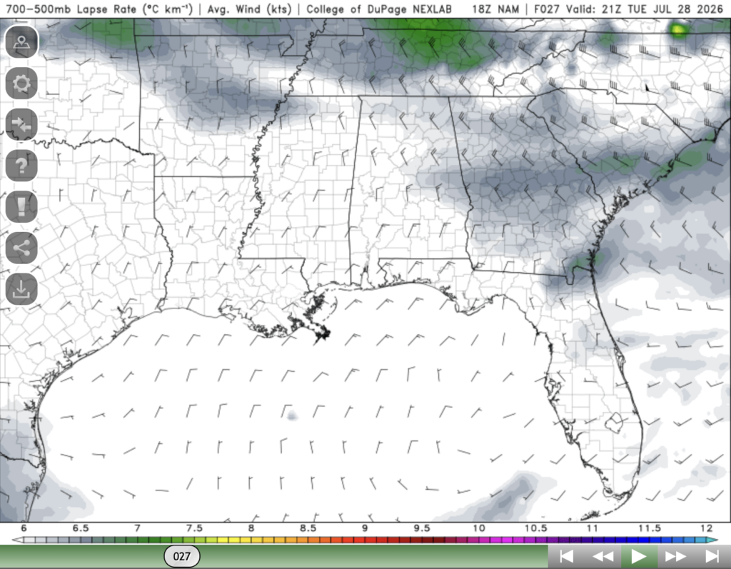
This can be explained by taking a look at the mid level atmosphere. Here, the lapse rates (rate that air cools with height) are pretty low, indicating that the air is not cooling down very much height. This indicates that there’s a layer of warm dry air that is suppressing storm development over our region tomorrow evening.
Wednesday
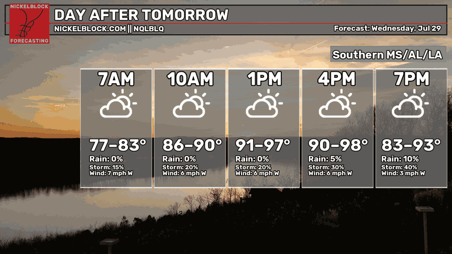
Wednesday, while cooler than tomorrow, won’t be too much better. Afternoon high temperatures will climb into the upper 90s on Wednesday following a morning where temperatures will bottom out into the upper 70s. Again, be sure to take the necessary precautions to protect yourself from the heat.
While temperatures will be slightly cooler on Wednesday, much of our area, especially by the coast, is still in an extreme NWS HeatRisk.
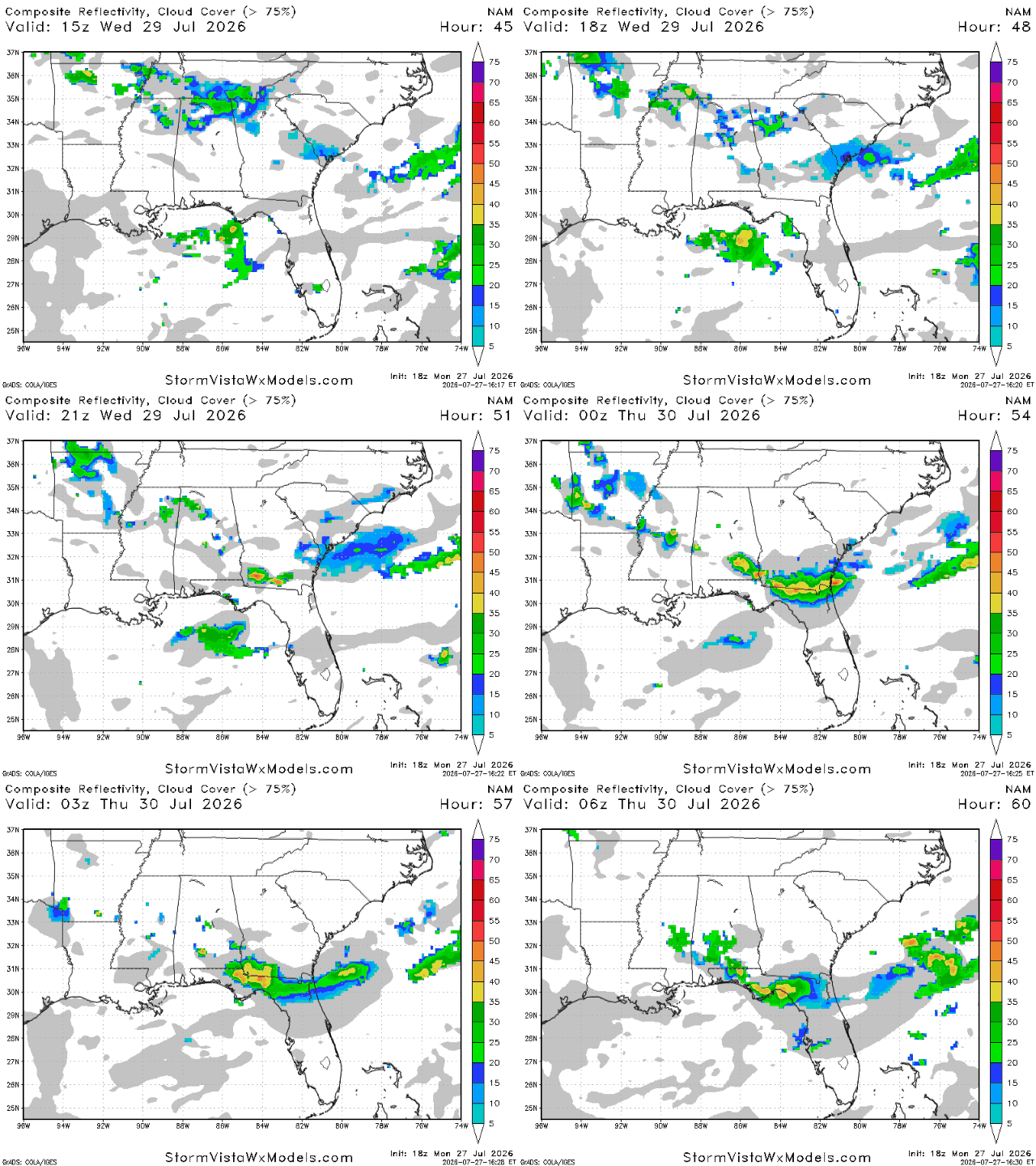
Storms make a comeback on Wednesday evening, with some moisture from up north making its way into our region. According to the NAM model, the highest risk for storms on Wednesday exists in the Florida panhandle a bit later in the night, while storms seem to mostly skip Louisiana.
After the storms on Wednesday, we can finally expect for temperatures to return to being fairly close to average for a couple of days.

Extended Outlook
At this point, you might be thinking to yourself, “when will this heat ever end?”. Well, I have some good news for you. Following storms on Wednesday evening, a weak cold front may pass through the area, bringing lower dew points and temperatures.
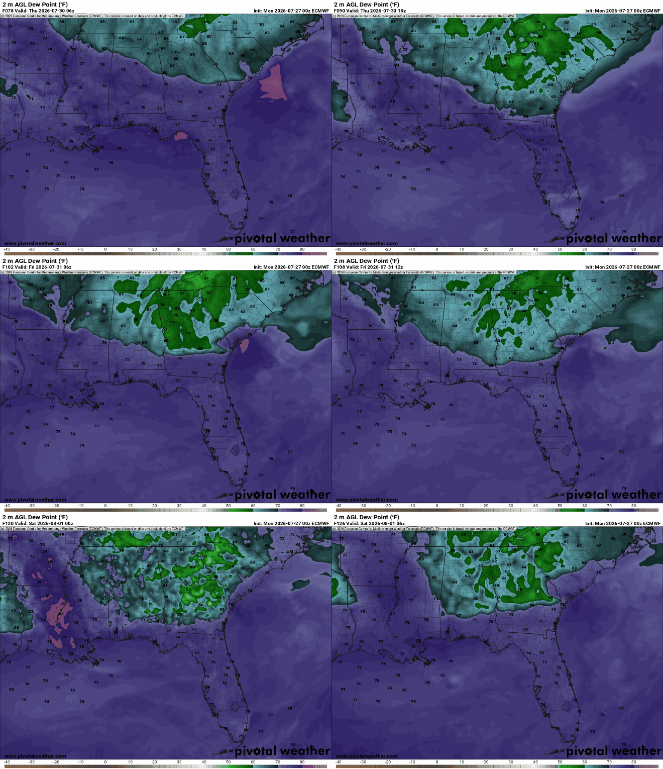
Beginning on Thursday until the weekend, dew points for the northern part of our region are expected to be below normal for this year, in the refreshing 50s and 60s. Cities like Atlanta, Birmingham, and Montgomery will see a nice break… sorry areas along the coast and Louisiana.
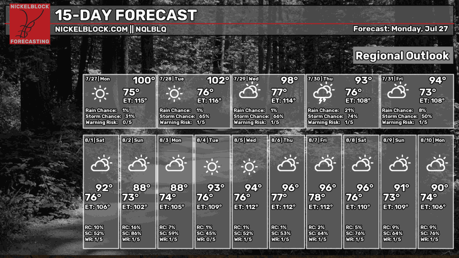
This weekend and early next week we’re likely to take a break from the excessively hot temperatures we’ve been experiencing for the past week. However, by late next week, we’re right back to oven conditions, though they won’t be as intolerable as the past couple days have been.
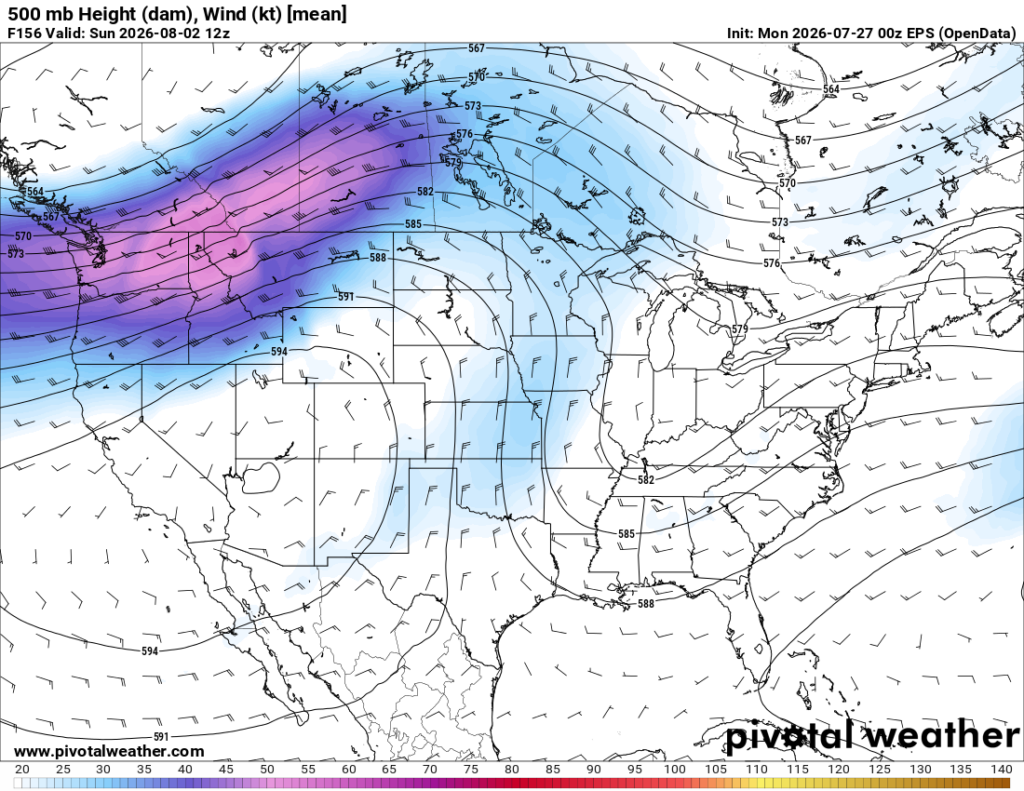
The cooler temperatures this weekend and early next week are being caused by the ridge of high pressure which has been baking our region shifting to the west along with the jet stream dipping down over the great plains. The jet stream is isolating our region from the ridge, therefore allowing a trough over the midwest and northeast to make its way south, bringing us cooler temperatures.
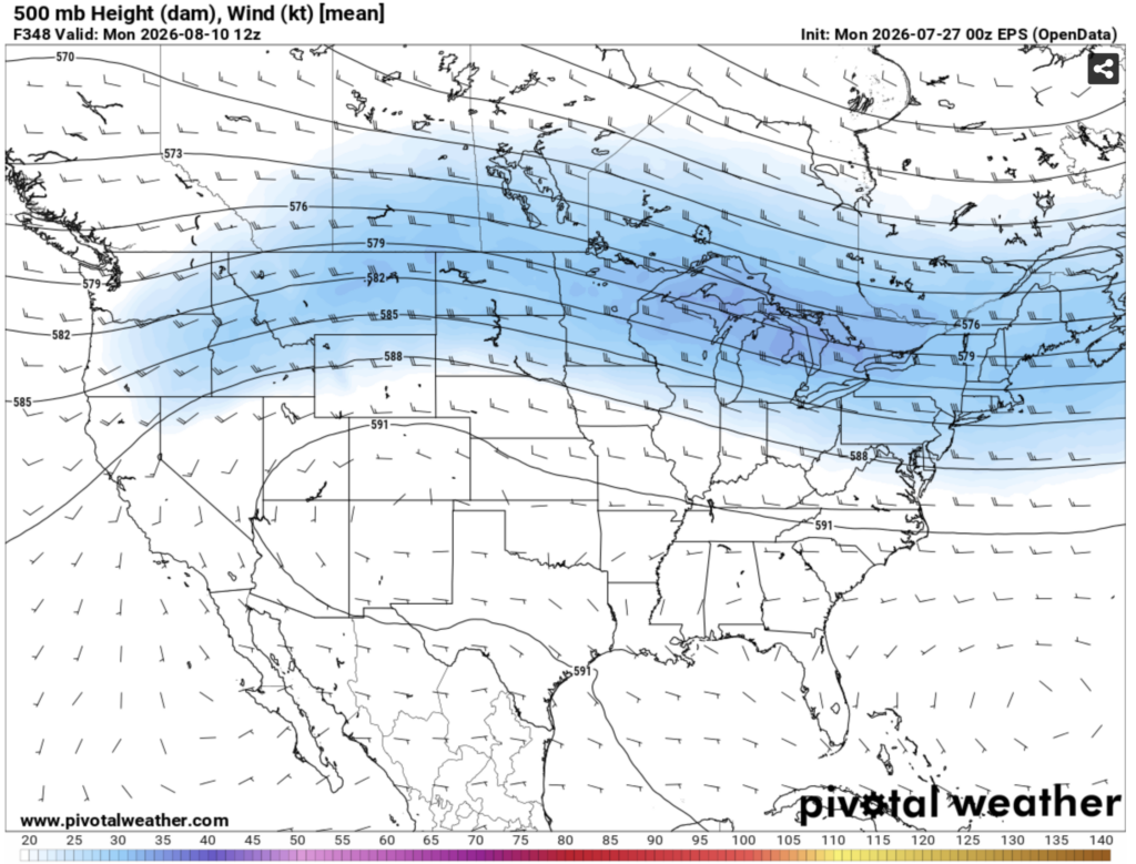
In the long term, I would guess that warmer than normal conditions are here to stay. Within the next 2 weeks or so, a pattern where mid level winds blow from an area of high pressure centered over the southwest to our region looks likely to take shape. This will cause hot air to be advected into our region.
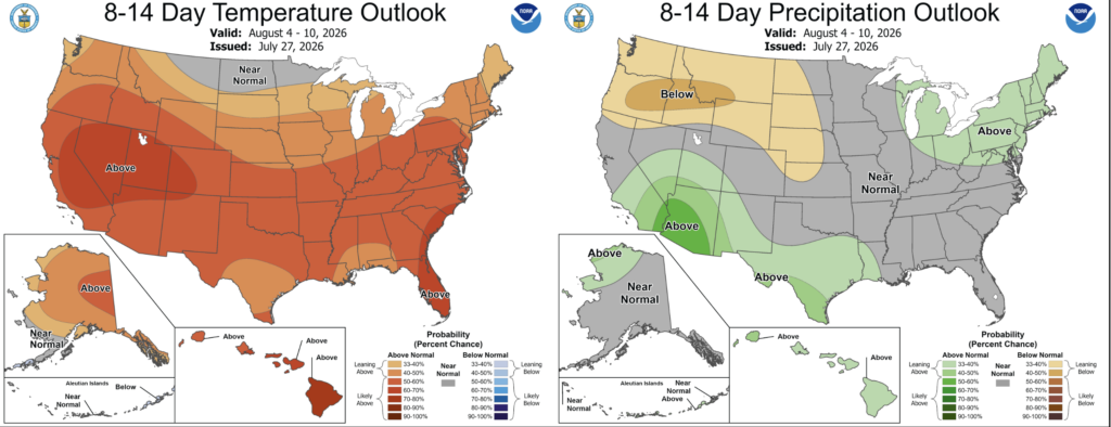
The NOAA CPC agrees. They have our area fairly likely to see above normal temperatures and near average precipitation during the August 4-10 period.


