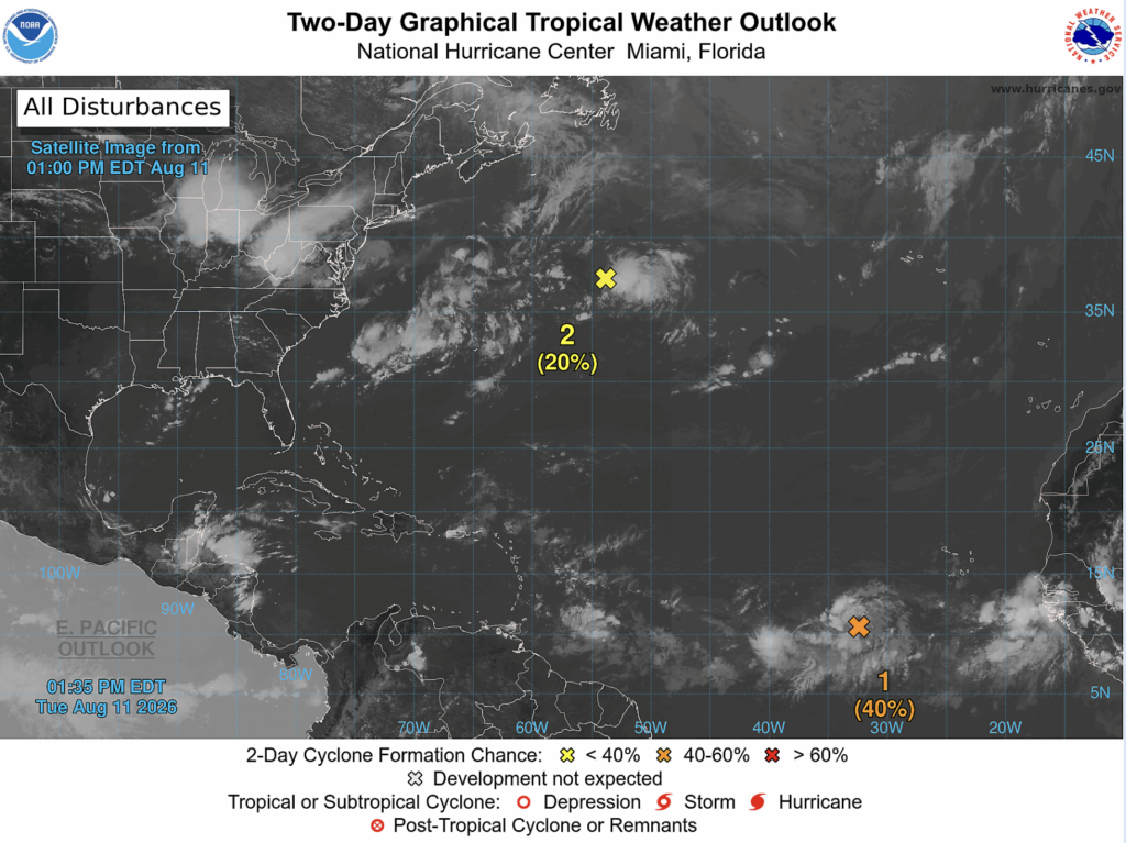
After a few weeks of inactivity, we’ve now got a few tropical invests on our hands.
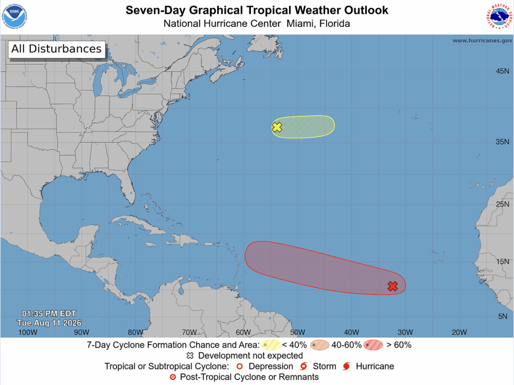
The first one I’m going to talk about is invest 92L, which sits in the central tropical Atlantic ocean. According to the National Hurricane Center, it has a medium chance of development (40%) in the next 48 hours, and a high chance of development (70%) in the next 7 days.
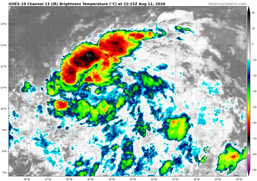
92L currently has moderate convection in its northwest corner, and disorganized convection everywhere else. The NHC has noted that 92L is likely to enter into more favorable conditions over the next few days, leading them to believe the development of a tropical depression is likely. Should it strengthen into a tropical storm, it will be named Cristobal.
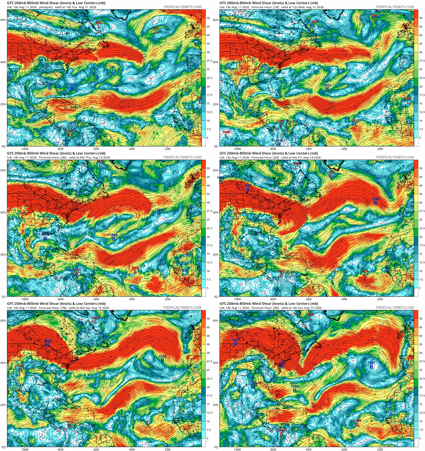
92L may have some trouble strengthening beyond a tropical depression or storm as it will likely run into heavy wind shear moving west to the Lesser Antilles, which is where 92L is forecasted to go in the coming days.
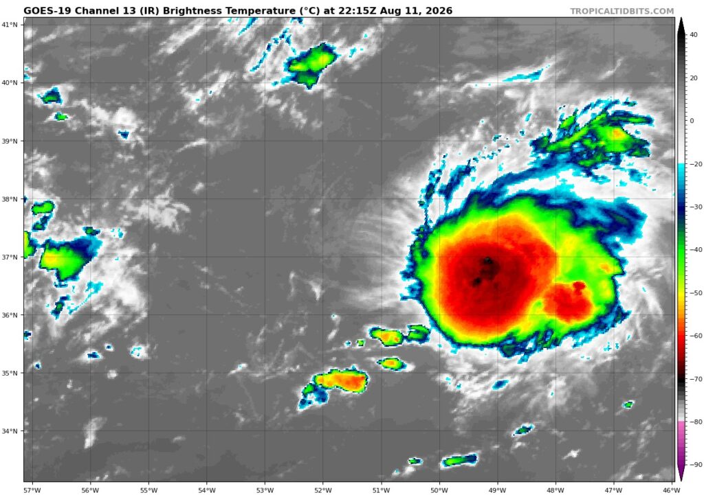
Moving onto invest 93L, we see that it has some deep convection in its center. But will it last? The NHC doesn’t think so, giving it only a 20% chance of development in the next 48 hours and 7 days.
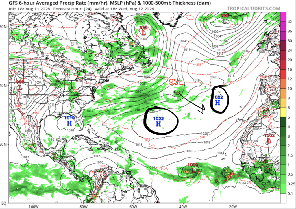
The NHC doesn’t think 93L will develop because over the next few days, it is forecasted to keep moving east, where it will eventually get stuck in between two areas of high pressure. These high pressure areas will suck 93L in and cause it to dissipate.
Neither of these invests are very likely to impact land.
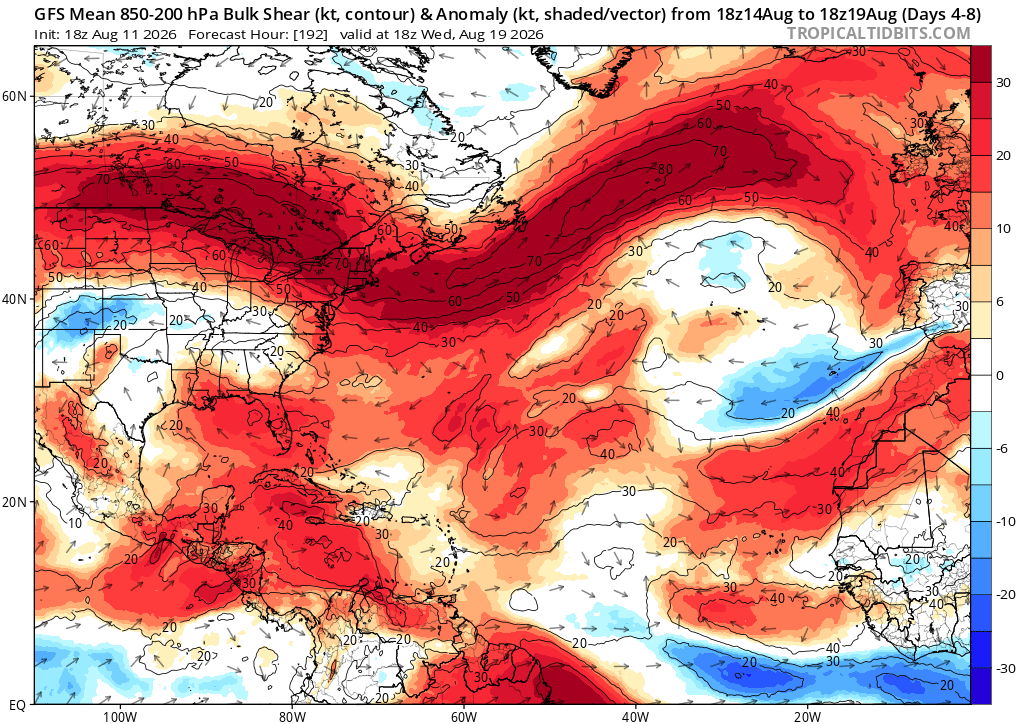
Over the next week or so, tropical cyclone development looks like a mixed bag. On one hand, wind shear looks to be near to even slightly below average in the main development region. Wind shear looks to be above normal in most other places in the Atlantic basin.
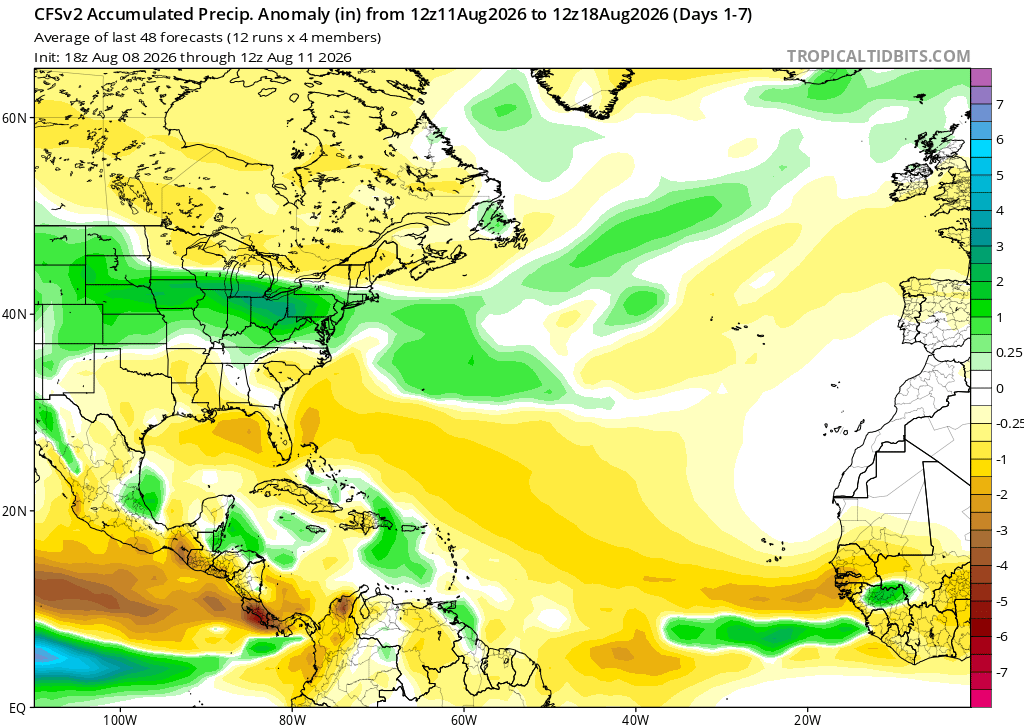
During this same time period, precipitation looks to be below normal in the main development region, tropical/subtropical Atlantic closer to the Bahamas, and in the Gulf of Mexico. This likely indicates that there will be a lack of tropical waves forming off the coast of Africa in the next week, which could mean tropical cyclone activity is being suppresssed.


