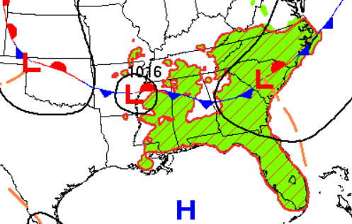
A hot and rain-free spell falls upon us as a strong ridge takes shape (below, left), while high pressure settles over the Gulf (below, right). These two features will gift us hot and dry conditions this week. The exception will be in coastal cities, where sea-breeze storms may fire off in the afternoon. Though even then, storms will be hard to come by.
The ridge will dry us out and allow temperatures to reach 95–100 degrees this week, with some places seeing 100+ degrees Sat–Mon.
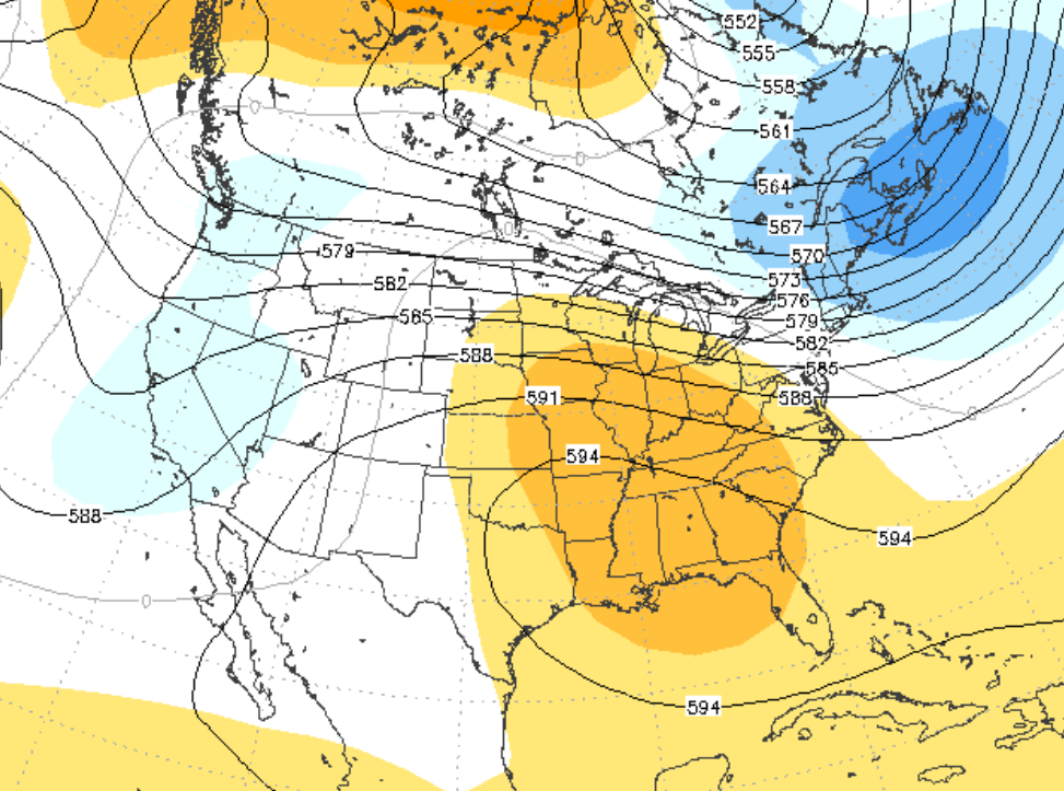
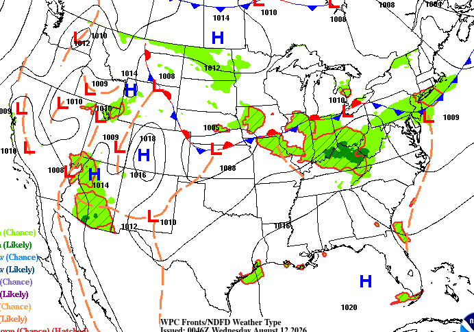
Triple-digit temperatures are dangerous enough on their own, but with humidity-enhanced heat along the coast, heat indices could reach 110 degrees. Warm, muggy nights unfortunately will provide little relief from the heat.
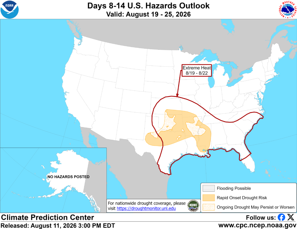
Something that comes to mind with prolonged heat and dry weather is the potential for drought. Looking a week ahead, the Climate Prediction Center has highlighted a risk for rapid-onset drought across the Lower Mississippi Valley, as well as the continuation of this extreme heat…great.

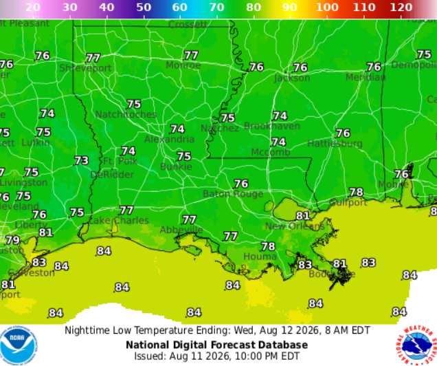
TONIGHT
Clear skies with a stray shower possible overnight. Staying warm tonight, with temperatures around 76 near Hattiesburg to 78 near Houma. Light southerly breeze around 5 mph.
TOMORROW
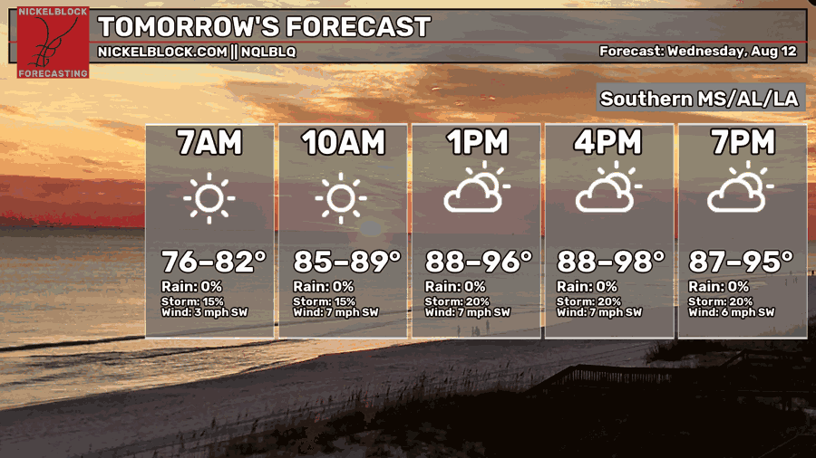
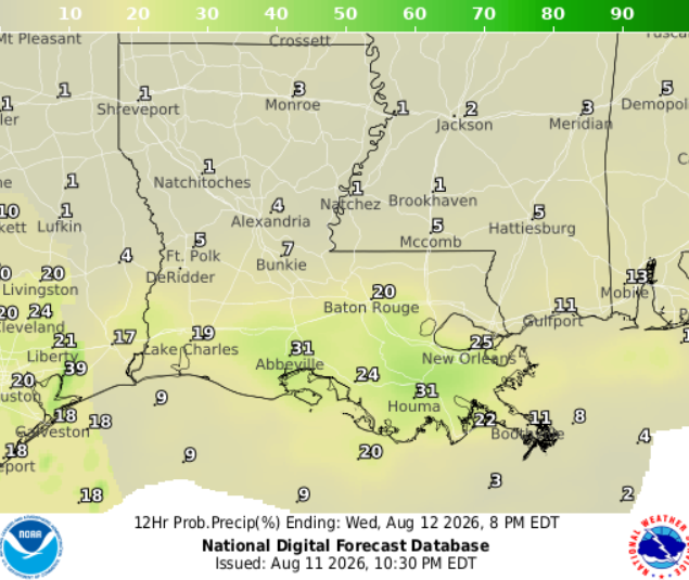
Wednesday, the chance for rain isn’t high to begin with, but a stray storm or two is possible in the afternoon, mostly confined to the coast.
Otherwise, expect plenty of sunshine, with highs ranging from around 90 along the coast to the mid-90s inland. A steady southwesterly breeze around 5 mph will continue.

DAY AFTER TOMORROW
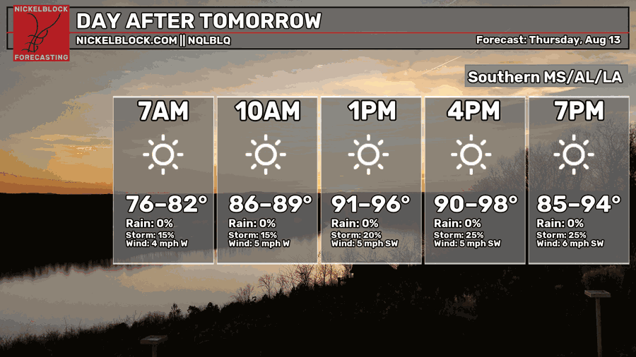
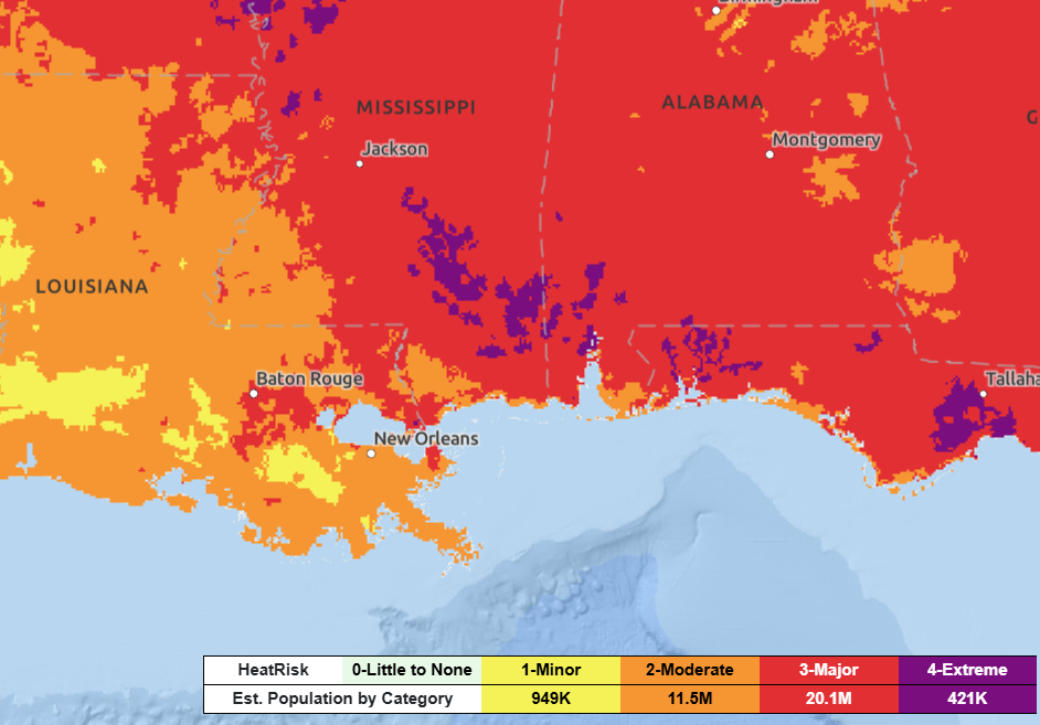
Thursday, the hot and relatively dry pattern continues, with highs again rising into the mid to upper 90s. Major to extreme heat risk is expected in eastern portions of Mississippi.

EXTENDED OUTLOOK
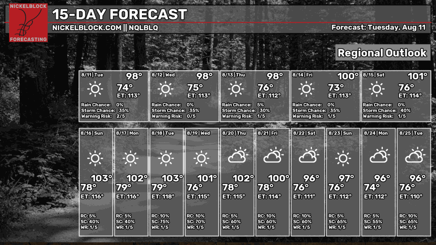
Dry weather should continue until Tuesday before a low-pressure system and cold front drift down south – meaning rain! But until then, check on friends, keep pets out of the heat, and find somewhere cool if you can.
Tonight – Clear skies with a stray shower possible overnight. Staying warm tonight, with temperatures around 76 near Hattiesburg to 78 near Houma. Light southerly breeze around 5 mph.
Wednesday – Heat advisory in place. High around 95, with heat indices up to 110. Sunny skies with a light breeze from the southwest at 5 mph. Stray thunderstorms are possible in the late afternoon across coastal Louisiana 30%, decreasing to 5% farther north near Hattiesburg.
Wednesday Night – Mostly clear, with a low around 76. Winds blowing from the southwest.
Thursday – Sunny and hot, with highs hovering around 95. Light breeze from the southwest continuing.
Thursday Night – Settling into a calm night under clear skies. Muggy with a low around 76. Calm winds.
Friday – Heat and humidity continue building with highs near 97, some places approaching 100. Abundant sunshine with calm winds. Drink water!
Friday Night – Clear night, with a low around 75. Calm winds.
Saturday – Another scorcher. Daily temperatures soaring to 100, but it will feel 10 degrees warmer. Mostly sunny with calm winds. Afternoon isolated storms possible along the coast. Rain chance: 10%
Saturday Night – Partly cloudy night, with a low around 76. Calm winds.
Sunday– Sunny and hot, with highs approaching 100 but it might feel closer to 110. A slight chance of afternoon showers and thunderstorms, mainly along the immediate coast. Rain chance: 20%
Sunday Night – Giving way to a partly cloudy night, with a low around 77. Calm winds.
Monday – Mix of sun and clouds. Daily highs approaching triple digits, but it will feel closer to 110 degrees. A slight chance of afternoon showers and thunderstorms, mainly along the immediate coast. Rain chance: 15%
Monday Night – Another warm night under clear skies. Low around 77. Light breeze from the south.


