Howdy!
So! Things are starting to fire up in the Atlantic. As of today, the National Hurricane Center has marked 3 areas of interest. In the time of me doing this forecast, the area of interest in the north Atlantic has upgraded to Tropical Storm Cristobal. Invest 92L has an 80% chance of formation within the next 2-7 days, while the third area has a 20-30% chance within the next 7 days.
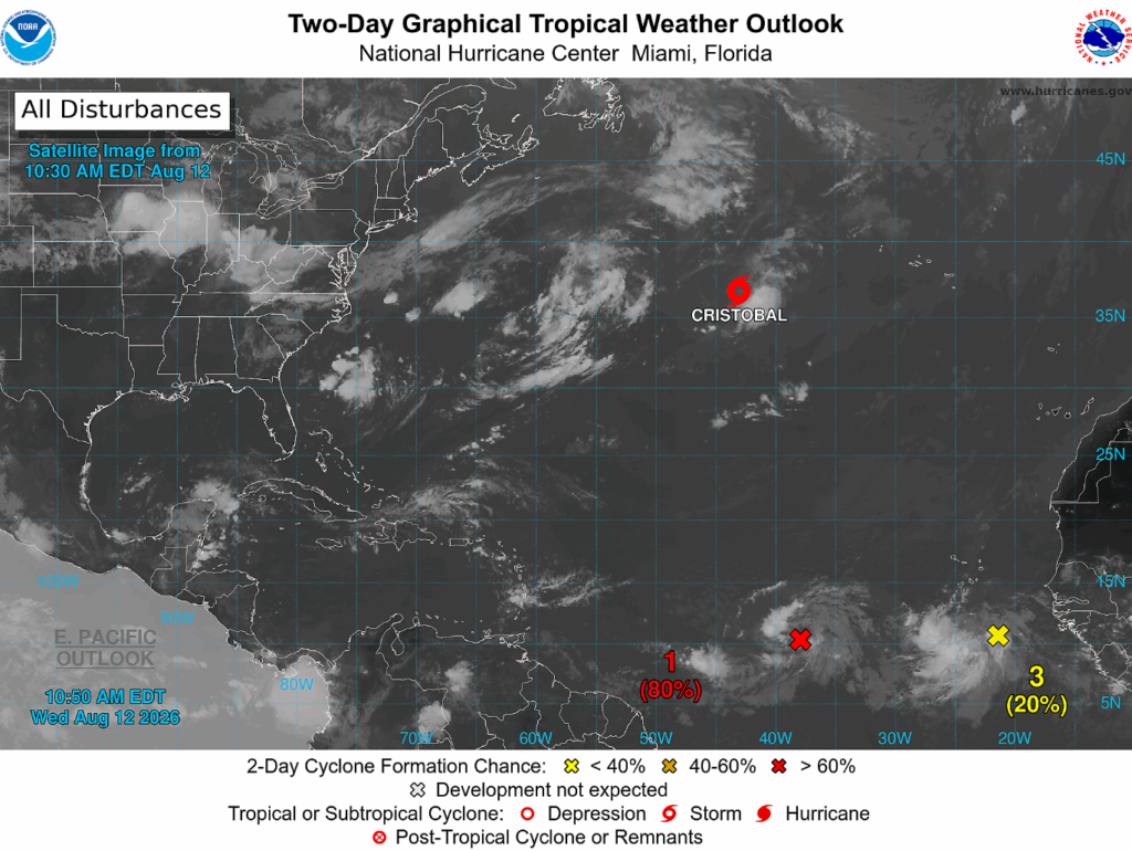
Invest 92L has some showers and thunderstorms that are showing signs of organization along a tropical wave. Additionally, there is a low pressure associated with it, environmental conditions looking to be favorable for development. On the satellite loop below, we can see the counterclockwise spin of the low pressure where invest 92L is indicated.
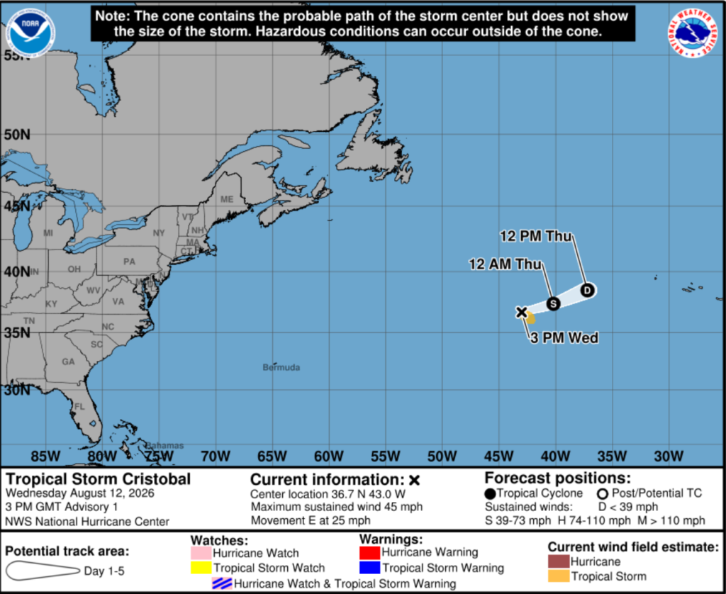
Tropical Storm Cristobal is likely to be a very short-lived storm that is nowhere near impacting the United States. Max sustained winds currently are 45 mph, moving eastward and is predicted to slowly weaken and dissipate by Thursday.
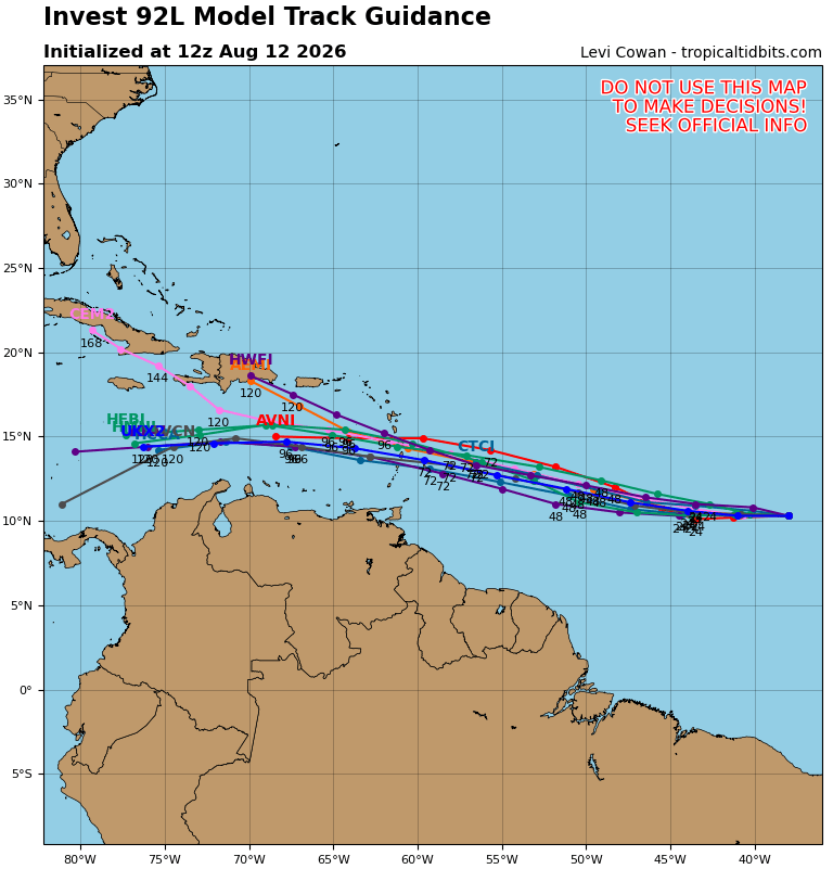
Invest 92L is predicted to form into a tropical depression as it continues to move westward. It is likely that it will not strengthen beyond a tropical depression, though, as it approaches the Lesser Antilles. Ocean temperatures are warm enough, but wind shear starts to factor in as it continues its journey.
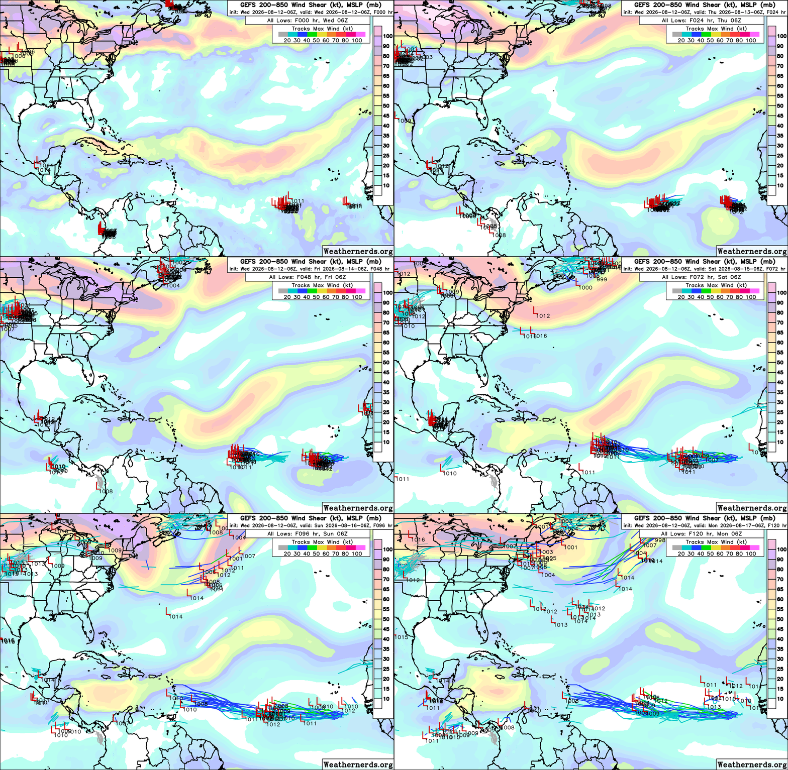
Above shows the possible paths and 200mb-850mb wind shear. There are a lot of different paths that the potential cyclones could take, a majority of models point to 92L invest going to the Lesser Antilles towards an area of stronger wind shear and dying out. Below also shows similar tracks, some models pointing to a longer life cycle for the storm, tracking all the way to Cuba.
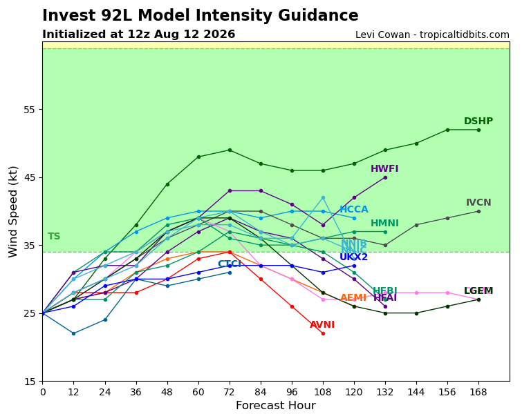
In terms of intensity, the highest predicted intensity is just below 55 kts (or around 63 mph). Invest 92L is not expected to form into a hurricane (no less a major one) but can still impact the Lesser Antilles with some heavy rain and high winds associated with tropical depressions.
In terms of the third disturbance in the eastern Atlantic, the NHC has low confidence that it will form into a cyclone, around 20-30% for the next 2-7 days. Environmental conditions will be generally conductive for development, and a tropical wave is associated with the area. This area will continue to be monitored.

Looking ahead, wind shear in the Atlantic seems to be mostly above the normal, although there are areas that are near normal/below average for this time of year, especially in the main development area. The areas with higher wind shear will be a limiting factor in storms that do develop.
As we get closer to the peak of the season and continue through August, it is important to put a plan in place just in case a storm does move to impact your area.
Watch my video forecast below!


