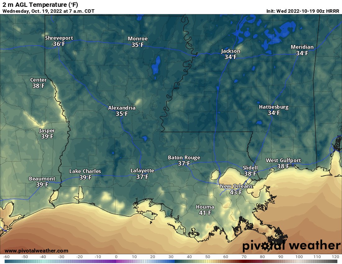
A rather chilly start this morning with temps hanging around in the mid 30s in most spots. A few locations have likely touched freezing this morning, but it looks like most of the area settled around 34F. Out at the Hattiesburg airport it got down to 32 for 15 minutes. It has been bouncing between 30F and 35F at the Jackson airport for the last few hours. Mobile got down to 39F. Bogalusa dropped to 32F for 30 minutes.
So, the lack of a long-lasting freeze is probably good news for those who forgot to bring in your plants!
Temps will warm back into the mid 60s to around 70F today. Then we have another chilly night on deck.
DAY TO DAY FORECAST
Today
Areas of frost this morning. Sunny. Highs in the mid 60s.
Tonight
Clear. Areas of frost after midnight. Lows in the mid 30s. Some spots bottoming out near freezing again.
Thursday
Areas of frost in the morning. Sunny. Highs in the upper 60s.
Thursday Night
Clear. Lows in the lower 40s.
Friday
Sunny. Highs in the upper 70s.
Friday Night
Clear. Lows around 50.
Saturday
Sunny. Highs around 80.
Saturday Night
Mostly clear. Lows around 50.
Sunday
Sunny. Highs around 80.
Sunday Night
Mostly clear in the evening, then becoming partly cloudy. Lows in the mid 50s.
Monday
Mostly sunny. Highs in the lower 80s.
Monday Night
Partly cloudy. Lows in the lower 60s.
Tuesday
Mostly sunny with a storms possible. Highs in the lower 80s. Chance of rain 30 percent.


