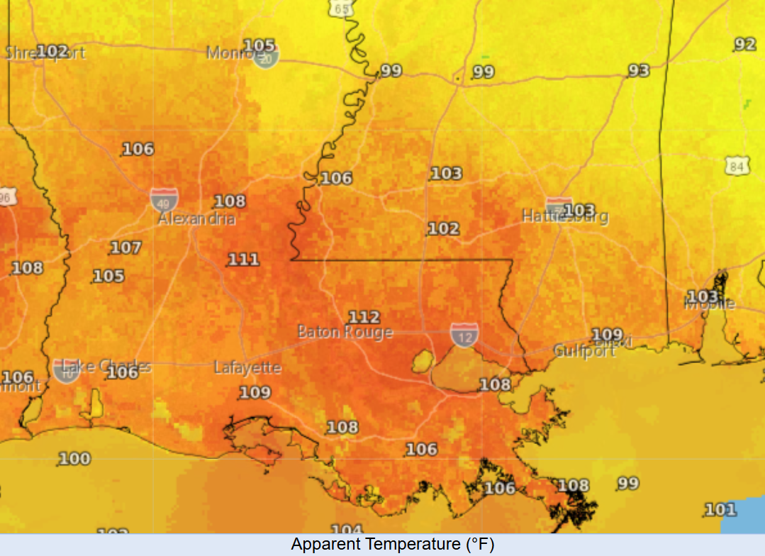
A heat advisory is in place for southern Louisiana and portions of southwestern Mississippi, with heat index values between 108 and 112 degrees being forecasted for today! Stay hydrated, and if you’re outside, take multiple rest breaks or postpone outdoor activities until the evening.
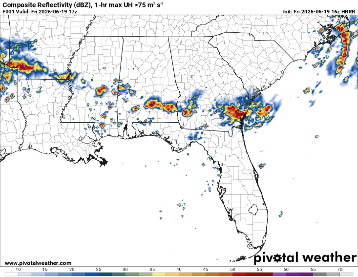
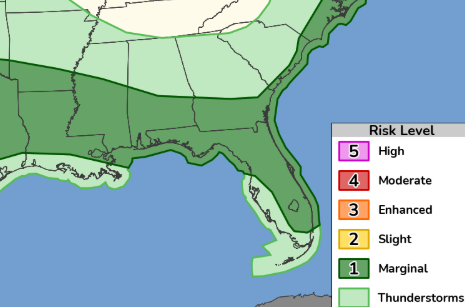
Scattered thunderstorms are ongoing near Jackson and the Meridian area along a cold front to our north and a trough left behind by Arthur. There is a Marginal Risk (Level 1/5) for severe thunderstorms today. Storms will be more of a hit-or-miss scenario. If you do get a storm, it could temporarily help with the heat. If not, you’ll continue dealing with dangerous heat through the day.
The main threats with any stronger storms will be damaging wind gusts and heavy downpours. Flooding remains a concern, and we also can’t rule out a brief tornado. A slight cap is in place across southern Louisiana, which is helping limit storm development for now. Even so, we should see showers and thunderstorms begin to develop later this afternoon and continue into the evening hours.