Howdy!
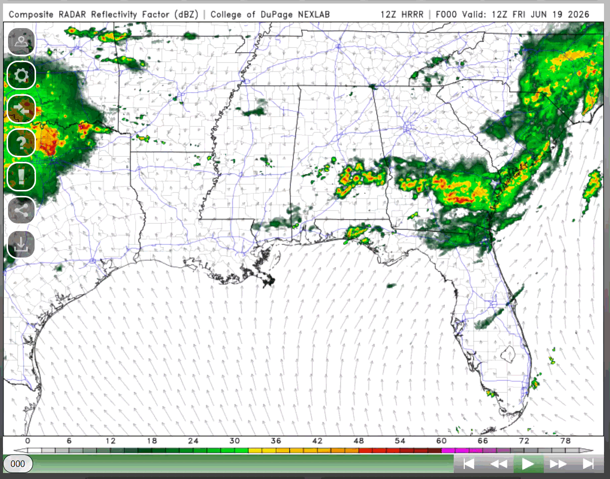
Yesterday, Tropical Storm Arthur was downgraded to a Post Tropical Cyclone as it headed inland over the southeast United States. It has produced heavy rainfall, severe storms, and strong winds. Its remnants are currently over South Carolina and Georgia.
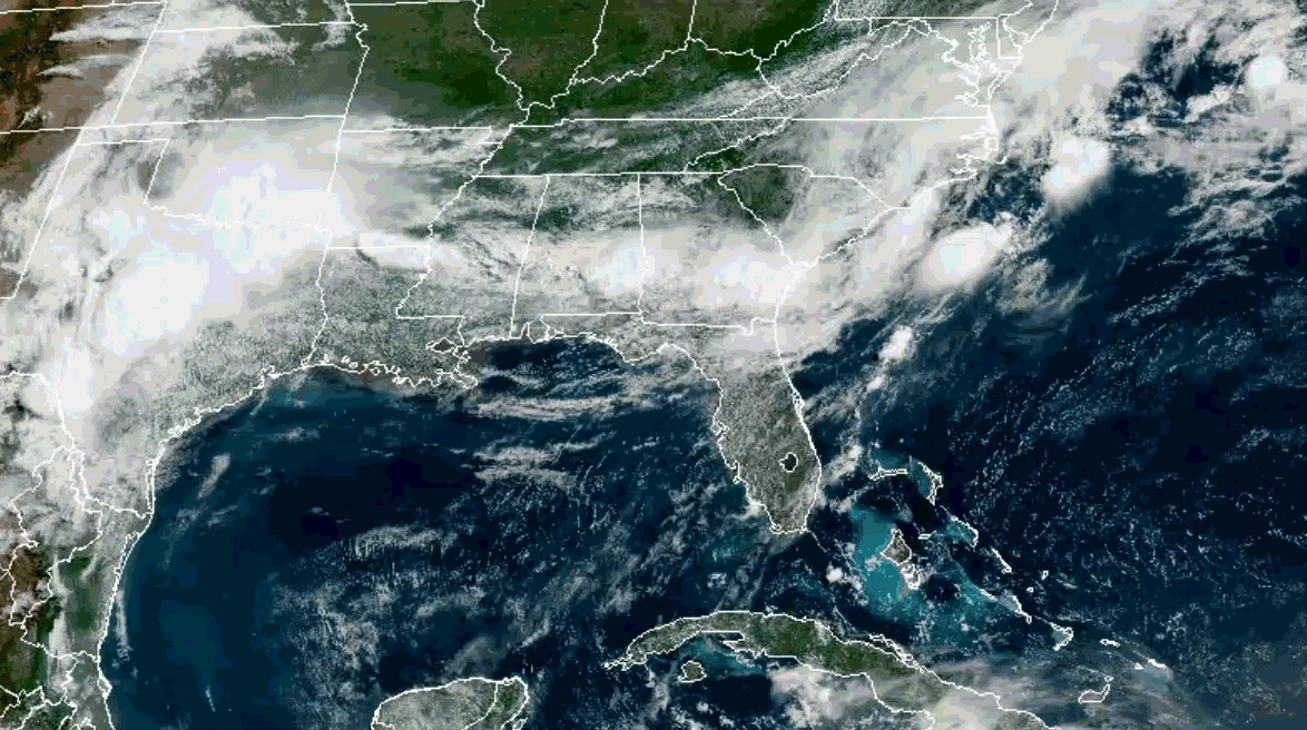
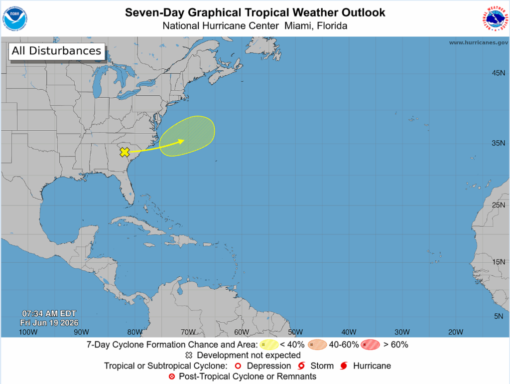
The National Hurricane Center marked an area offshore the East Coast where there is a slight (10%) chance of cyclone formation as the remnants of Arthur head back into the Atlantic later today. Environmental conditions are marginal for the development as it heads northeast. Regardless of formation, what is left of Arthur will be producing heavy rainfall today so there are risks of flash flooding. Please keep this in mind and avoid traveling today if you can as this flooding could be life threatening!
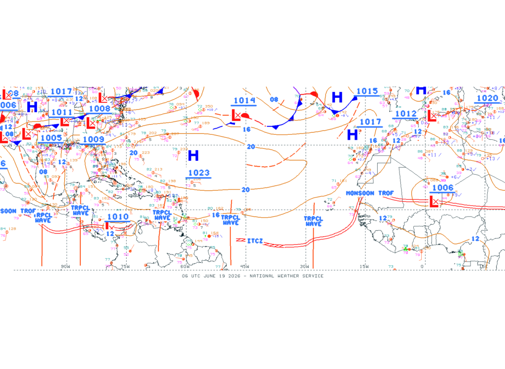
Sea surface temperatures are warming up in the Atlantic, and the NHC has marked some tropical waves (see below) in the Atlantic that are heading west from Africa. These waves are vital in the development of tropical storms and hurricanes, so it is always important that they are monitored and identified, especially as we get deeper into hurricane season. The only chance of development at this time is off the East Coast due to Arthur.
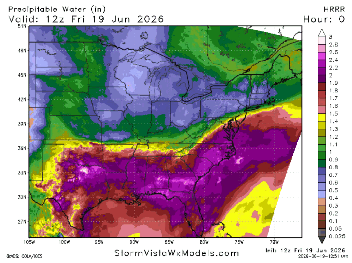
Arthur has brought and left us a lot of moisture (shown below) which helps fuel all the heavy rain and thunderstorms that we have seen for the last couple days and will continue to see going into the weekend. This moisture will stick around through the weekend and into next week as well.
Chances of rain start to decrease going into next week, so we won’t be seeing any heavy rain like we have had. These last few days, some areas got a couple inches of rain, others had greater than 12 inches of rain.
Looking ahead at today and the weekend, the region will still be getting rain with all the tropical moisture and a frontal boundary propagates closer. Some storms could be severe and produce a lot of rain, so flash flooding will still be a possibility. Stay weather aware as threats are not over with yet and keep each other safe today and this weekend.
By Sunday and next week, a mid-level ridge will start to build up and head into the region, so less chances of rain and some warmer conditions are in store for us. But until then, try to stay dry today and avoid traveling if you are able to! Take care of yourself and have a good Friday!


