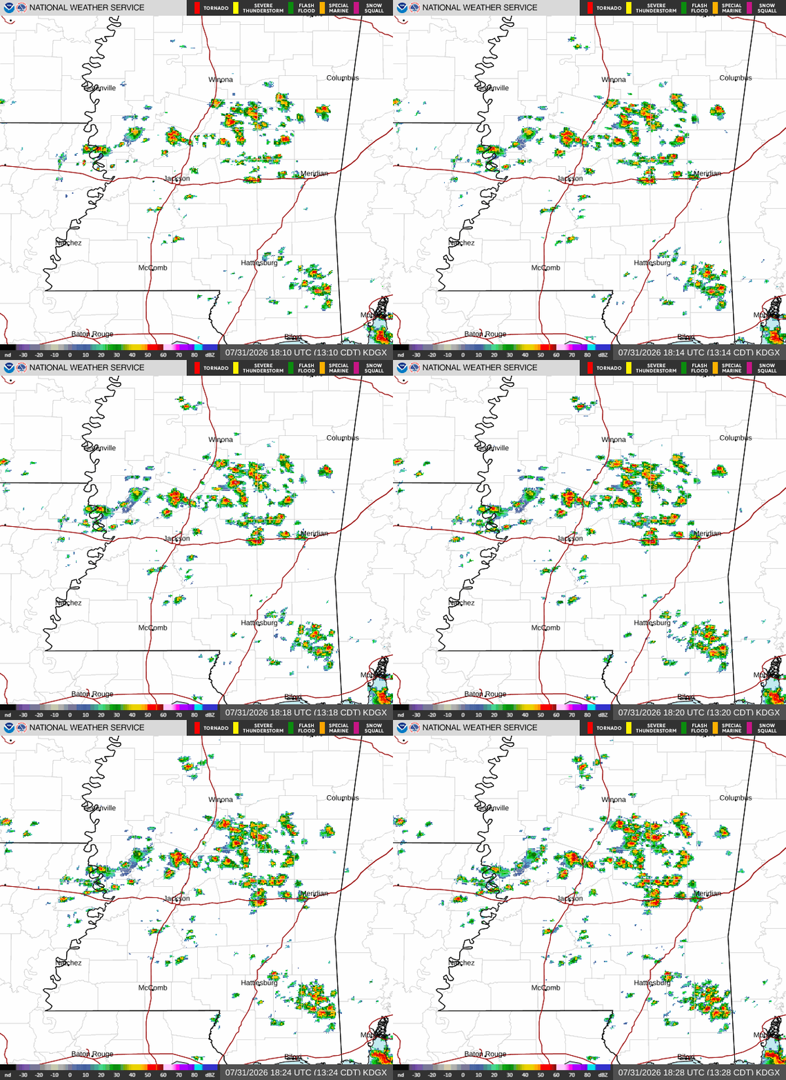
We are seeing storms of the splash-and-dash variety across central Mississippi, providing a brief cooldown for some folks. Scattered showers and thunderstorms are expected to continue across southern Mississippi during the afternoon-evening timeframe.
Short-range models have these storms staying mainly east of the I-55 corridor, near Laurel, Waynesboro, and the Meridian area. With any stronger storm, expect heavy downpours, frequent lightning, wind gusts up to 40 mph, and of course we can’t rule out a brief spin-up.
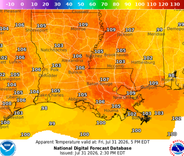
With all of the humidity (dewpoints of 77 degrees), heat advisories are in effect, with heat index values of 105–110 possible, especially around New Orleans, Houma, Gulfport, and in areas that miss out on a cooling shower today.